The geoEpi project explores the spatio-temporal dynamics of emerging viruses, including SARS-CoV-2, Dengue, Chikungunya, Yellow Fever, Zika, and Ebola. These viruses pose significant global health challenges, and understanding the factors influencing their spread is crucial for improving disease monitoring and response.
By combining geodata and official health surveillance records, geoEpi seeks to enhance early disease detection and provide more accurate predictions about the spread of infectious diseases.
The project aims to develop innovative approaches for analyzing disease dispersal patterns by integrating multiple data sources and using machine learning techniques.
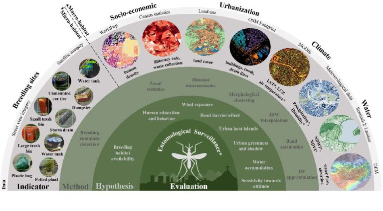
A particular focus lies in understanding how environmental conditions, land use, transport networks, and human movement patterns influence disease outbreaks. By quantifying these interactions, geoEpi aims to provide a more comprehensive framework for predicting and mitigating the spread of emerging viruses.
Incorporating temporal dynamics into spatial epidemiology to improve outbreak monitoring.
Combining geodata with official health surveillance records for fine-scale disease tracking.
Developing machine learning algorithms to handle large-scale data and enhance traditional epidemiological models.
Identifying “socio-ecological corridors” that describe likely disease spread pathways based on mobility, demographic, and environmental factors.

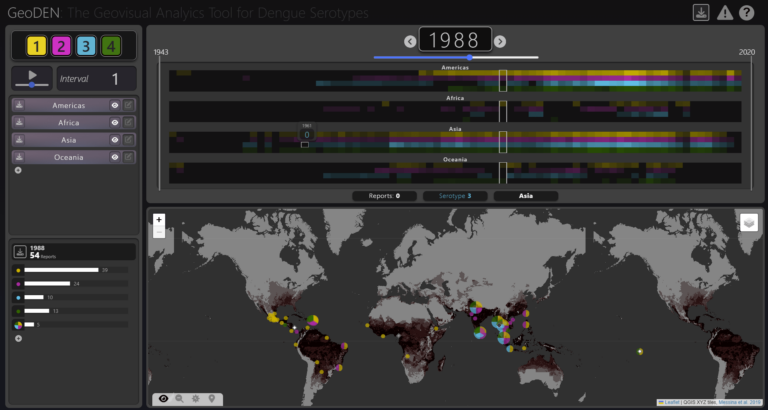
GeoDEN is a visual analytics tool created to help dengue researchers and epidemiologists better understand how DENV serotypes move and interact among populations.


Prof. Dr. Alexander Zipf

Dr. Steffen Knoblauch

apl. Prof. Sven Lautenbach

Prof. Dr. Bernd Resch

Dorian Arifi

PD Dr. med. Thomas Jänisch, PhD
Dr. rer. nat. Ivonne Morales Benavides
Searching for early warning systems during the COVID-19 pandemic, the…
To improve vector control strategies, Dr. Steffen Knoblauch (PostDoc at…
With the increasing availability of global disease datasets, Visual Analytics…

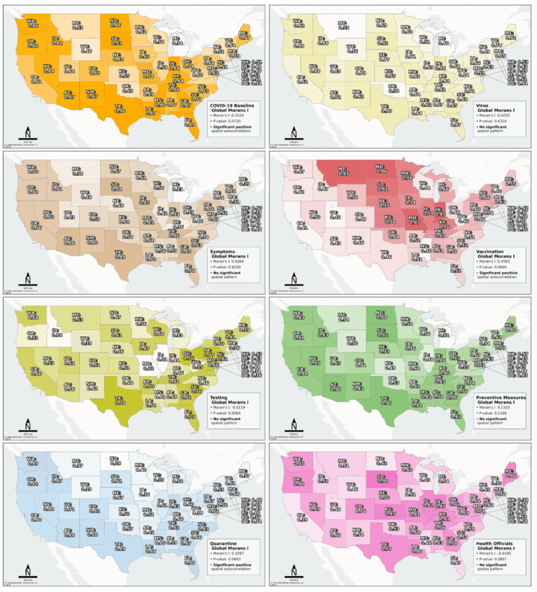
The COVID-19 pandemic highlighted the importance of understanding human behavior…
The novel coronavirus disease (COVID-19) generated significant health concerns worldwide,…