Identifying priority areas for Anticipatory Action
Deciding where to act before a disaster occurs requires a large amount of reliable, clear information. Geoinformation technologies can deliver valuable insights to support Anticipatory Action, but often require advanced technical skills, and available data does not always fit.
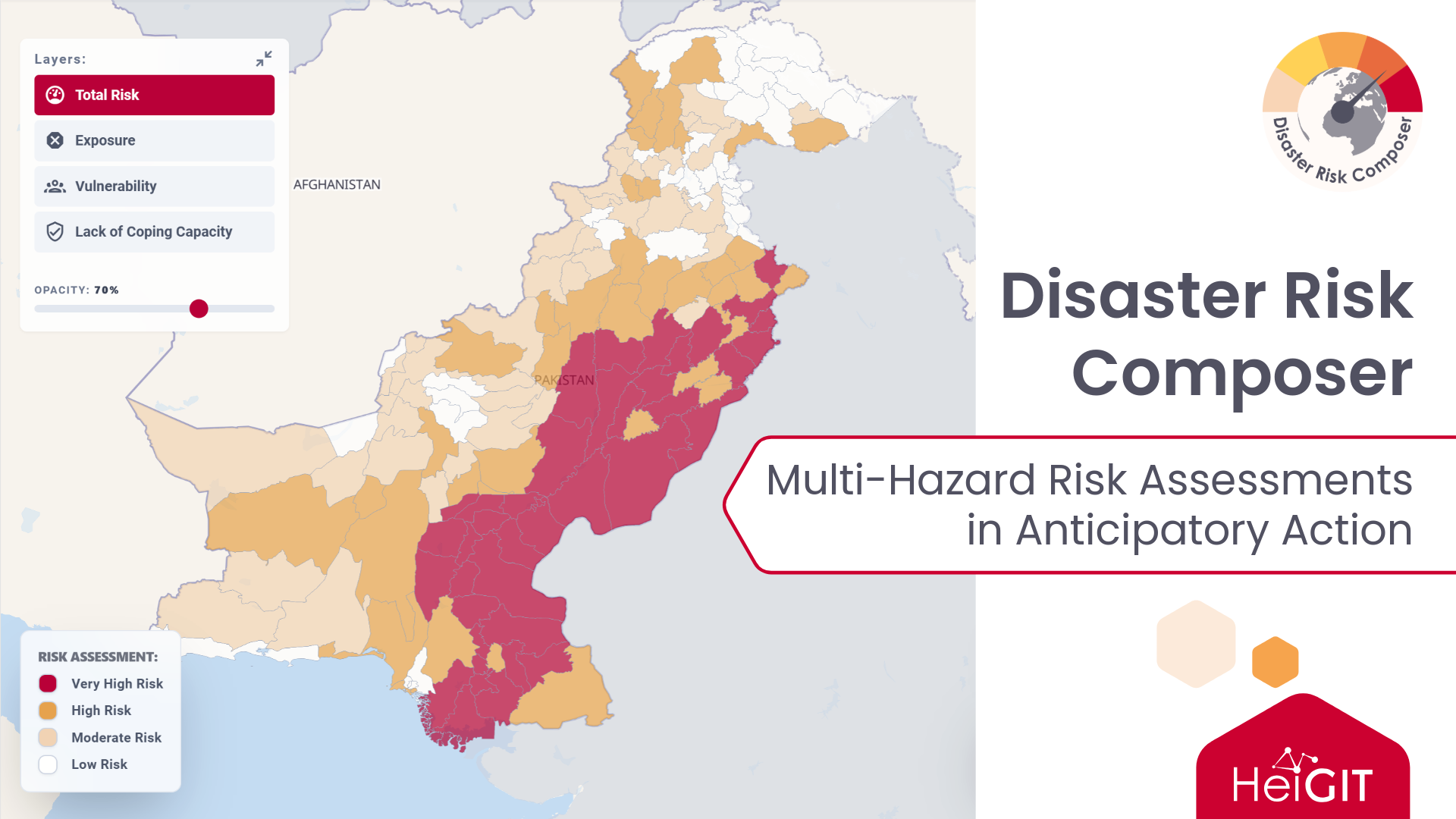
The Disaster Risk Composer transforms large-scale geospatial and statistical data into admin-level indicators for multi-hazard, evidence-based risk assessments.
The dashboard is intended for decision-makers in humanitarian aid and disaster risk management who need to identify priority areas for Anticipatory Action interventions. Based on global datasets, it is a straightforward foundation for decision makers, which is meant to be refined with local data and knowledge. It delivers insights without requiring advanced GIS or statistics skills, while allowing full customization of datasets and weights for those who need a flexible framework.
Visualizing risk on the Disaster Risk Composer
The Disaster Risk Composer currently covers three kinds of natural hazards: floods, cyclones, and drought. It is currently available for 137 countries worldwide, including most of the Global South.
After selecting a country and a hazard type, the dashboard visualizes the total risk score in its three components:
- Hazard Exposure: Identifying regions prone to a given disaster type, i. e. where vulnerable populations and essential facilities are exposed to a specific hazard.
- Vulnerability: Representing the sensitivity of a population to external shocks, e. g. depending on the share of children and elderly in the population.
- Coping Capacity: Measuring the ability of a population to access essential services, such as hospitals and other healthcare facilities.
Map and statistics components display the results side by side, so users can compare administrative units. For each region, the dashboard can show either the aggregated total risk or the single components of hazard exposure, vulnerability, and coping capacity.
Three basemaps are available to place the results in their geographic context: CARTO Positron, OpenStreetMap, and satellite imagery.
Customizing the datasets
By default, the dashboard uses datasets provided by HeiGIT. However, users can also work with their own data: they can upload datasets, assign them to the exposure, vulnerability, or coping capacity dimension, and freely adjust the weights of each indicator. All visualizations are then recalculated from the custom input.
Customizations apply to the current session only; when reloading the page, the user is asked if they wish to continue with the custom dataset or reset the dashboard to the original HeiGIT datasets.
Users who prefer to calculate risk assessments in QGIS can use our dedicated QGIS plugin, which allows for more in-depth customization, e. g. setting different administrative levels, and further analysis within QGIS.
All datasets that are used by default on the Disaster Risk Composer are available on the Humanitarian Data Exchange (HDX).
Methods and constraints
The analysis pipeline relies on open-source datasets and tools. Hazard datasets are overlaid with OpenStreetMap (OSM) and population data to compute exposure, vulnerability, and coping capacity metrics, which are combined into a composite risk index. The unit of analysis is the sub-national administrative boundary (ADM1 or ADM2).
A few constraints may be taken into consideration when using the dashboard:
- Data Completeness: In regions with unmapped critical infrastructure or outdated population models, the risk may be captured inaccurately.
- Aggregation Granularity: Presenting results aggregated at ADM1 or ADM2 level can obscure very localized variations in risk.
- Static Snapshots: Hazards are dynamic, and static layers may not perfectly reflect ongoing or rapidly changing disaster events.
- Lack of Local Knowledge: The model does not account for local knowledge and practices.
The full documentation on the pipeline and underlying methodology can be found on the IFRC Network GIS Training Platform.
Explore disaster risk for your country of interest on the Disaster Risk Composer. More information on HeiGIT´s work in Anticipatory Action can be found here.
Questions and feedback are welcome at humanitarian_gi@heigit.org. If you have a concrete use case for this dashboard, we would love to hear about it!