Campus reporter Nils Birschmann spoke with Prof. Alexander Zipf about our Disaster Portal. The interview was broadcast on Radio Regenbogen.
You can listen to the full length of the article here (please note: the interview is only available in German):
 Audio clip: The Disaster Portal – secure and quickly available data bases in the event of a disaster
Here’s what it’s about:
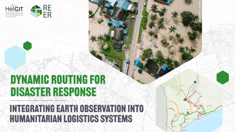
In the event of a disaster, relief workers depend on up-to-date location data for the affected region: Which roads are passable? Are hospitals in operation? And where are particularly many houses uninhabitable and people in need? Such information can change by the minute in the event of, for example, natural disasters such as floods, earthquakes or storms – but many routing services are not up-to-date enough to provide relief workers with reliable information. That’s why HeiGIT developed the Disaster Portal: Through the application, aid organizations such as Doctors Without Borders, the Red Cross or the Red Crescent can access the most up-to-date data and reliably plan their missions.
To make this possible, the Disaster Portal accesses two data sources:
-
OpenStreetMap data. Everyone can contribute to OpenStreetMap; in a way, it is a Wikipedia in map form. In the event of a disaster, volunteers all over the world can update the map and keep it up-to-date as part of mapping activities based on the latest aerial photographs.
-
Relief organization data. Relief organizations often have their own data sets that are important for their operations. The Disaster Portal can also integrate this data into the routing.
These two data sources ensure that aid organizations are always up-to-date about the infrastructure on the ground in an emergency. For example, the Disaster Portal provided important data that Médecins Sans Frontières needed during their operations after the severe earthquake in Syria and Türkiye.
More on the use of the Disaster Portal in Syria and Türkiye: