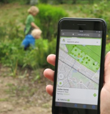
Urban green spaces (UGSs) can provide important ecosystem services for citizens and their well-being. To make use of these services according to UGS user demands, urban residents, tourists, and city administrations should know where UGSs are located, what qualities they have and how to reach them on convenient routes. A new open access paper at the 6th International Conference on Smart Data and Smart Cities based on the results of the MeinGrün project presents a novel digital infrastructure which combines and fuses different data to map UGSs and their qualities, and makes this information available in a web app.
The interactive information service of the app aims to support citizens to explore and search for suitable UGSs and to provide routing options to reach them based on their preferences. Via implicit and explicit feedback functions included in the app, further information on UGS users’ preferences can be collected to enhance the overall knowledge basis, while respecting data privacy issues. The underlying data base consists primarily of open and volunteered geographic data (VGI), which allows for transferability to other cities.
The paper describes the system design, its backend and front-end components, as well as the process of development and deployment of the system in two pilot cities. Preliminary results of the piloting in the two cities (Heidelberg and Dresden) are presented, focusing on user preferences for UGSs searches. The added value of the web app for city residents and the role of the newly gained knowledge for urban planning is discussed and reflected upon.
Hecht, R., Artmann, M., Brzoska, P., Burghardt, D., Cakir, S., Dunkel, A., Gröbe, M., Gugulica, M., Krellenberg, K., Kreutzarek, N., Lautenbach, S., Ludwig, C., Lümkemann, D., Meinel, G., Schorcht, M., Sonnenbichler, A., Stanley, C., Tenikl, J., Wurm, M., and Zipf, A.: A WEB APP TO GENERATE AND DISSEMINATE NEW KNOWLEDGE ON URBAN GREEN SPACE QUALITIES AND THEIR ACCESSIBILITY, ISPRS Ann. Photogramm. Remote Sens. Spatial Inf. Sci., VIII-4/W1-2021, 65–72.
https://doi.org/10.5194/isprs-annals-VIII-4-W1-2021-65-2021, 2021.
ACKNOWLEDGEMENTS The research is supported by the German Federal Ministry of Transport and Digital Infrastructure (BMVI) under the frame of mFUND, a research initiative funding R&D projects related to digital data-based applications for Mobility 4.0 (grant number 19F2073A). We would like to thank the administrations and citizens of the pilot cities for their support.
Further news http://giscienceblog.uni-hd.de/tag/meingrun/
The meinGrün app https://meingruen.org/
Openrouteservice serves the general public since 2008.
A new follow-up project (HEAL) deals with heat-stress avoiding shady routing.
Related publications
- Ludwig C, Hecht R, Lautenbach S, Schorcht M, Zipf A. (2021): Mapping Public Urban Green Spaces Based on OpenStreetMap and Sentinel-2 Imagery Using Belief Functions. ISPRS International Journal of Geo-Information. 2021; 10(4):251. https://doi.org/10.3390/ijgi10040251
- Ludwig, C, Fendrich, S, Zipf, A. Regional variations of context‐based association rules in OpenStreetMap. Transactions in GIS. 2020; 00: 1– 21. https://doi.org/10.1111/tgis.12694
- H. Tost, M. Reichert, U. Braun, I. Reinhard, R. Peters, S. Lautenbach, A. Hoell, E. Schwarz, U. Ebner-Priemer, A. Zipf, and A. Meyer-Lindenberg (2019): Neural correlates of individual differences in affective benefits of real-life urban green space exposure. Nature Neuroscience (published online 29 July 2019). https://doi.org/10.1038/s41593-019-0451-y
- Neis, P. & Zipf, A (2008): OpenRouteService.org is three times “Open”: Combining OpenSource, OpenLS and OpenStreetMap. GIS Research UK (GISRUK 08). Manchester.
- Ludwig, C.; Zipf, A. (2019): Exploring regional differences in the representation of urban green spaces in OpenStreetMap. Proceedings of the GeoCultGIS – Geographic and Cultural Aspects of Geo-Information: Issues and Solutions, Limassol (Cyprus)
- Novack, T.; Wang, Z.; Zipf, A. (2018): A System for Generating Customized Pleasant Pedestrian Routes Based on OpenStreetMap Data. Sensors 2018, 18, 3794.
- Ludwig, C., S. Fendrich, T. Novack, S. Marx, A. Oleś, S. Lautenbach, A. Zipf (2020): Optimal ans Ziel: Routing-Dienste auf Basis nutzergenerierter Geodaten – Herausforderungen und Lösungsansätze für globale Datensätze, In: Zagl, Loidl (Hrsg.): Geo-IT in Mobilität und Verkehr, Geoinformatik als Grundlage für moderne Verkehrsplanung und Mobilitätsmanagement. VDE Wichmann Verlag. S. 89-106. ISBN 978-3-87907-682-6, E-Book: ISBN 978-3-87907-683-3
- Wang, Z.; T. Novack, Y. Yan and A. Zipf (2020): Quiet Route Planning for Pedestrians in Traffic Noise Polluted Environments. IEEE Transactions on Intelligent Transportation Systems, doi: 10.1109/TITS.2020.3004660.
- Goetz, M. & Zipf, A. (2013): The Evolution of Geo-Crowdsourcing: Bringing Volunteered Geographic Information to the Third Dimension. In: Sui, D.Z., Elwood, S. & Goodchild, M.F. (eds.): Crowdsourcing Geographic Knowledge. Volunteered Geographic Information (VGI) in Theory and Practice. Berlin: Springer. 2013, XII, 396 pp. 139-159.
- Schmitz, S., Neis, P. & Zipf, A. (2008): New Applications based on Collaborative Geodata – the Case of Routing. XXVIII INCA International Congress on Collaborative Mapping and SpaceTechnology, Gandhinagar, Gujarat, India.
- Goetz, M. & Zipf, A. (2012): OpenStreetMap in 3D – Detailed Insights on the Current Situation in Germany. AGILE 2012. Avignon, France.

