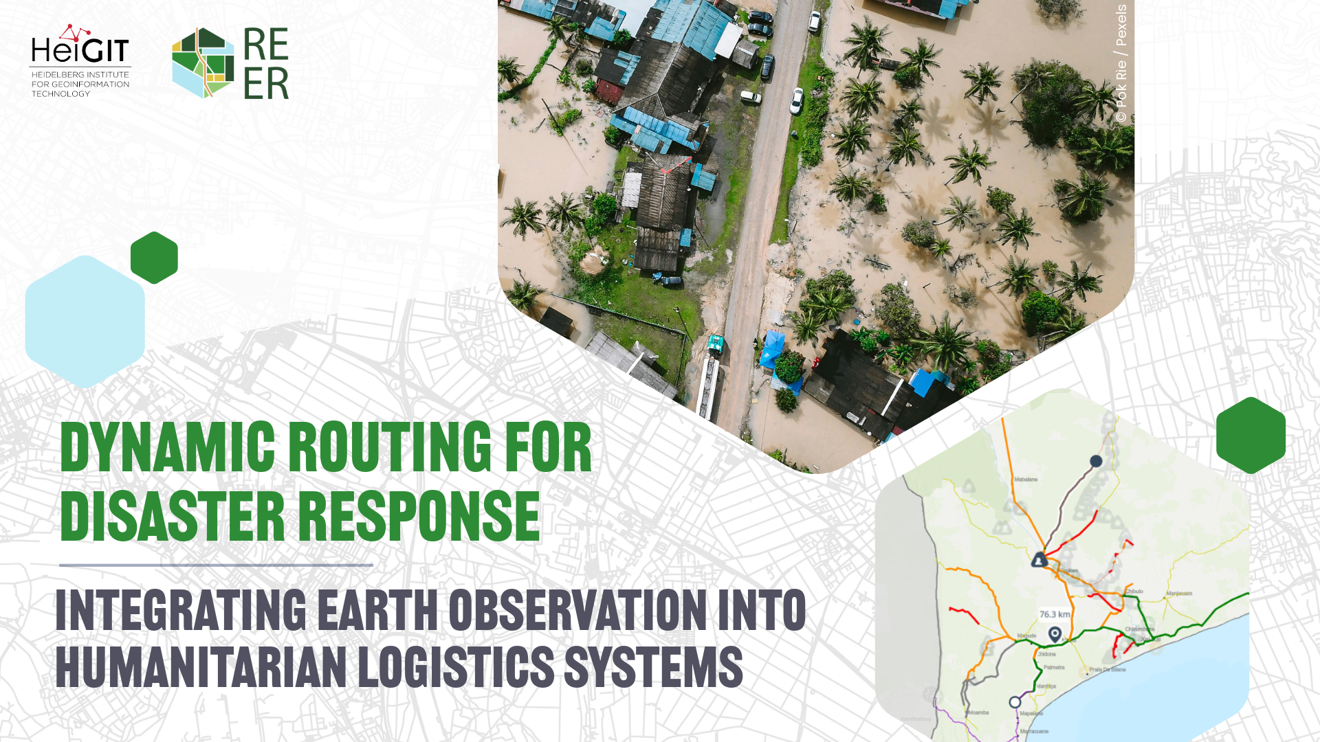
The Vision: a Dynamic Routing System for Humanitarian Logistics
The REER (Reliable and Effective Earth Observation Guided Routing in Disaster) project aims at providing a routing solution that improves the efficiency and safety of humanitarian aid operations during disaster events. By automatically integrating dynamic, Earth Observation–derived and operational data into routing processes, the REER system is set to support faster and more informed decision-making by enabling data-driven route planning that adapts to changing conditions on the ground, e. g. when floods quickly block roads.
The REER service portal is designed for easy uploading, managing, and sharing data on disaster-affected infrastructure and transport networks, helping humanitarian organizations deliver aid more efficiently, reduce risks, and make effective use of limited resources. This is increasingly relevant as disasters are becoming more frequent and severe, while humanitarian resources are under growing pressure.
A Collaborative Project to Co-Design Solutions with Real-World Users
The REER research project is led by HeiGIT in collaboration with the German Aerospace Center (DLR), with funding support from the European Space Agency (ESA). A cornerstone of the project is the close collaboration with global humanitarian organizations such as the World Food Programme–led Logistics Cluster, Map Action, Humanitarian OpenStreetMap Team (HOT), British Red Cross, German Red Cross, Nigerian Red Cross, and the International Federation of Red Cross and Red Crescent Societies (IFRC).
These partners contribute real-world use cases, requirements, and feedback to ensure the system is aligned with operational needs. All humanitarian organizations involved in the project confirmed the need for the REER routing system and their willingness to support its development beyond this first feasibility project stage.
REER Phase 1 Successfully Completed
During the first phase of the project, which ran from September 2025 to March 2026, the project team focused on understanding user needs, testing technical feasibility, and building an initial proof of concept.
After engaging with multiple humanitarian organizations to identify concrete user requirements, we successfully tested a flood detection pipeline using satellite data, with results showing high accuracy across different regions and scenarios. In addition, data ingestion pipelines were developed to automatically collect, integrate and synchronize external datasets, adding a key feature for a routing portal with multiple, dynamic data sources. Further tests demonstrated that such data can be successfully used directly in routing, enabling routes to adapt to hazards like floods or blocked roads.
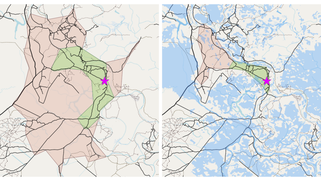
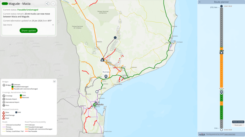
The resulting proof of concept allows for calculating road accessibility from a specific point while taking into consideration flooded areas to be avoided, which can be automatically detected from satellite images (figure 1). This can be integrated into custom routing that takes into account the current passabilty of roads, e. g. including information on road damage, flooded areas, unpassable bridges and other restrictions (figure 2).
Next Steps
The project partners are currently preparing a project proposal to move towards further development and real-world application of the routing system with the development of a full demo routing system. In the longer term, we aim at expanding the system to include additional hazard types beyond floods, portable deployment testing (particularly for offline and field use scenarios), and the development of targeted training and documentation, with a focus on practical usage and interpretation of routing results.