After the latest update of openrouteservice to v6.2.1, we are pleased to announce that it is now possible to calculate long distance routes using all bike and pedestrian profiles whilst taking into account of restrictions such as avoiding ferries. Previously, this super fast routing was only available with the car and HGV profiles, but after some modifications in our code, the Core-ALT algorithm has been deployed to all of the bike and foot based profiles.
So let’s do an example! Let’s say we were planning a bike trip across Europe starting in Lisbon (Portugal) and ending up in Athens (Greece). Doing a standard route, the openrouteservice API calculates you a 3800km route in less than a second.
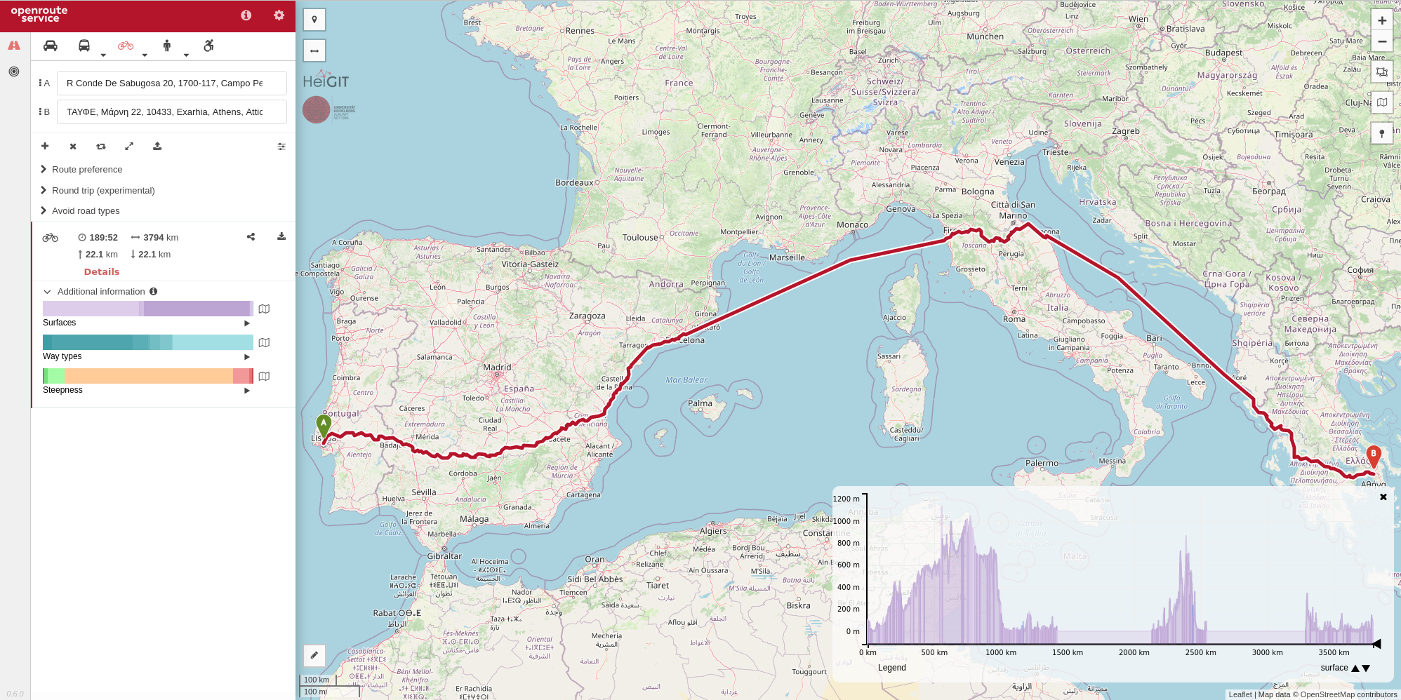
Lisbon to Athens on a bike
However, when calculating the route we see that it is telling us to take ferries, but that really isn’t the idea of our cross Europe bike trip… Because openrouteservice uses the Core-ALT algorithm, we can tell it that we don’t want to use ferries by adding these as an avoidable. Then when the route is generated again, we get a route from Lisbon to Athens (a total of nearly 5000km) without any ferries being used! And again, generating the route is pretty fast taking less than 4 seconds to calculate and transmit (that’s 0.0008 seconds per kilometre of route if you were interested).
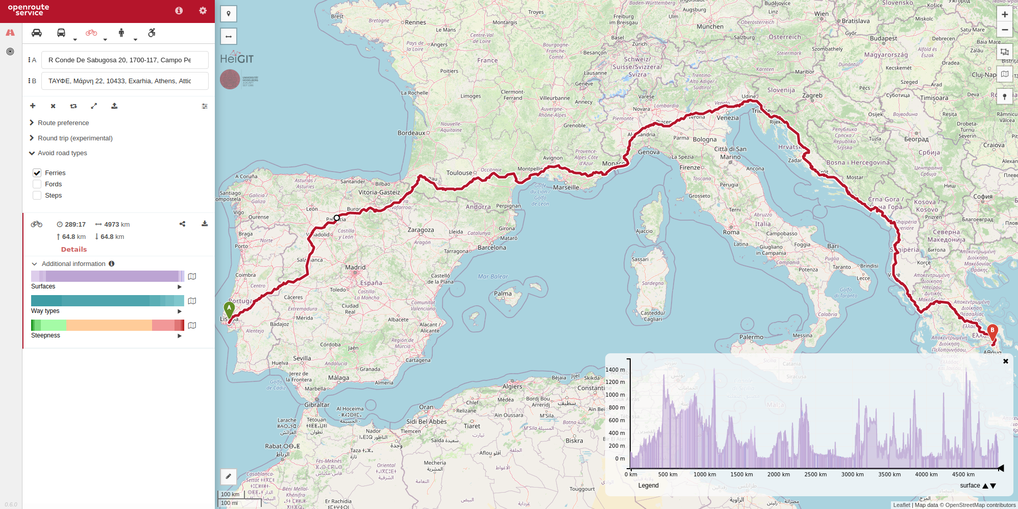
Lisbon to Athens avoiding ferries
As always, the same route that was obtained from our maps client can be generated through our API and on our “under development” new maps client. You can find information about parameters in our interactive documentation, and you can sign up for a free API key on our developer dashboard. Openrouteservice is serving the OSM community and more already since 2008 .
Happy “long distance bike and foot without ferries” routing everyone!