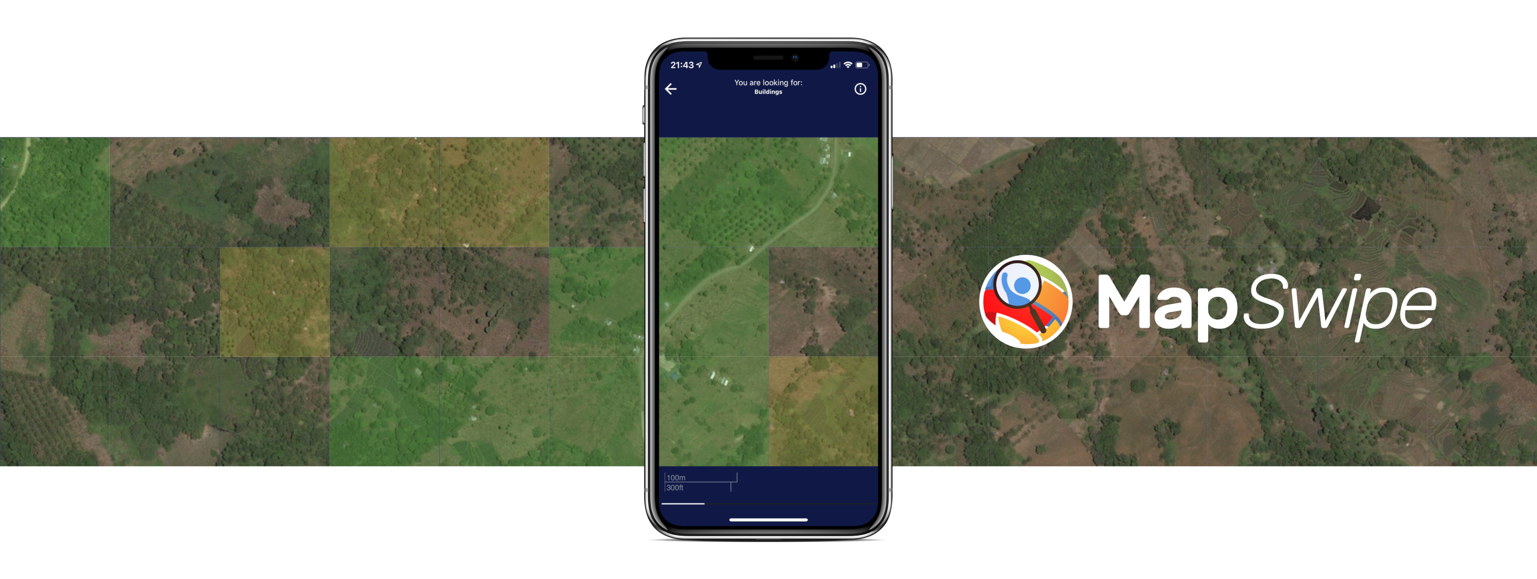
MapSwipe is an open-source mobile and web application designed to enhance global mapping efforts, making them more coordinated and efficient. Launched in 2015, MapSwipe has grown into a community of over 95,000 users who have collectively mapped over 1.3 million square kilometers, supporting critical humanitarian mapping initiatives.
Collaborative Impact Through Partnerships
The project is powered by the collaborative efforts of HeiGIT technologies, the British Red Cross, the American Red Cross, the GIScience Research Group at Heidelberg University, the Humanitarian OpenStreetMap Team, and Médecins Sans Frontières. Built and maintained by a dedicated team of volunteers, MapSwipe leverages HeiGIT’s innovative technology to ensure that mapping data is accurate and accessible.
Crowdsourcing for a Purpose
From the beginning, HeiGIT and the GIScience Research Group have been instrumental in shaping MapSwipe. They designed the crowdsourcing approach that underpins the app, provided the tools needed to manage this global initiative, and ensured the data generated by volunteers is used effectively and promptly. Their contributions help transform volunteer input into actionable data for humanitarian organizations, enabling timely support where it’s needed most. Over the years, we have explored a variety of innovative approaches to expand the app’s functionality, adapting it to meet new challenges and maximize its impact.
Ongoing Projects
April - December 2025
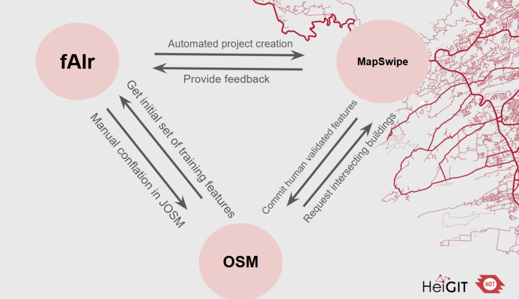
fAIrSwipe
fAIrSwipe aims to combine AI‐generated building predictions from fAIr with crowdsourced validation and conflation workflows in MapSwipe, ultimately pushing high‐confidence conflated map data into OpenStreetMap (OSM).
Completed Projects
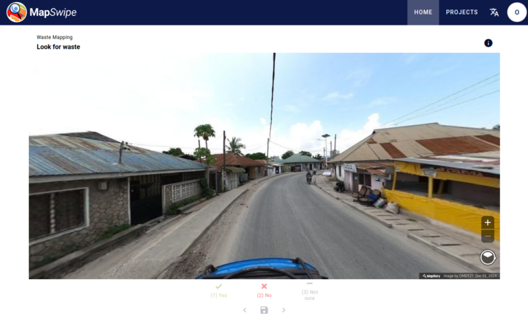
MapSwipe4Web: Street-level imagery classification
August - December 2024
We have partnered with the Humanitarian OpenStreetMap Tam (HOT) to create a new humanitarian use case project type for MapSwipe4Web. We will use street-level imagery to contribute to the hyperlocalization in the data collection by allowing users to indicate for example if a street is paved, if streetlights are present, or if there are facilities like health centers or schools.
example of the MapSwipe street level imagery
MapSwipe4Web
November 2023 - March 2024
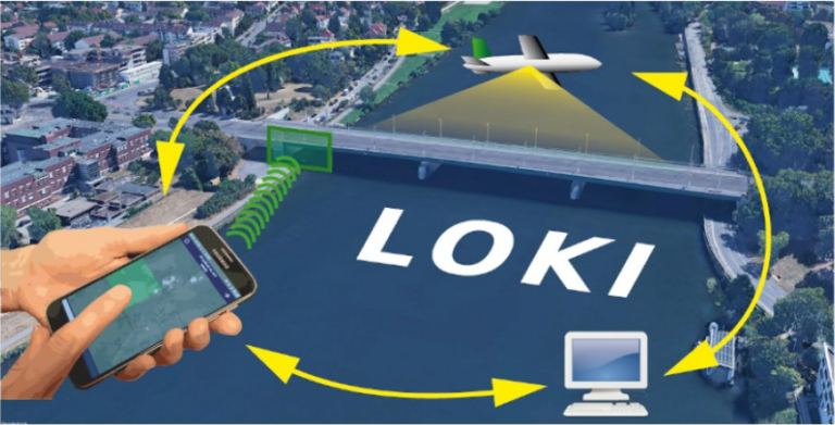
The web app was developed by HeiGIT with support from the Humanitarian OpenStreetMap Team (HOT). It is based on an application for crowdmapping originally used in the LOKI and UndercoverEisAgenten projects to map earthquake damage and permafrost in UAV imagery. The source code of the MapSwipe Web App is public and available under a free license. Contributions and bug reports are welcome.
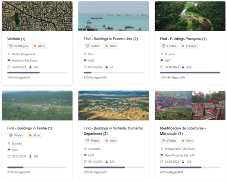
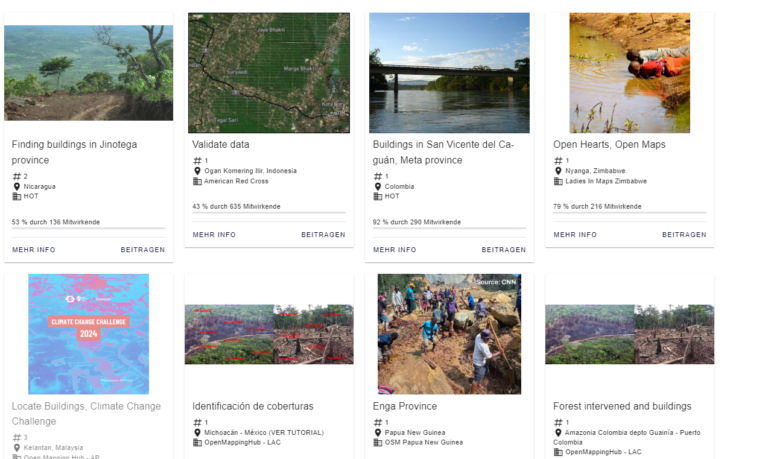
Figure 1: Current and past MapSwipe projects engage volunteers in various mapping tasks worldwide.
Completeness
January 2023 - April 2023
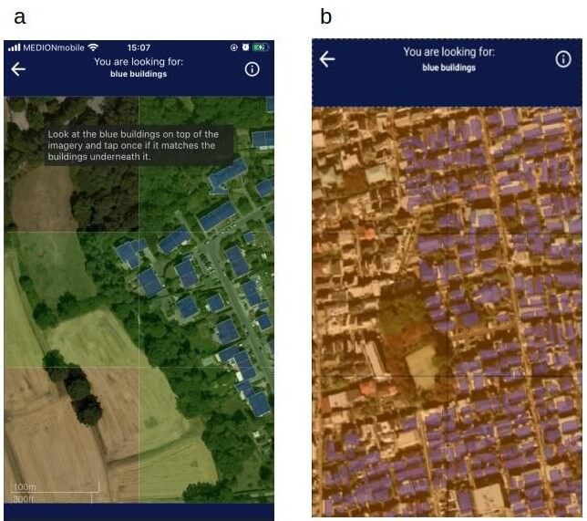
As part of the LOKI project, we introduced and refined a new project type to evaluate the completeness of OpenStreetMap (OSM) building data tile by tile. This feature enables users to classify tiles as “no building,” “complete,” or “incomplete” through a simple interaction: no tap, single tap, or double tap, respectively. This intuitive approach provides an efficient way to assess and enhance the accuracy of building data in OSM.
Figure 1: Add image caption
MapSwipe American Red Cross
November 2021 - December 2021
This project aimed to create tools and guidance for conducting “building footprint review” initiatives in MapSwipe. Key objectives included designing user response options and ensuring previously reviewed answers persist when revisiting a feature. The project also explored optimal visualization methods, such as translucent shapes or outlines, and designed an intuitive interface for this project type. A tutorial was developed to guide users, and user testing, facilitated by the American Red Cross, ensured usability and effectiveness.
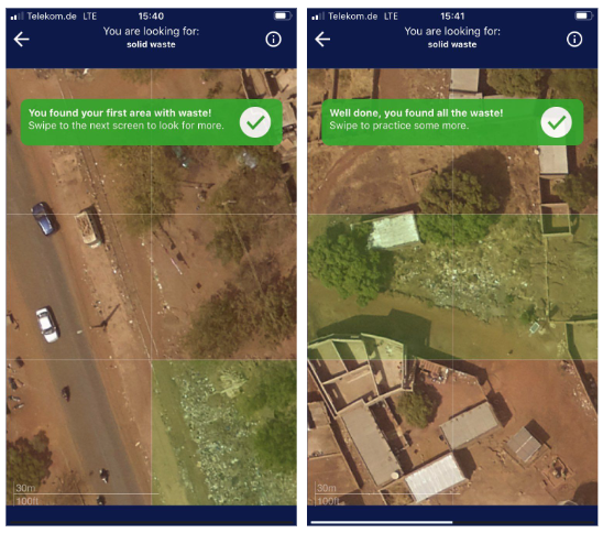
Solid Waste Mapping Bamako, Mali
2020 - 2021
MapSwipe was deployed in Bamako to pinpoint areas with solid waste, supporting safer and more efficient household waste collection. By identifying waste locations, the project contributed to making Bamako a cleaner, healthier city for its residents. Over the course of the project, users made 6,760,332 classifications of satellite imagery, helping to map and understand the distribution of waste across the city.
Example of the solid waste mapping
Change Detection Proof-of-Concept
April 2019 - Juni 2019
The Humanitarian OpenStreetMap Team (HOT) , the Heidelberg Institute of Geoinformation Technology (HeiGIT) , and the wider MapSwipe Community, we developed a new project type for detecting changes in satellite imagery. This extension enables users to compare two satellite images from different time periods (e.g., before and after a disaster) to identify areas of change. This capability is particularly valuable for rapid damage assessments in the aftermath of disasters, improving response and recovery efforts.