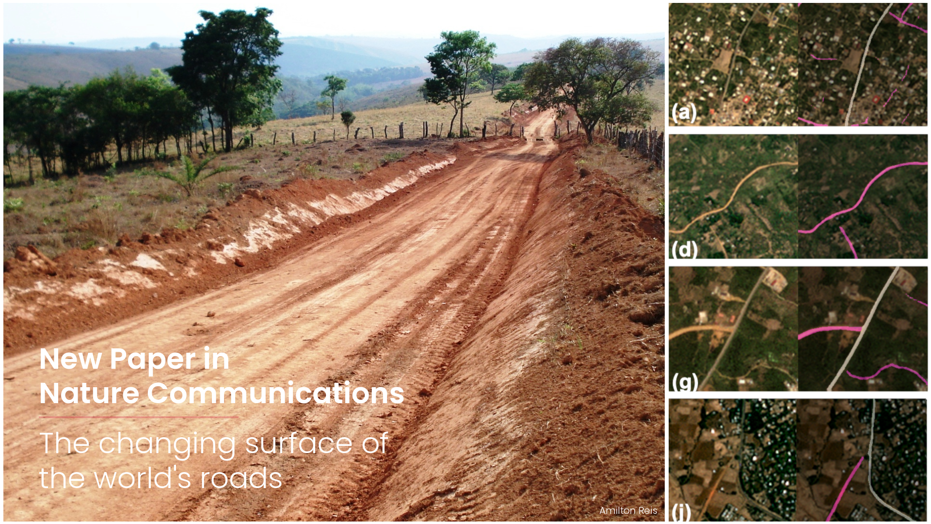
Road infrastructure is a foundational element of the UN Sustainable Development Goals, yet no global baseline of road surface conditions exists. This absence undermines assessments of network functionality, resilience, and development trajectories worldwide. To address this gap, researchers from HeiGIT and GIScience developed the first global, multi-temporal dataset of road pavedness and width and passability.
The authors apply a deep learning framework to the PlanetScope satellite imagery at 3 to 4 meter resolution, captured in 2020 and 2024. This approach produces classifications for 9.2 million kilometers of critical arterial roads, achieving 95.5% coverage and an overall accuracy of 89.2%. The model outperforms open volunteered datasets by more than 20 percentage points. Both road pavedness (paved or unpaved) and road width are extracted, enabling both a static snapshot of global infrastructure and the quantification of change over the four-year period. The temporal dimension, here demonstrated by comparing two acquisition years, enables capturing the dynamics of infrastructure investment and deterioration at a level of detail that traditional proxy indicators such as nighttime lights cannot provide. This approach can be extended to analyze changes over any desired timeframe.
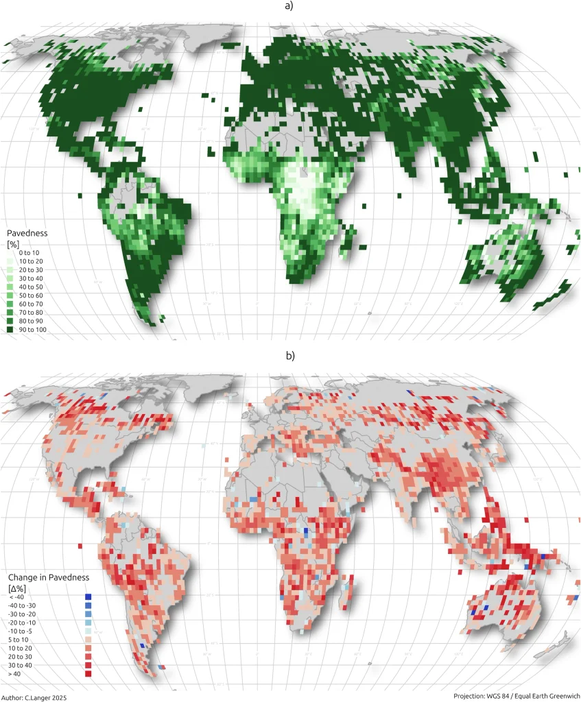
Global road surface pavedness in 2024. The upper panel displays the percentage of road length classified as paved within a global grid for primary arterial roads in 2024, based on deep learning analysis of Planet satellite imagery. b Global road surface pavedness change from 2020 to 2024. The lower panel quantifies the absolute change in the share of paved roads between 2020 and 2024. Red cells indicate a net increase in pavedness, highlighting substantial infrastructure investment, particularly in lower- and lower-middle-income regions. Blue cells indicate an apparent decrease, which may reflect either model uncertainty or actual road degradation. Country border data are sourced from Natural Earth.
Our spatial analysis reveals a pronounced multi-scale geography of human development. At the planetary scale, changes in road pavedness between 2020 and 2024 provide a dynamic proxy for national development trajectories, showing a statistically significant association with human development. These temporal patterns complement the cross-sectional patterns observed in overall infrastructure levels. At the national scale, the data quantify how unpaved roads constitute a fragile backbone for economic connectivity, revealing the structural vulnerability of networks in which key arterials remain unsurfaced. The authors synthesize these findings into a global Humanitarian Passability Matrix, which is designed to inform humanitarian operations.
At the local scale, two case studies ground the global patterns in concrete contexts. In Ghana, disparities in road quality across districts expose the spatial outcomes of governance and public investment decisions. In Pakistan, the temporal data identify infrastructure vulnerabilities relevant to climate resilience planning, demonstrating how newly paved or persistently unpaved roads intersect with flood risk. Together, these case studies demonstrate the versatility of the framework to a range of policy questions.
This work delivers both a foundational open dataset and a multi-scale analytical framework. By translating satellite imagery into a continuous, updatable record of road surface conditions, researchers provide governments, development organizations, and researchers with a tool that tracks infrastructure development. The alignment of infrastructure change with Human Development Index dynamics suggests that road surface data could serve as a signal of development, offering policymakers a measurable target for strategic investment in the regions that matter most.
Reference: Randhawa, S., Randhawa, G., Langer, C. et al. The changing surface of the world’s roads. Nat Commun 17, 9345 (2026). https://doi.org/10.1038/s41467-026-76234-8
Dataset on the Humanitarian Data Exchange: https://data.humdata.org/organization/heidelberg-institute-for-geoinformation-technology?q=Planet&ext_page_size=25