With the OSHDB Ver. 1.0, the Heidelberg Institute for Geoinformation Technology (HeiGIT) releases a professional software that enables analyzing and visualizing of OpenStreetMap data development via a simple dashboard.
Heidelberg, January 12, 2023. Two clicks. That’s all it takes to access the history of OpenStreetMap data. No IT expertise or technical know-how is necessary. The data is thus open to everyone, whether they belong to journalism, science or humanitarian organizations. OSHDB is short for OpenStreetMap History Data Base. With version 1.0, OSHDB has made the step from prototype to professional software – and the HeiGIT-team has thus reached an important milestone.
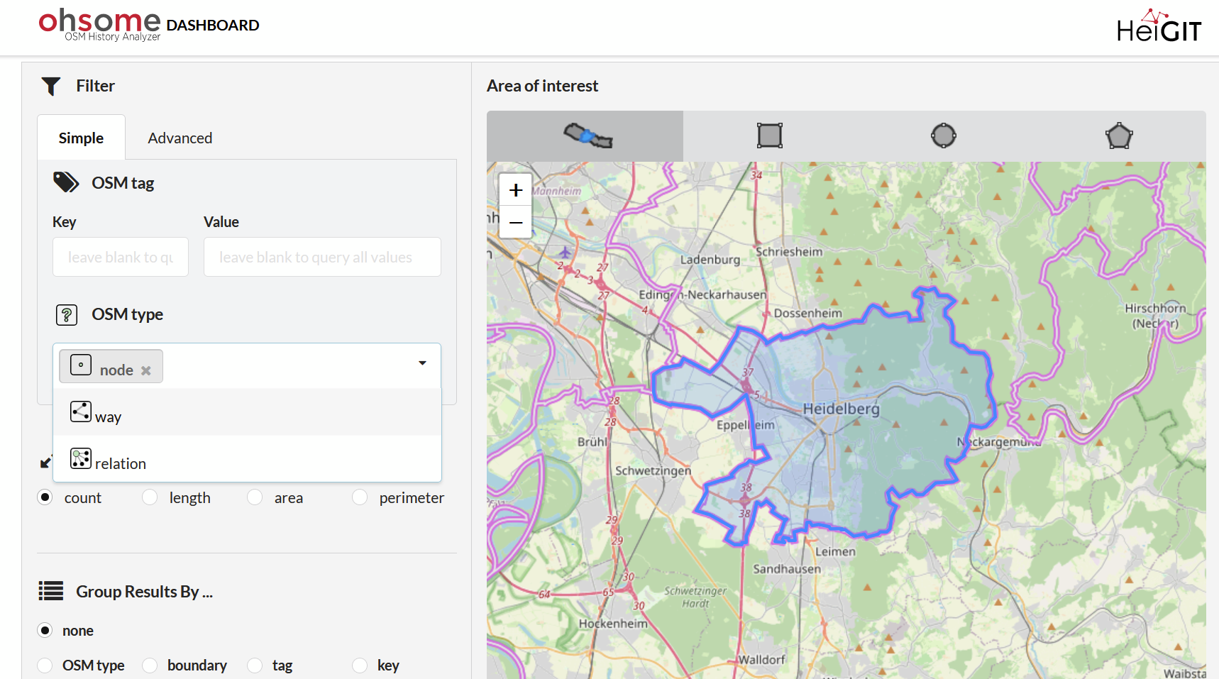
OSHDB delivers what the name promises: The software can analyze and visualize contributions, changes and deletions, looking back over a period of time up to the year 2007. OpenStreetMap is an online map service to which everybody can contribute. Every change, every added or deleted detail, and every description is stored and archived – resulting in an enormous amount of historical OSM data. OSHDB now helps to use this data: Via an intuitive dashboard, users can select a specific region or draw one themselves, specify the desired geometry or attributes (the type of objects) in more detail if necessary, and display and visualize all data changes, contributions, or deletions since 2007 in a clear diagram. The dashboard is the easiest way to do this: Technical experts and scientists can even make complex queries via the ohsome API.
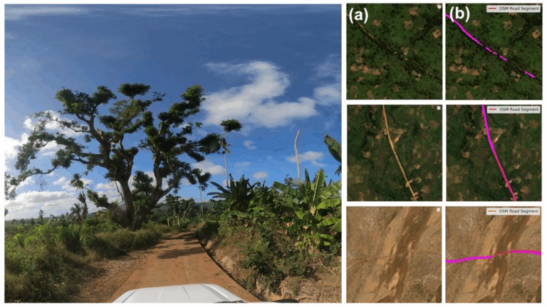
Looking into OSM history provides important insights into the quality of the data: If no changes have been recorded in a certain region for some time, this area is probably saturated, i.e. almost completely mapped. If, on the other hand, erratic changes occur, or if the number of changes continuously increases, the selected area is probably still in the mapping process and has not yet been fully recorded. Such information is important for researchers concerned with the quality and comparability of OpenStreetMap data and also has practical benefits for humanitarian organizations. In times of crisis, they rely on OSM because the data can be quickly updated and adapted to the prevailing conditions. Roads that are impassable due to natural disasters immediately appear on the map. Accordingly, it is important for humanitarian organizations to gain a quick overview of the quality of the respective data. With OSHDB, they have access to this within a few seconds and can react promptly in the event of a crisis. The German Red Cross and the Humanitarian OpenStreetMap Team, for example, have been close partner organizations of HeiGIT for years and tools like OSHDB are optimized precisely for this target group.
The potential for a software that could access the history of OSM data was recognized early on by the HeiGIT team: While current OSM data was relatively easy to analyze, historical contributions posed challenges for users just a few years ago. “Scientists had to find their own setup and their own way to evaluate data,” says Dr. Alexander Zipf, Scientific Director and Managing Director of HeiGIT. He and his colleagues have made it their goal to change this – not least out of their own interest, since appropriate software would also make their own work easier and enable new projects. In 2016, Rafael Troilo and his team started working on the first working versions of OSHDB. After years of tweaking, the team led by Big Data expert Benjamin Herfort has now made version 1.0 a professional application: “We’ve shown that we can turn scientific ideas into stable software.”
Although HeiGIT has reached an important milestone with OSHDB version 1.0, their work is far from finished: Further improvements and optimizations are already planned. For example, in the future it will be possible to analyze all new changes in OSM every minute, for instance with regard to data quality.
Link to dashboard: Ohsome – Dashboard
The aim of the Heidelberg Institute for Geoinformation Technology (HeiGIT) is to improve the transfer of knowledge and technology from basic geoinformatics research into practice by using innovative geoinformation technologies. It was founded in 2019 as an affiliated institute of Heidelberg University and has since then been core-funded by the Klaus Tschira Stiftung. The institute researches and develops intelligent routing and navigation services for sustainable mobility and provides geodata for humanitarian missions. In addition, innovative services from the research areas spatial data mining and machine learning are used to analyze, process, enrich and visualize user-generated geodata (e.g. OpenStreetMap).
The German foundation Klaus Tschira Stiftung supports natural sciences, mathematics and computer science and the appreciation of these subjects. It was founded in 1995 by physicist and SAP co-founder Klaus Tschira (1940–2015) by private means. Its three priorities are: education, research and science communication. This commitment begins in kindergarten and continues in schools, universities and research institutions throughout Germany. The foundation advocates the dialogue between science and society. Further information (in German) at: www.klaus-tschira-stiftung.de