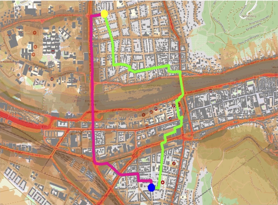
#Noise #pollution is one of the main stressors in urban environments, having negative impacts on people’s quality of life and health. For some groups of citizens, such as school children, patients, and elders, there is a need to support them in finding pedestrian routes in noise polluted areas of cities. In a new paper, we focus on the estimation of traffic noise, and present an approach to provide quiet routing services, taking into account the estimated noise levels of roads.
By combining Volunteered Geographic Information from OpenStreetMap (OSM), official socio-economic data, and open-access GPS trajectory data, we develop a set of traffic related variables, and apply machine learning methods to perform traffic volume estimations. Given the estimated traffic information, an existing traffic noise model is then employed to derive the noise polluted areas. For generation of quiet routes, a new routing algorithm is proposed. It minimizes the exposure of pedestrians to traffic noise pollution while taking into account the route distance constraint. We apply our quiet routing approach to the city of Heidelberg (Germany). The application results demonstrate the efficacy of our algorithms in the generation of quiet routes customized to pedestrian preferences.
Z. Wang, T. Novack, Y. Yan and A. Zipf, “Quiet Route Planning for Pedestrians in Traffic Noise Polluted Environments,” in IEEE Transactions on Intelligent Transportation Systems, doi: 10.1109/TITS.2020.3004660.
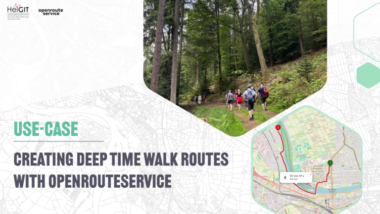
In earlier work we looked already into generating customized pleasant pedestrian routes based on several factors like greenness, noise and sociability, and added this to Openrouteservice by HeiGIT & GIScience HD:
Novack, T.; Wang, Z.; Zipf, A. (2018): A System for Generating Customized Pleasant Pedestrian Routes Based on OpenStreetMap Data. Sensors 2018, 18, 3794.
Also currently we started to test related approaches in Dresden and Heidelberg in the context of the meinGrün project.
This builds upon early work by Zipf and Röther (2000), But nowadays the needed data sources are much more available, so that it becomes possible to scale these ideas to new levels using open data which allow to finetune and evaluate the approach using real world data.
The relevance of green spaces for wellbeing and mental health in cities has been proofed by a study published in Nature Neuroscience
H. Tost, M. Reichert, U. Braun, I. Reinhard, R. Peters, S. Lautenbach, A. Hoell, E. Schwarz, U. Ebner-Priemer, A. Zipf, and A. Meyer-Lindenberg (2019): Neural correlates of individual differences in affective benefits of real-life urban green space exposure. Nature Neuroscience. https://doi.org/10.1038/s41593-019-0451-y
Zipf, A. & Röther, S. (2000): Tourenvorschläge für Stadttouristen mit dem ArcView Network Analyst. In: Liebig, W. (Hrsg.): ArcView Arbeitsbuch. Hüthig Verlag. Heidelberg.
Other early examples on using OpenStreetMap for specialized routing and navigation applications for large areas or specific scenarios (e.g. disaster management, wheelchairs etc.) are given below:
Neis, P. & Zipf, A (2008): OpenRouteService.org is three times “Open”: Combining OpenSource, OpenLS and OpenStreetMap. GIS Research UK (GISRUK 08). Manchester.
Schmitz, S., Neis, P. & Zipf, A. (2008): New Applications based on Collaborative Geodata – the Case of Routing. XXVIII INCA International Congress on Collaborative Mapping and SpaceTechnology, Gandhinagar, Gujarat, India.
Rousell A. and Zipf A. (2017): Towards a landmark based pedestrian navigation service using OSM data. International Journal of Geo-Information, ISPRS IJGI, 6(3): 64.
Neis, P., Singler, P. & Zipf, A. (2010): Collaborative mapping and Emergency Routing for Disaster Logistics – Case studies from the Haiti earthquake and the UN portal for Afrika. In: Car, A., Griesebner, G. & Strobl, J. (Eds.): Geospatial Crossroads @ GI_Forum ‘10. Proceedings of the Geoinformatics Forum Salzburg.
Zipf, A., Mobasheri, A., Rousell, A. ,Hahmann, S. (2016): Crowdsourcing for individual needs – the case of routing and navigation for mobility-impaired persons . In: Capineri, C, Haklay, M, Huang, H, Antoniou, V, Kettunen, J, Ostermann, F and Purves, R. (eds.) European Handbook of Crowdsourced Geographic Information, p. 325–337. London: Ubiquity Press. DOI: dx.doi.org/10.5334/bax.x
Miksch, J., Hahmann, S., Resch, B., Lauer, J., Zipf, A. (2017): Routing Through Open Spaces – A Performance Comparison Of Algorithms. Geo-Spatial information Science, 2017. Taylor & Francis. Geo-Spatial information Science, 2017. Taylor & Francis. https://doi.org/10.1080/10095020.2017.1399675