The HeiKA autumn school urban data science that took place last week was a good success with participating students varying between five and fifteen during the week. Topics covered included visualization, spatial statistics, analysis of movement data, intrinsic data quality assessment based on the ohsome API and the use of the openrouteservice API. Hands-on exercises were based on QGIS, GeoDa, R and Python. The lab work was augmented by inspiring talks by guest lecturers:
- Alexander Zipf (GIScience HD, HeiGIT)
- Peter Vortisch (KIT-IFV)
- Sina Keller (KIT-IPF)
- Anita Graser (AIT)
- Karin Hitscherich (PTV Group)
- Julian Bruns & Akira Sriamulu (Disy)
- Till Nagel (HS Mannheim)
Examples from the labwork:
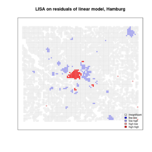
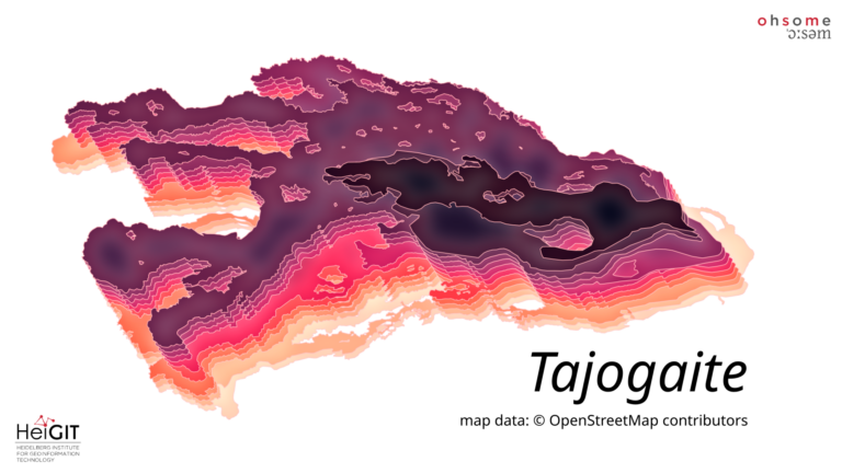
Local Moran’s I for residuals of a regression analysis on factors associated with the distrubiton of charging stations for e-mobility
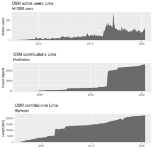
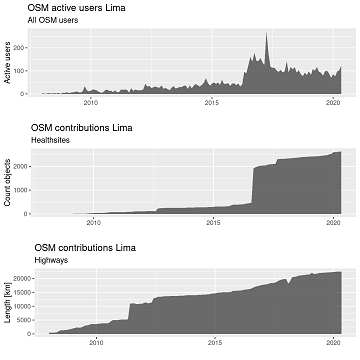
Checking completeness of OSM features for Lima with help of the ohsome API.
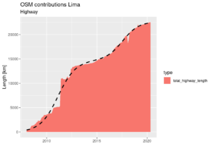
Fitting a double logistic curve to the cumulative OSM contributions for highway=* in Lima.
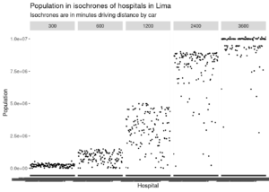
Population in different driving distances around hospitals in Lima.
If you want to know more about our ohsome framework, don’t hesitate to reach out to us via info(at)heigit.org or contact any member of our team directly. Stay ohsome and happy cycling!
Information on the ohsome OpenStreetMap History Data Analytics Platform and more examples of how to use the ohsome API can be found here:
- ohsome general idea
- ohsome general architecture
- the whole “how to become ohsome” tutorials series
- Scientific article on OSHDB
- OSHDB and ohsome API git repositories
- For some recent work that has been accomplished using the ohsome framework see for example
- Analyzing the spatio-temporal patterns and impacts of large-scale data production events in OpenStreetMap In: Minghini, M., Grinberger, A.Y., Juhász, L., Yeboah, G., Mooney, P. (Eds.). Proc. of the Academic Track at the State of the Map 2019, 9-10. Heidelberg
- Auer, M.; Eckle, M.; Fendrich, S.; Griesbaum, L.; Kowatsch, F.; Marx, S.; Raifer, M.; Schott, M.; Troilo, R.; Zipf, A. (2018): Towards Using the Potential of OpenStreetMap History for Disaster Activation Monitoring. ISCRAM 2018. Rochester. NY. US.
- Wu, Zhaoyan, Li, Hao, & Zipf, Alexander. (2020). From Historical OpenStreetMap data to customized training samples for geospatial machine learning. In proceedings of the Academic Track at the State of the Map 2020 Online Conference, July 4-5 2020. DOI: http://doi.org/10.5281/zenodo.3923040
- Ludwig, C., Fendrich, S., Zipf, A. (2020 accepted): Regional Variations of Context-based AssociationRules in OpenStreetMap. Transactions in GIS DOI: 10.1111/tgis.12694

