Following the catastrophic earthquakes in Venezuela on June 24, 2026, humanitarian organizations face a compromised operational landscape. With over 3,600 confirmed fatalities and tens of thousands missing, the immediate priority…
At Explore Science 2026, young students experimented with computer vision for humanitarian mapping: an occasion to learn how AI models are trained and why human input remains essential for generating…
The Colombian Red Cross’s Disaster Risk Management (DRM) team works to mitigate the impact of emergencies and enhance community resilience throughout the country. Coordinating actions at both national and regional…
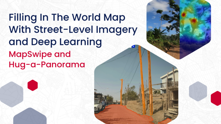
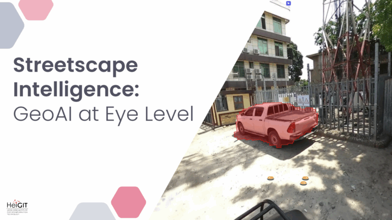
HeiGIT has been working with deep learning models and street-level imagery for some time, with the goal to contribute to „filling in the world map“ by gaining high-resolution information about…
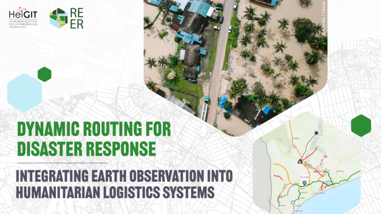
As disasters grow more frequent and complex, the REER project aims at supporting the operational needs of humanitarian organizations. By combining Earth Observation outputs with data from the ground, the…
This study is based on Celina Thomé’s master thesis. It was presented at the ISCRAM 2026 conference, where it added to conversations about using data-driven methods to improve crisis management,…
The new OpenAccessLens platform provides open, global data on accessibility to healthcare and education. Built on OpenStreetMap data and openrouteservice modeling, it can support accessibility research, humanitarian work, public health…
In 2023, a shared vision emerged to make geospatial skills more accessible, consistent, and sustainable across the Red Cross and Red Crescent Movement. Initiated by the British, German, and Netherlands…
neuer globaler Datensatz zeigt Lücken beim Zugang zu Bildungseinrichtungen und der Gesundheitsversorgung auf Zahlen allein erzählen selten die ganze Geschichte – etwa darüber, ob ein Kind zur Schule geht oder…
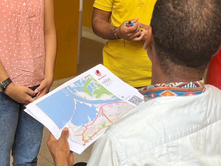
The Sketch Map Tool was strategically used within Colombia’s National Disaster Management System to steer community mapping in the southern city of Cali. The National Unit for Disaster Risk Management…
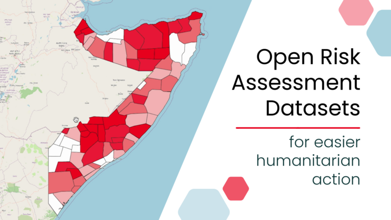
New open, ready-to-use global risk assessment datasets can simplify risk analysis by removing major technical barriers to data preparation. Designed for easy use with the Risk Assessment QGIS Plugin, the…
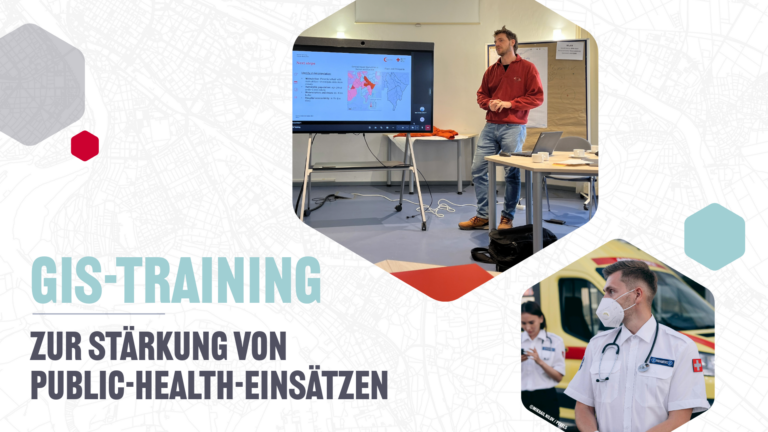
Geodatenanalysen sind von zentraler Bedeutung im Public-Health-Sektor, zum Beispiel bei Notfalleinsätzen und Krankheitsausbrüchen. Mit einer Pilot-GIS-Schulung haben wir gezeigt, wie Gesundheitsfachkräfte und Informationsmanager gemeinsam komplexe Daten in wirksame Entscheidungsgrundlagen überführen…
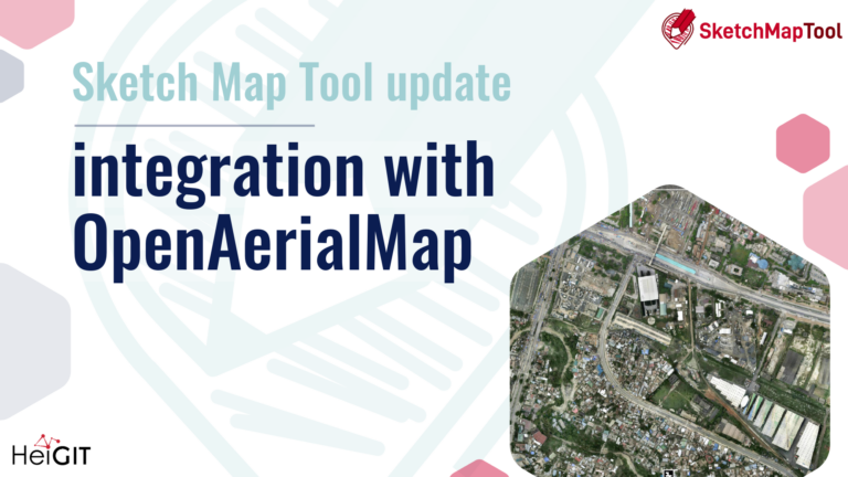
The latest update to the Sketch Map Tool introduces a direct integration with OpenAerialMap (OAM), making it easier to bring drone and aerial imagery into community and humanitarian mapping….
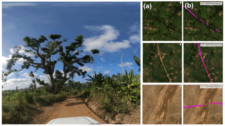
Ein neuer globaler Datensatz des HeiGIT (Heidelberg Institute for Geoinformation Technology) ermöglicht es weltweit zwischen befestigten und unbefestigten Straßen mit bisher unerreichter Konsistenz zu unterscheiden. Die aus hochauflösenden Satellitenbildern abgeleiteten Daten…
Crowdsourced street-level imagery can be used to detect and map humanitarian-relevant features in near real time. We have developed a machine-learning-based analytical pipeline that integrates with the open-source imagery catalogue…
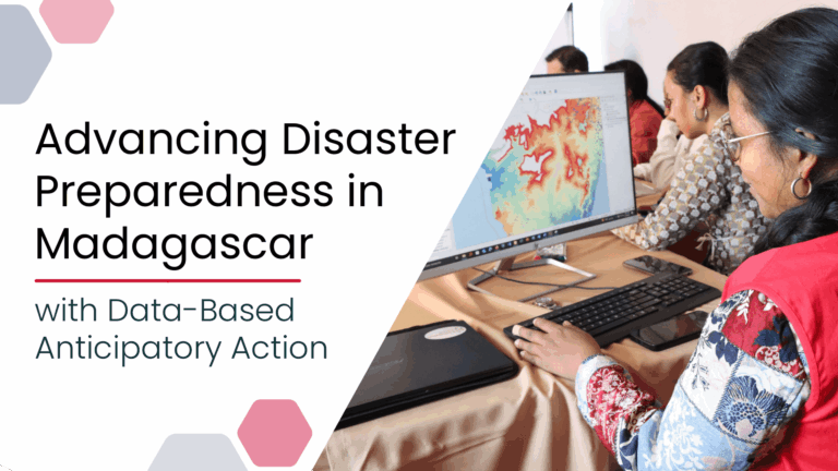
Anticipatory Action (AA) is becoming an increasingly vital approach in humanitarian and disaster risk management. By leveraging forecasts and risk data, AA enables timely interventions before extreme events occur. Geoinformation…
Das Sketch Map Tool wurde in Cartagena, Chile, eingesetzt, um geographische Informationen für eine effektive Katastrophenvorsorge zu sammeln. Es ist ein einfach anwendbares Tool für partizipatives Sketch-Mapping, das bei der…
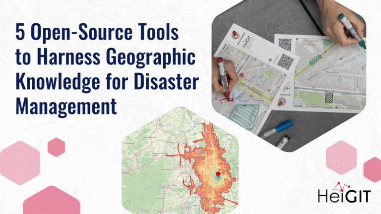
Volunteered Geographic Information (VGI) is a valuable resource for an effective disaster management. This article presents five free tools to enhance humanitarian work using VGI. What is VGI and why…
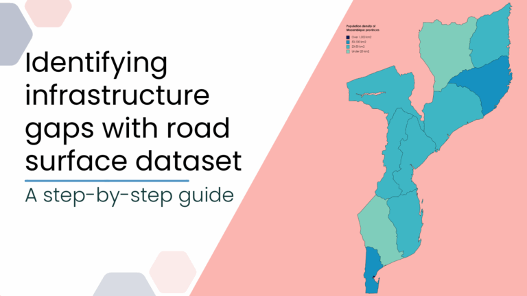
This blog post introduces a step-by-step tutorial for working with a global road surface dataset. Using open-source tools, the tutorial demonstrates how to identify infrastructure gaps by combining road surface…
Im Juni 2025 führten Wissenschaftler*innen des Urban Big Data Centre (UBDC) und HeiGIT (Heidelberg Institute for Geoinformation Technology) eine gemeinsame Exkursionen nach Kolumbien durch, um dort die Zusammenarbeit für partizipative…