Das Deutsche Rote Kreuz (DRK) hat gemeinsam mit dem Heidelberg Institute for Geoinformation Technology (HeiGIT gGmbH) und dem Deutschen Zentrum für Luft- und Raumfahrttechnik (DLR) für einige Jahre zusammengearbeitet, um…
Letzten Mittwoch konnten wir die neue Version des Sketch Map Tool in einer Online-Startveranstaltung präsentieren! Wir bedanken uns bei allen Teilnehmenden für ihre Beteiligung und ihr Feedback, ebenso wie für…
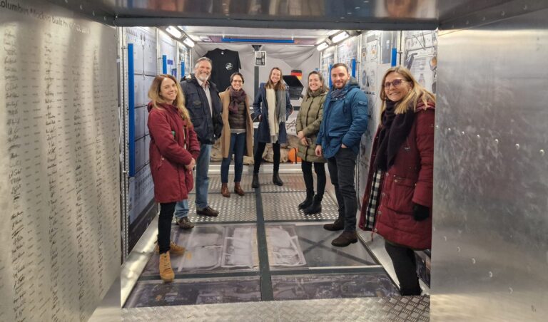
Titelbild: Teamvertreter von DRK, DRL und HeiGIT in dem Nachbau der europäischen Forschungskapsel COLUMBUS, die einen Teil der internationalen Raumstation (ISS) bildet. Foto: Anne Schneibel, 24.01.2023. Welche Gebäude sind nach…
Am 6. Februar um 4.17 Uhr morgens wurde ein Erdbeben der Magnitude 7.7 im Süden der Türkei aufgezeichnet. Dies ist das stärkste Erdbeben in der Türkei seit Beginn der Aufzeichnungen…
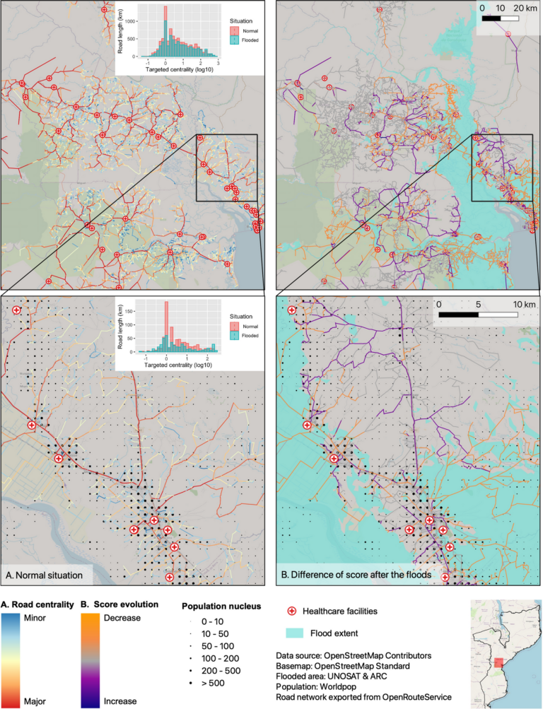
Zentralitätsindikatoren werden verwendet, um wichtige Knoten oder Kanten in Graphennetzwerken zu identifizieren. Angewandt auf Straßennetze können diese Indikatoren beispielsweise zur Modellierung der Verkehrsgeschwindigkeit oder zur Ermittlung beschädigter Straßen zur Unterstützung…
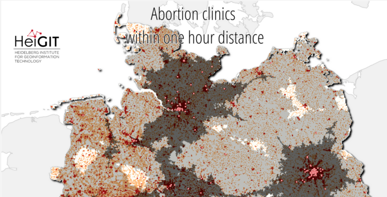
Volume 26, Ausgabe 8 von Transactions in GIS, die im Dezember 2022 erschien, hat eine Titelgeschichte, und zwar einen unserer Artikel. Wir wollen darin nicht nur unsere Liebe zur Mathematik,…
Gezeigtes Bild: Straßennetzwerkanalyse für die Fahrprofile. A Normale Verhältnisse vor dem Flutereignis. B Entwicklung des Scores nach den Überschwemmungen durch den Zyklon Idai. Die untere Reihe zeigt eine Nahaufnahme des…
Beitragsbild: Ohsome-Dashboard-Interface für Heidelberg, Deutschland. Mit den Worten von Konfuzius: „Der Mann, der einen Berg versetzt, beginnt damit, kleine Steine wegzutragen.“ Mit der Veröffentlichung der OSHDB (OpenStreetMap History Database) Version…
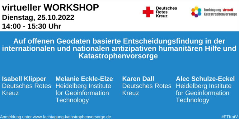
„Komplexe Krisen“ stehen dieses Jahr im Fokus der Fachtagung Katastrophenvorsorge, die vom 25. – 27. Oktober 2022 stattfinden wird. „Schaffen wir den notwendigen Paradigmenwechsel hin zu einer effizienteren, wirksameren und…
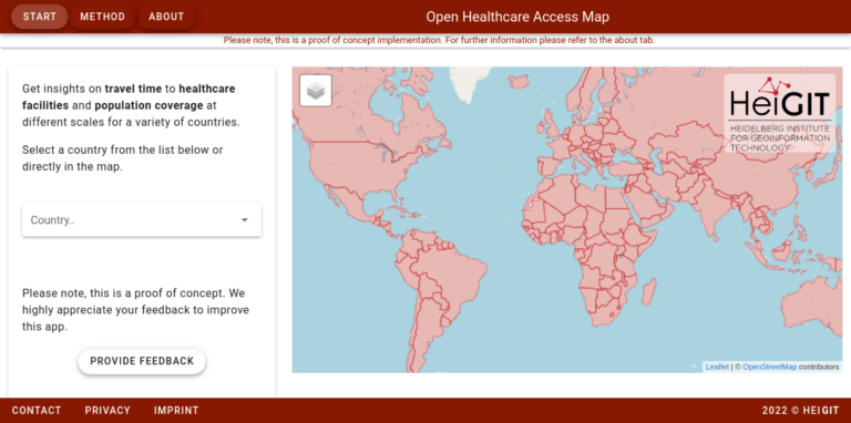
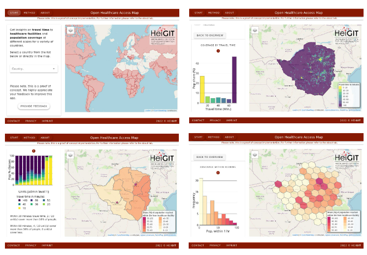
Im vergangenen Jahr haben wir die Open Healthcare Access Map gestartet. Zunächst waren nur einige Länder und später Kontinente verfügbar. Wir freuen uns heute anzukündigen, dass wir die restlichen,…
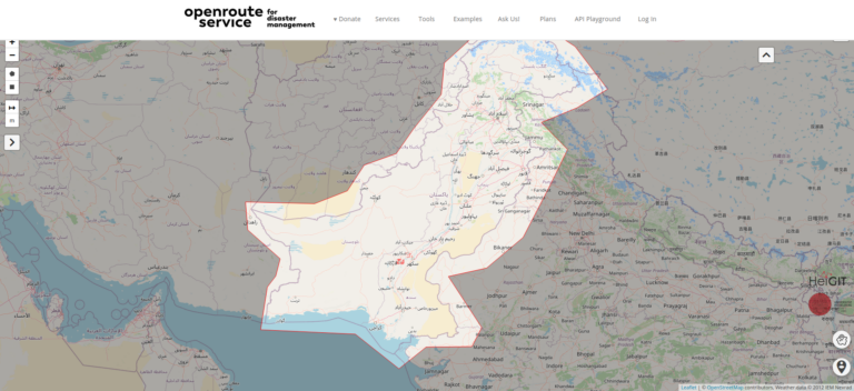
In den vergangenen Wochen hat die Monsunflut in Pakistan über 1.000 Tote gefordert und Millionen Menschen ohne Dach über dem Kopf hinterlassen. Da Berichte und Fotos von rapide steigenden Lebensmittelpreisen,…
UPDATE 09.11.2022: Unser Team hat an der State of the Map 2022 Tagung in Florenz, die neuerdings wieder in-Person stattfindet, teilgenommen. Wir haben bei Workshops mitgemacht, Vorträge angehört und hatten…
Diesen Juni fand die GIS-Woche 2022 von Ärzte ohne Grenzen (MSF) wieder im schönen Prag statt. Nahezu das gesamte MSF-Team, das sich mit Geodaten und Geodatenanalyse befasst, nahm an der…
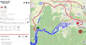
Unterführungen, Treppen und hohe Bordsteinkanten sind für Menschen mit Gehbeeinträchtigungen eine große Herausforderung. Ein maßgeschneiderter Routenplaner kann aber ihre Mobilität erhöhen, indem er Wege mit möglichst wenigen Hindernissen berechnet. Dieses…
Permafrost ist gefrorener Boden und in der Arktis weit verbreitet. Gebäude und Straßen werden auf ihm gebaut. Doch was passiert, wenn diese Böden durch die Klimaerwärmung zunehmend auftauen? Zusammen mit…
Just a couple of days ago, on December 16th, large area of the Philippines were hit by Typhoon Rai (local name Odette). The typhoon not only caused vast destruction but…
In the context of the United Nations World Data Forum 2021 organised by theUnited Nations Statistics Division and UN member states a series of blogposts has been published by UNSTATS….
Einladung Vortrag Online: Dienstag, 14. Dezember 2021, 19:15 Uhr Melanie Eckle-Elze, Benjamin Herfort, Dr. Carolin Klonner Digitale Geographie im Katastrophenmanagement Klimawandel, Bevölkerungswachstum, Verstädterung und weitere zunehmende Landnutzungsveränderungen führen dazu, dass…
Aktuelle Meldung der Universität Heidelberg zum Projekt HEAL: https://www.uni-heidelberg.de/de/newsroom/wenn-es-in-der-stadt-zu-heiss-wird BADEN-WÜRTTEMBERG STIFTUNG FÖRDERT HEIDELBERGER PROJEKT ZU ROUTINGDIENST MIT HITZEVERMEIDENDEN WEGSTRECKEN Wo in der Stadt Heidelberg ist es besonders heiß und wie…
On October 12th the “25 Mapathon project” was finalized with an exceptionally successful public online mapathon. Around 20 participants with various professional backgrounds mapped 2273 buildings in three hours to…