The climate crisis is intensifying, and while awareness is rising, there is a persistent gap between understanding and action. To address this, we are developing two key services:
A dashboard displaying high-resolution spatial climate action indicators, designed to support communities, organizations, and decision-makers with tailored data and information.
A high-resolution greenhouse gas inventory built on Volunteered Geographic Information (VGI), offering precise, actionable data for targeted mitigation efforts.
Together, these tools aim to drive effective climate action across all levels.
The Climate Action Navigator delivers climate action indicators tailored to specific cities. Using a framework of high-resolution spatial indicators, it provides actionable insights through data, maps, and reports co-developed with our partners. The dashboard integrates multiple data sources, including OpenStreetMap (OSM), openrouteservice (ORS), satellite imagery, and scientific research, ensuring comprehensive and reliable insights for decision-makers.
The full functionality of the dashboard is available to our partners. Contact us to become a partner now!
The codebase behind the Climate Action Navigator are freely available our GitLab page.
If you have any questions regarding the dashboard, you might find an answer here.
The tool estimates carbon emissions from land use and land cover (LULC) change, given a selected area of interest and observation period.
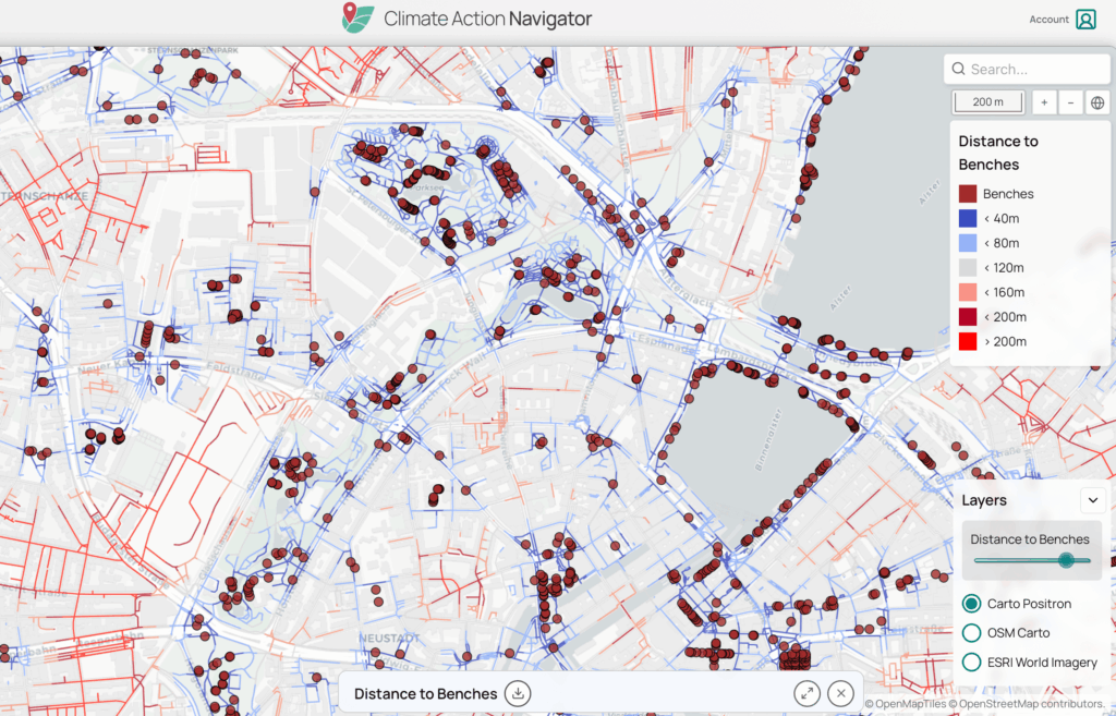
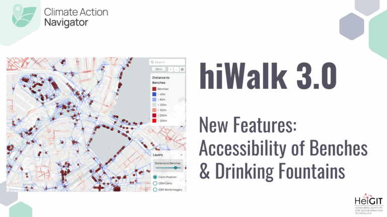
A collection of indicators related to different aspects that determine the perceived quality (safety, comfort, practicality) of walking along street or within an area of interest.
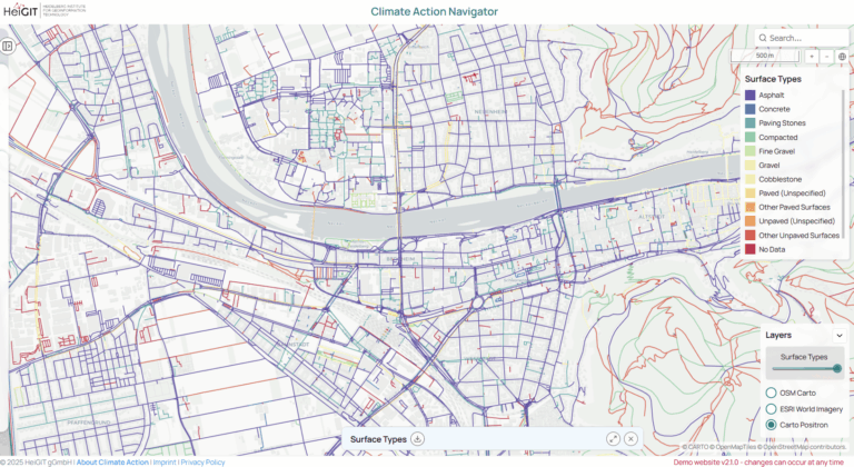
A collection of indicators related to different aspects that determine the perceived quality (safety, comfort, practicality) of cycling along street or within an area of interest.
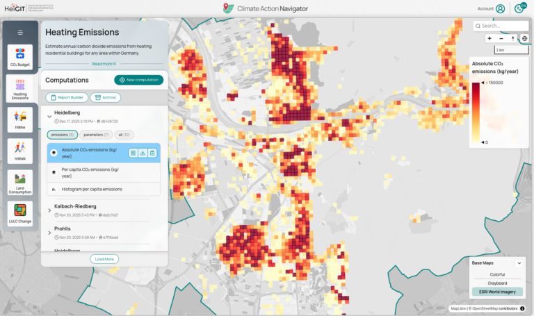
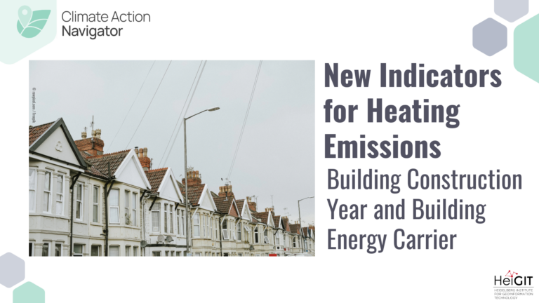
The tool estimates CO₂ emissions from heating in residential buildings largely based on 100-m gridded data from the 2022 German census.
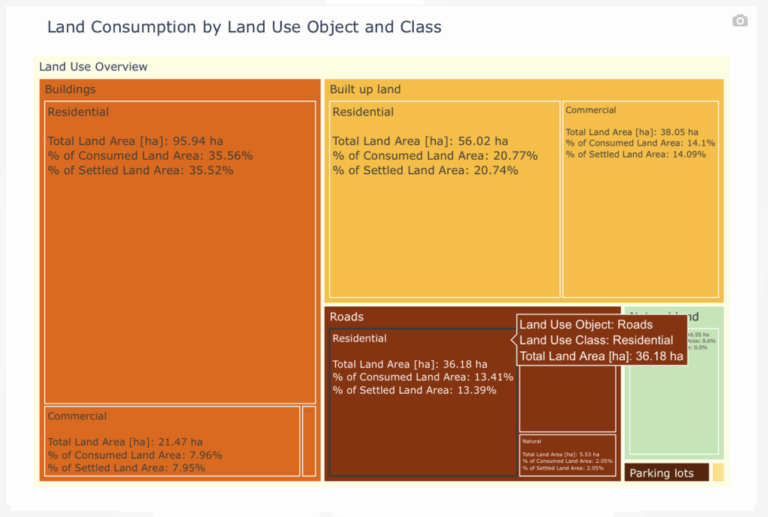
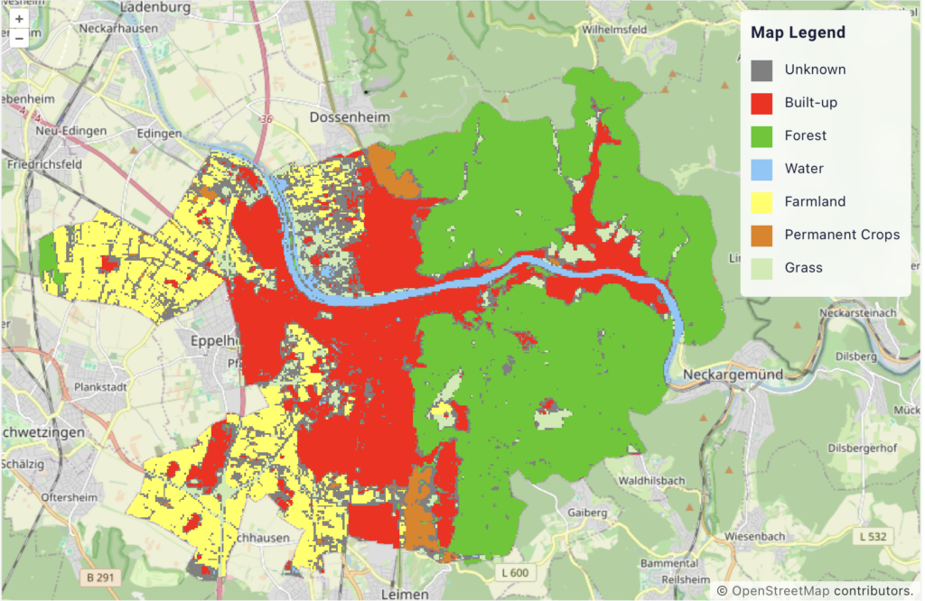
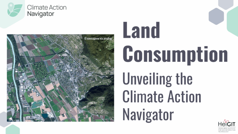
Land Consumption tool estimates how much non-urban land (e.g. forest, farmland, natural landscape) has been transformed into built-up or sealed surfaces (buildings, roads, parking lots, infrastructure) in a given area and breaks down consumption by land-use type (residential, commercial, industrial, etc.)
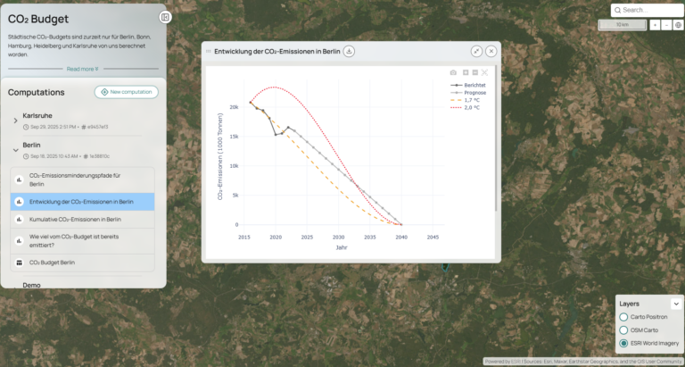
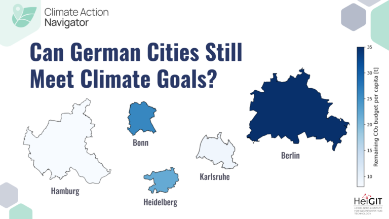
The CO₂ Budget assessment tool calculates the remaining CO₂ budget for several German cities (Berlin, Bonn, Hamburg, Heidelberg, and Karlsruhe) to stay within certain global warming limits (e.g. +1,5°C). The tool also tracks if the city is on the right track to stay within this budget.
The High-Resolution Greenhouse Gas Inventory with VGI (Volunteered Geographic Information) is a research initiative aimed at creating detailed, localized greenhouse gas emissions on a neighborhood level. By integrating data from various sources, including VGI, this project seeks to provide a more accurate and granular understanding of GHG emissions at the neighborhood level. Currently in the research phase, the project focuses on harnessing the power of open data to fill data gaps and enhance the precision of climate action planning.
We see lazy computing — an approach that optimizes workflows by avoiding redundant data processing and minimizing energy use — as vital to climate action. By streamlining computation, we reduce our carbon footprint while delivering actionable data. Acting responsibly in our computational practices is a key part of our mission, ensuring that our tools for driving climate solutions are as sustainable as the outcomes we aim to achieve.
In a first step towards minimizing our footprint, we measured electricity consumption during machine learning model training for our Land Use and Land Cover (LULC) utility, to understand and reduce our carbon footprint. By adopting sustainable practices at every level, we can ensure that our technological advancements align with our commitment to climate action and environmental responsibility.

hiWalk assesses the quality and accessibility of walking infrastructure by…
In May this year we officially launched the Climate Action…
Auf der Weltklimakonferenz COP29 in Baku diskutieren Forscher und Politikerinnen über die Erderwärmung.
In dieser Podcast-Folge wollen wir genau das herausfinden und die Frage klären: wie lässt sich klimafreundliches Handeln überhaupt messen?