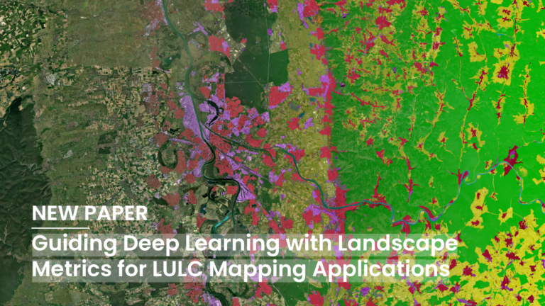
Deep Learning (DL) has become a core methodological pillar in remote sensing and GeoAI, enabling large-scale applications such as Land Use Land Cover (LULC) mapping, object detection, and spatiotemporal prediction….
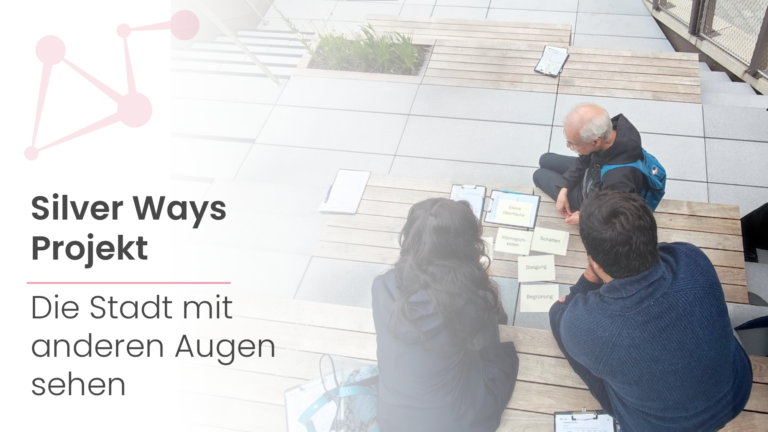
Wir haben das Büro verlassen, um die Stadt durch die Augen älterer Menschen zu erleben. Aber bevor wir dazu kommen, möchten wir einen Schritt zurückgehen und erklären, warum. Das Silver…
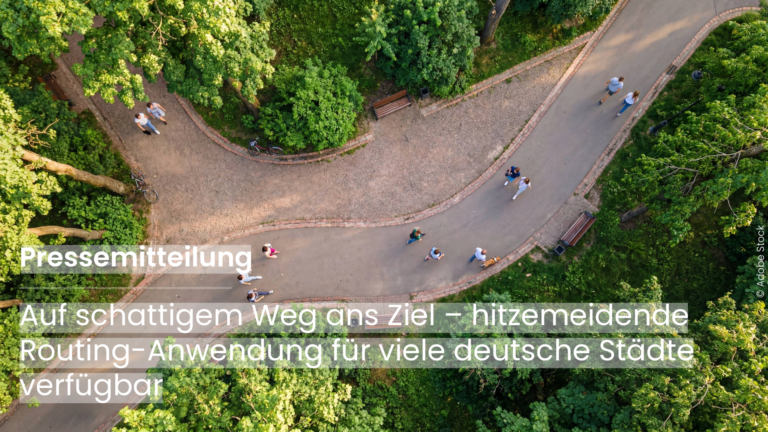
Die neue HeiGIT-Anwendung zeigt, wie digitale Geodaten Städte hitzeresilienter machen können und sucht interessierte Partnerstädte, die mit eigenen Daten das Routing für sich weiterentwickeln. Heidelberg, 20. Mai 2026. Wenn die…
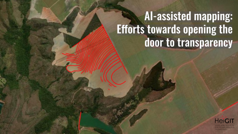
What role does the human-in-the-loop play in AI-assisted mapping? AI-assisted mapping is rapidly changing how geospatial data is created, enabling features to be generated at a scale and speed that…
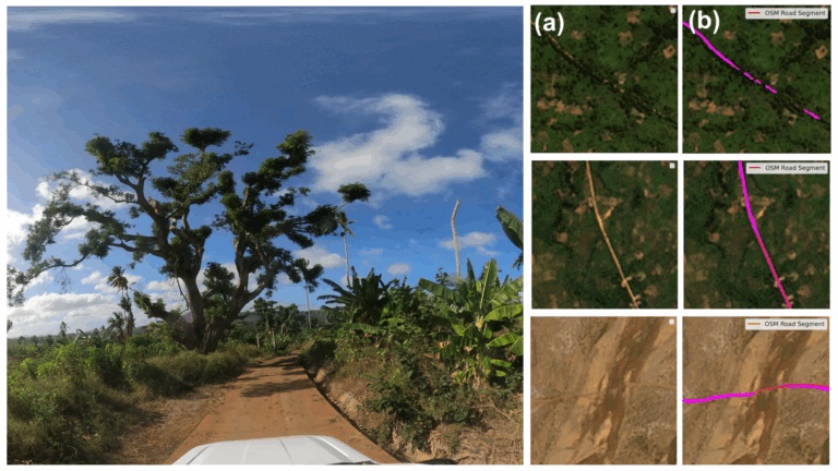
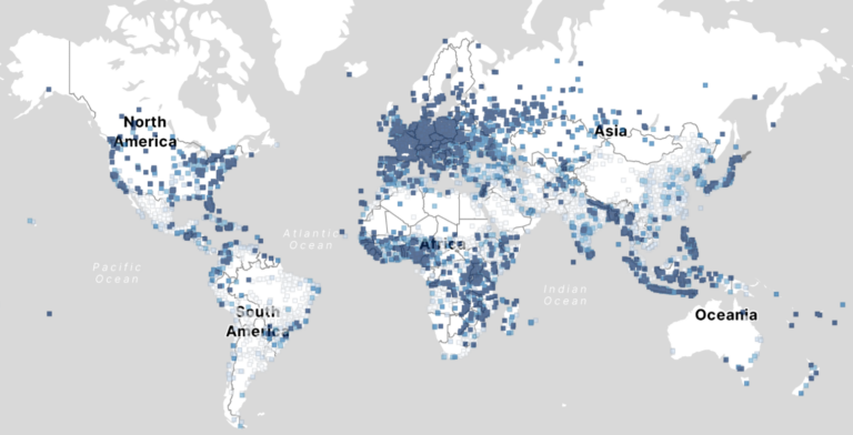
Ein neuer globaler Datensatz des HeiGIT (Heidelberg Institute for Geoinformation Technology) ermöglicht es weltweit zwischen befestigten und unbefestigten Straßen mit bisher unerreichter Konsistenz zu unterscheiden. Die aus hochauflösenden Satellitenbildern abgeleiteten Daten…
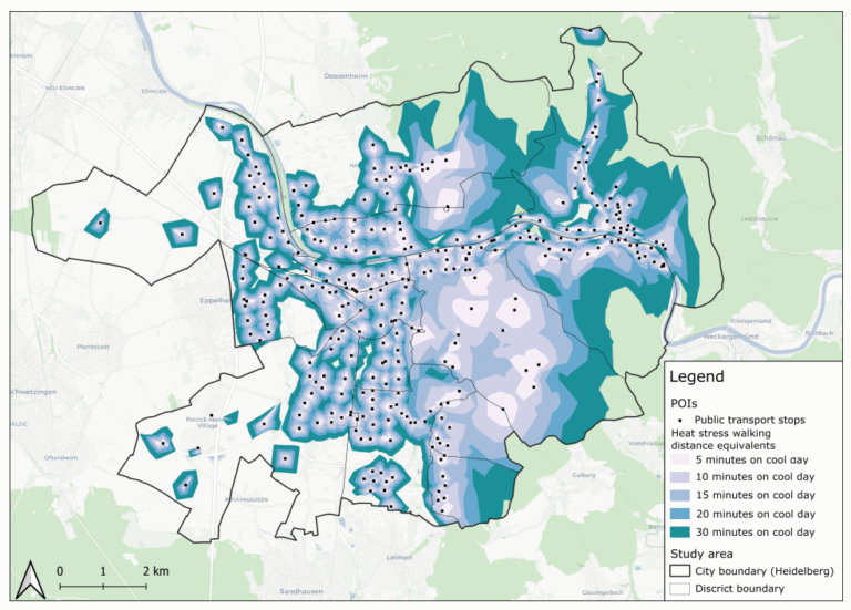
This study introduces the isocalor approach to assess how solar exposure and heat stress impact pedestrian access to essential services in Heidelberg, using OpenStreetMap data and a customized openrouteservice routing…
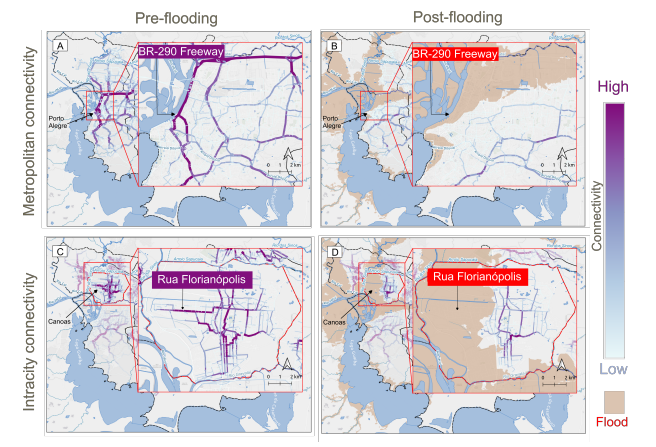
This study examines the resilience of urban infrastructure, with a focus on road network connectivity and redundancy in the face of extreme weather events. Using OpenStreetMap (OSM) data and the…
Brauchen wir wirklich digitale Souveränität – und wenn ja, warum? Momentan stammen mehr als 80% der europäischen digitalen Produkte, Services, Infrastrukturen und des digitalen geistigen Eigentums von außerhalb der EU….
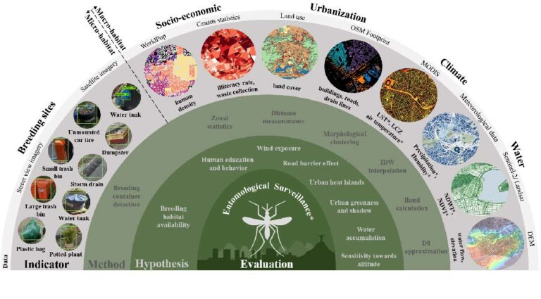
To improve vector control strategies, Dr. Steffen Knoblauch (PostDoc at GIScience and HeiGIT) has developed detailed maps showing where Aedes aegyti is most likely to thrive. Using a holistic approach,…
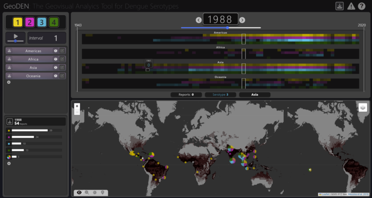
With the increasing availability of global disease datasets, Visual Analytics (VA) has emerged as a valuable tool in spatial epidemiology, particularly for studying serotype interactions in diseases like dengue. Dengue,…
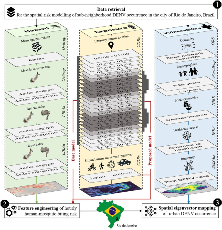
Scientific Reports publishes a paper by Steffen Knoblauch et al. that underscores the critical importance of integrating vector ecology and human behavior into advanced disease modeling frameworks. The increasing availability…
The concept of a „Digital Earth“ has long envisioned a future where technological advancements enable the large-scale collection and visualization of spatial and environmental data. Today, open data sources such…
To what extent does crime potentially inhibit geographical access to schools, measured by cumulative average travel time? Education is recognized globally as a fundamental human right and essential for promoting…
Join us at this year’s Global Dialogue Platform on Anticipatory Humanitarian Action, themed “Mainstreaming Anticipatory Action: Collaboration in Complex Contexts.” This topic has been a focal point for HeiGIT over…
GeoAI integrates AI, geospatial big data, and high-performance computing for solving data- and computation-intensive geospatial problems. This field has gained continuous momentum, driven by strong demands in geography and the…
Eine Arbeitsgruppe der Weltbank betreibt derzeit Forschung, um zu beurteilen, welche räumlichen Schlüsselindikatoren die Einstellungschancen von Frauen im Bereich der erneuerbaren Energien am meisten beeinflussen. Die Forschung zielt darauf ab,…
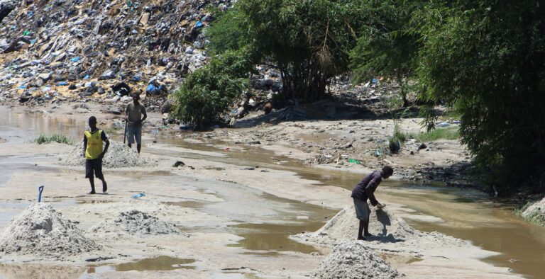
Solid waste pollution is the cause of many environmental and health risks, especially in areas where waste is generated in large quantities but cannot be properly disposed of. Knowledge of…
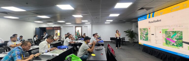
Zusammen mit dem kolumbianischen Roten Kreuz (CRC), der nationalen Universität Kolumbiens in Manizales (UNAL) und dem UBDC, hat HeiGIT am 29. September 2024 in Cartagena, Kolumbien die IDRiM 2024 veranstaltet….
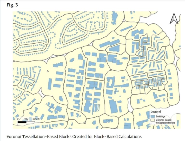
Rapid global urbanization is placing immense pressure on planners to make informed decisions that promote sustainable growth. A crucial aspect of this challenge is understanding how urban buildings are used….
Jeden Tag kartieren tausende Menschen in OSM, wodurch die Anzahl der fehlenden Gebäudedaten in urbanen Zentren kontinuierlich zurückgeht. OSM ist eine weit verbreitete Ressource für Projekte, die die Besonderheiten urbaner…