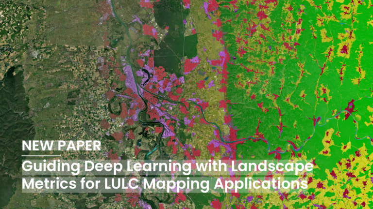
Deep Learning (DL) has become a core methodological pillar in remote sensing and GeoAI, enabling large-scale applications such as Land Use Land Cover (LULC) mapping, object detection, and spatiotemporal prediction….
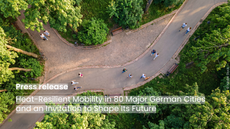
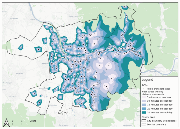
The new HeiGIT application shows how digital geodata can make cities more heat-resilient and is looking for partner cities that want to co-develop the routing further using their own data….
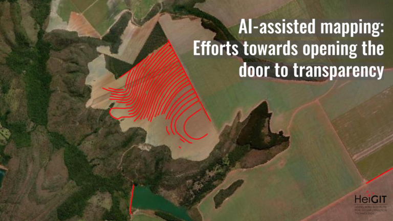
What role does the human-in-the-loop play in AI-assisted mapping? AI-assisted mapping is rapidly changing how geospatial data is created, enabling features to be generated at a scale and speed that…
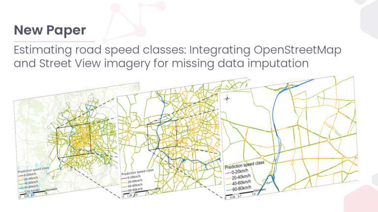
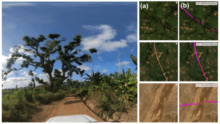
This study presents an environment-driven, open-data approach to infer and spatially complete urban traffic speed classes at the citywide scale. As cities grow and urban mobility demands intensify, accurately forecasting…
A new global dataset released by the HeiGIT (Heidelberg Institute for Geoinformation Technology) makes it possible to distinguish between paved and unpaved roads worldwide with unprecedented consistency. Derived from high-resolution…
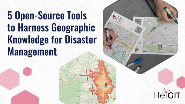
Volunteered Geographic Information (VGI) is a valuable resource for an effective disaster management. This article presents five free tools to enhance humanitarian work using VGI. What is VGI and why…
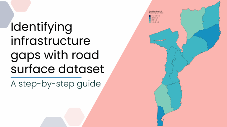
This blog post introduces a step-by-step tutorial for working with a global road surface dataset. Using open-source tools, the tutorial demonstrates how to identify infrastructure gaps by combining road surface…
This study introduces the isocalor approach to assess how solar exposure and heat stress impact pedestrian access to essential services in Heidelberg, using OpenStreetMap data and a customized openrouteservice routing…
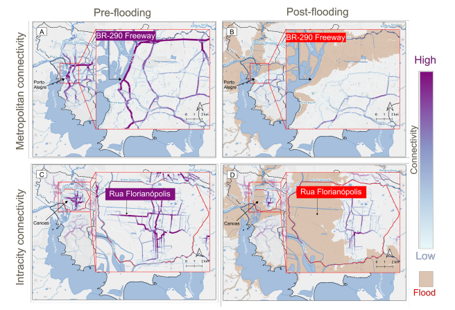
This study examines the resilience of urban infrastructure, with a focus on road network connectivity and redundancy in the face of extreme weather events. Using OpenStreetMap (OSM) data and the…
Do we really need digital sovereignty—and why? Today, over 80% of Europe’s digital products, services, infrastructures, and intellectual property originate from outside the EU. This dependency affects not only innovation…
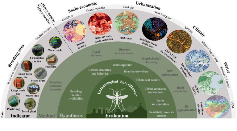
To improve vector control strategies, Dr. Steffen Knoblauch (PostDoc at GIScience and HeiGIT) has developed detailed maps showing where Aedes aegyti is most likely to thrive. Using a holistic approach,…
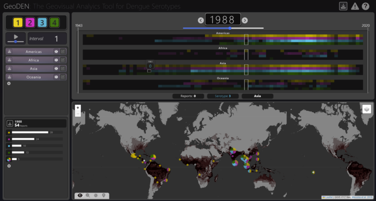
With the increasing availability of global disease datasets, Visual Analytics (VA) has emerged as a valuable tool in spatial epidemiology, particularly for studying serotype interactions in diseases like dengue. Dengue,…
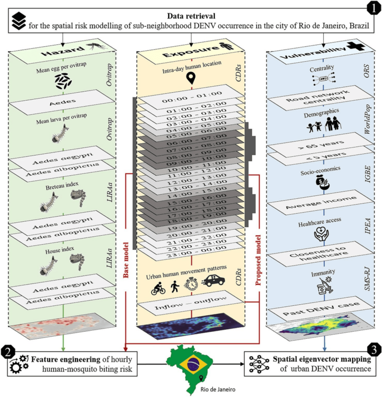
Scientific Reports publishes a paper by Steffen Knoblauch et al. that underscores the critical importance of integrating vector ecology and human behavior into advanced disease modeling frameworks. The increasing availability…
The concept of a “Digital Earth” has long envisioned a future where technological advancements enable the large-scale collection and visualization of spatial and environmental data. Today, open data sources such…
To what extent does crime potentially inhibit geographical access to schools, measured by cumulative average travel time? Education is recognized globally as a fundamental human right and essential for promoting…
The openrouteservice (ORS) continuously evolves, bringing a suite of new features: the export and snap endpoints. These new features will change the way how users interact with and process routing…
Recently, our colleague Kirsten von Elverfeldt attended the Walk21 Conference in Lisbon, an inspiring event dedicated to reimagining cities by transforming car-centered spaces into active, livable, and vibrant environments for…
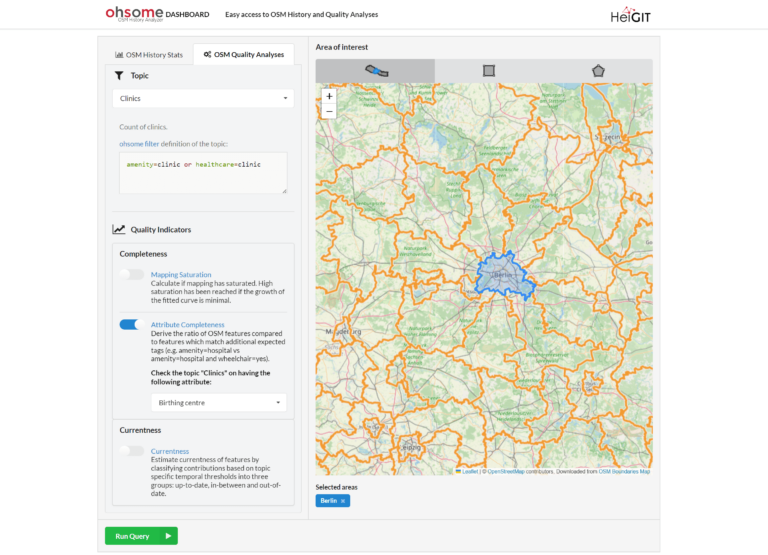
In the last few weeks, a lot of work has been put into expanding the functionalities of the ohsome Quality API. Most notably, the ohsome dashboard now has a new…
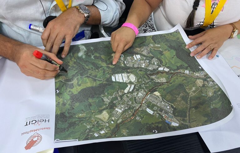
We are happy to share new developments on our ongoing work with the Sketch Map Tool! To help you better understand the tool, its key functionalities, and potential applications, we…