We are happy to announce that the IDEAL-VGI project by GIScience has been successfully completed. IDEAL-VGI was a tandem project in cooperation with Begüm Demir from the TU Berlin and…
Dear Postdoctoral Scholars and Researchers, You are a highly motivated researcher who loves spatial data science and open geodata? You want to use your expertise for the benefit of society…
Context During natural disasters and other catastrophic events, quickly identifying and distributing resources is essential. Even a brief delay in evacuating residents or sourcing water can significantly hamper relief efforts…
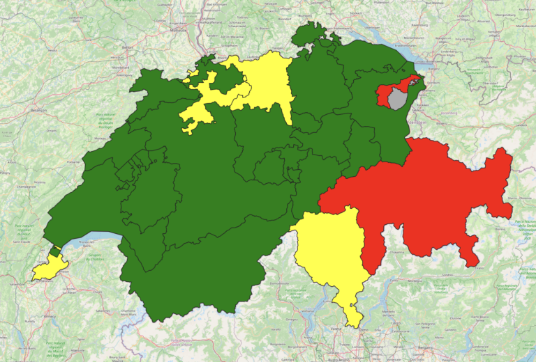
A new rate limit is introduced The OpenStreetMap (OSM) API recently introduced a rate limit, which is designed to limit the impact of a particular kind of map vandalism: new…
HeiGIT is embarking on an initiative to address one of the most critical challenges of our time — climate change. We are proud to announce the commencement of the Climate…
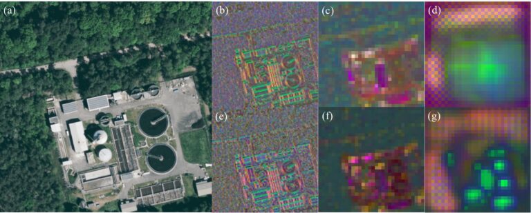
Introduction In an era where technology continuously reshapes our world, the fusion of artificial intelligence and geospatial data offers exciting possibilities. HeiGIT (Heidelberg Institute for Geoinformation Technology), a pioneering research…
The “Waterproofing Data” project has won the ESRC Celebrating Impact Prize 2023 in the category “Outstanding Societal Impact” for helping to protect residents of flood-prone areas in Brazil. In 2018,…
HeiGIT and the Amsterdam University Medical Center (UMC) partnered up to investigate food environments through the lens of OpenStreetMap (OSM) data. UMC analyses how exposure to different categories of food…
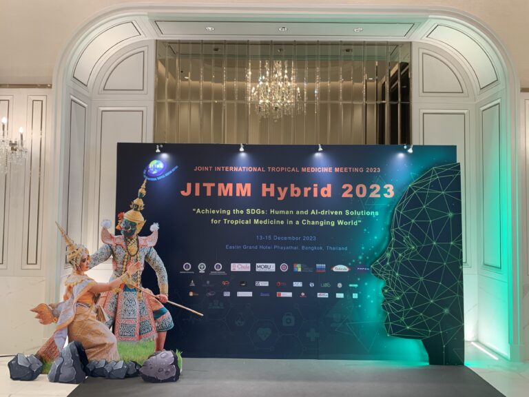
GIScience member and PhD candidate Steffen Knoblauch was invited as a speaker at the Joint Internationl Tropical Medicine Meeting (JITMM) 2023. The conference’s focal topic was “Achieving the SDGs: Human…
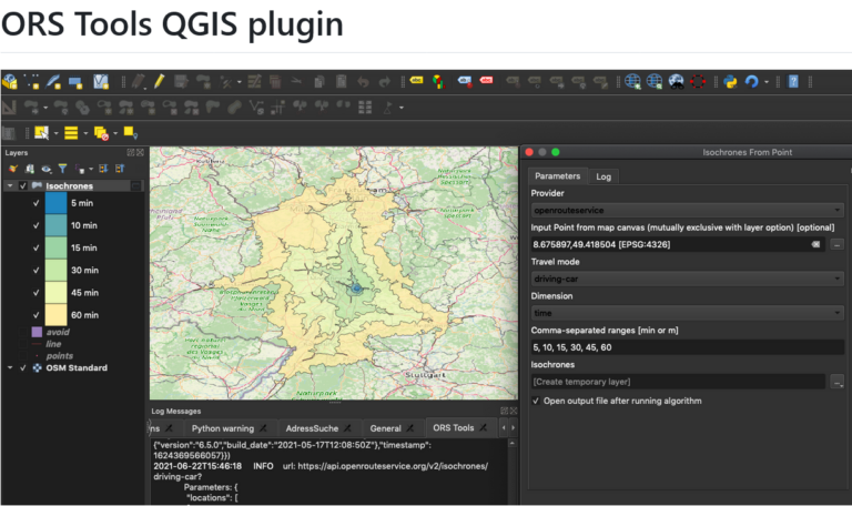
Just in time for the new year, the openrouteservice team proudly announces the release of v1.7.0 of the ORS Tools QGIS plugin! Quite a lot has happened. First, the GUI…
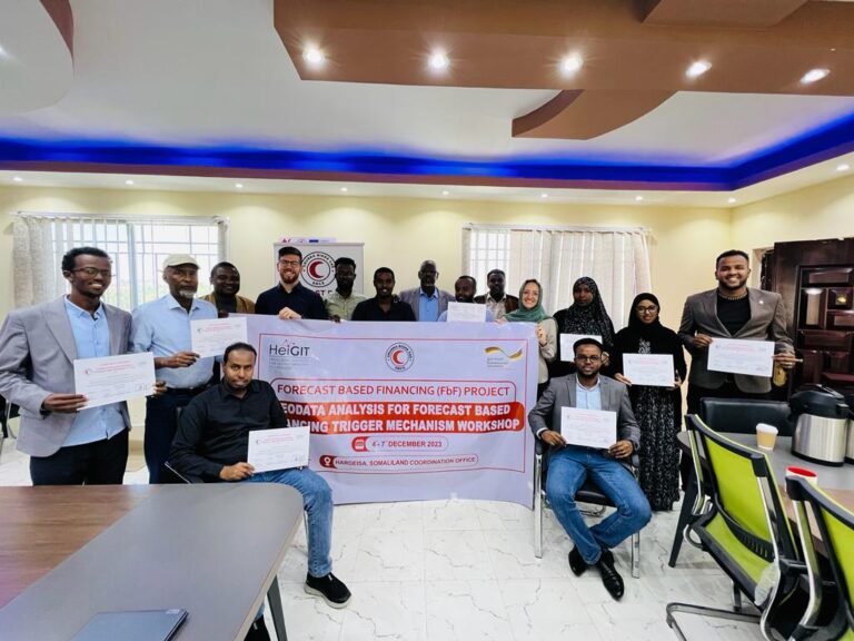
Since 2022, HeiGIT is providing technical support to the Somali Red Crescent Society (SRCS) in Somalia. The objective was the development of an Early Action Protocol (EAP) for droughts in…
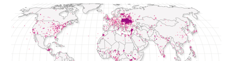
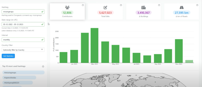
Today, we’d like to shine a light on the online tool OhsomeNowStats. OhsomeNowStats allows users to take a look at the mapping activity in OpenStreetMap. This is especially useful for…
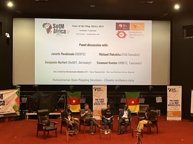
The recently concluded State of the Map Africa 2023, hosted in Yaoundé, Cameroon, marked the fourth edition of this regional OpenStreetMap (OSM) conference. The State of the Map was a…
As 2023 is coming to an end, we would like to take the opportunity to look back at this eventful year and appreciate the advance that HeiGIT has made towards…
The HeiGIT team recently secured the top position in the third edition of the Open Source Software for Sustainable Development Goals (OSS4SDG) hackathon. These hackathons are based on the 17…
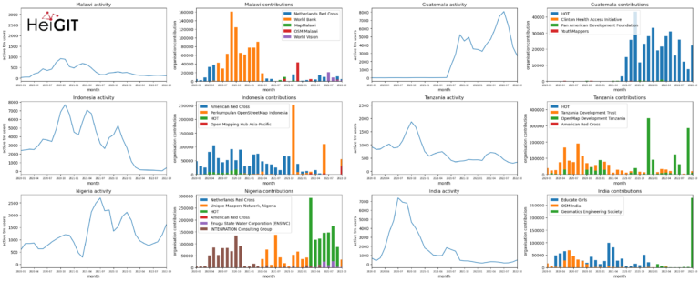
Introduction In this blogpost we are taking a look at humanitarian mapping through the Tasking Manager (HOT-TM) that is operated by the Humanitarian OpenStreetMap Team (HOT). At HeiGIT we work…
We would like to congratulate Dr. Christina Ludwig on successfully defending her PhD on how to map urban green spaces using OpenStreetMap (OSM) data last month. In her thesis Christina…
HeiGIT and the Amsterdam University Medical Centers (UMC) partnered up to investigate food environments through the lens of OpenStreetMap (OSM) data. UMC analyses how exposure to different categories of food…
The completeness of the OpenStreetMap (OSM) road network has been an ongoing focus for researchers for more than 15 years. For instance, Neis et al. (2011) investigated the OSM street…
On October 5th and 6th, 2023, the XP Days Germany 2023, an open conference for agile software development and extreme programming with a focus on software development topics, took place…