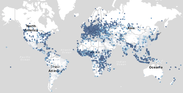
Data on mobility behavior can yield valuable insights that are beneficial for various applications such as public policy, emergency response, and urban planning. As the availability of freely-accessible mobility data…
At HeiGIT, the recently established Climate Action team is a group of dedicated professionals of diverse backgrounds and areas of expertise working together to drive impactful environmental solutions. The climate…
GeoAI integrates AI, geospatial big data, and high-performance computing for solving data- and computation-intensive geospatial problems. This field has gained continuous momentum, driven by strong demands in geography and the…
A workgroup of the World Bank is researching and evaluating the key spatial factors affecting women’s employment opportunities in the renewable energy sector. Their research aimed to develop an analytical…
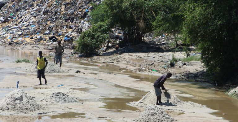
Solid waste pollution is the cause of many environmental and health risks, especially in areas where waste is generated in large quantities but cannot be properly disposed of. Knowledge of…
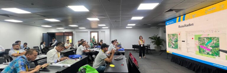
HeiGIT, the Colombian Red Cross (CRC), Colombia’s National University in Manizales (UNAL) and UBDC successfully ran the international workshop “Digitalizing Paper-based Participatory Risk Mapping with the Sketch Map Tool” at…
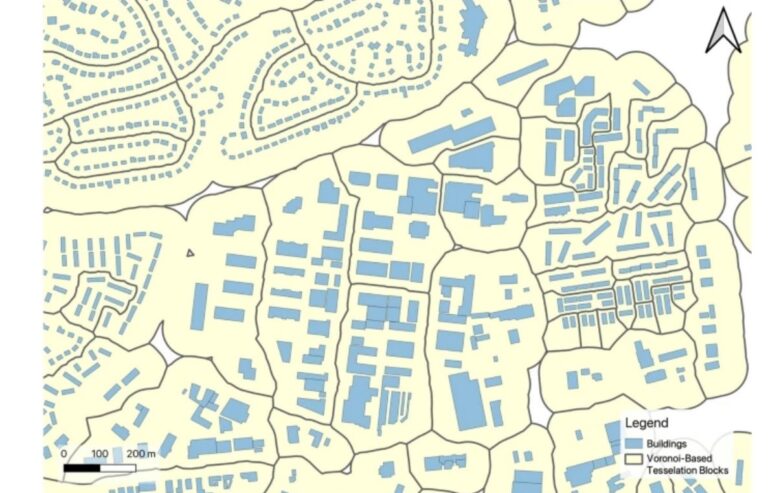
Rapid global urbanization is placing immense pressure on planners to make informed decisions that promote sustainable growth. A crucial aspect of this challenge is understanding how urban buildings are used….
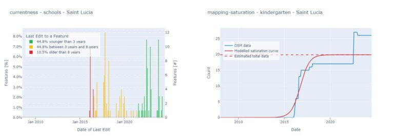
With thousands of people mapping in OSM every day, missing building data in urban centers is steadily decreasing. Since OSM is a widely used source for projects researching urban phenomena…
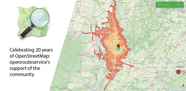
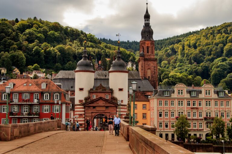
August 9 marks a turning point for the global mapping community: the 20th anniversary of OpenStreetMap (OSM). For two decades, OSM has revolutionized the way we perceive and interact with…
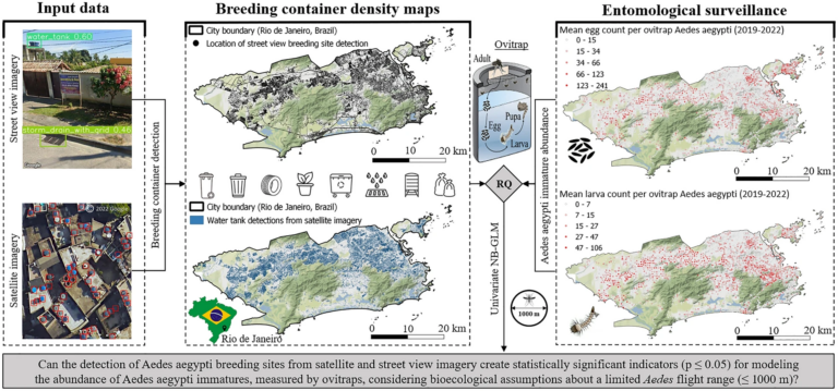
„High-resolution Mapping of Urban Aedes Aegypti Immature Abundance Through Breeding Site Detection Based on Satellite and Street View Imagery“ Knoblauch, S; Su Yin, M.; Chatrinan, Krittin; Rocha, Antonio A. de…
HeiGIT and PLANUM are happy to announce their cooperation in the field of climate action. PLANUM is committed to driving positive change through innovative engineering solutions. The company specializes in…
Claudio Sossio De Simone is a PhD candidate at the University of Rome Tor Vergata in the field of Cultural Heritage, Education and Territory. His research interests include GIS science…
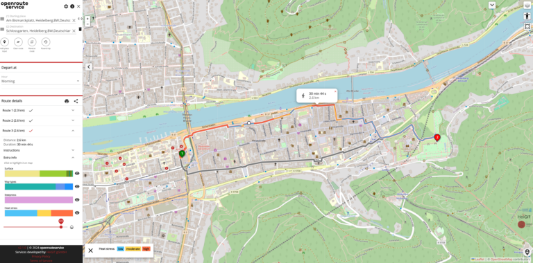
As summer temperatures soar, the health risks associated with heat stress become increasingly significant. This issue is particularly pronounced in urban areas such as Heidelberg and other cities, where dense…
Forecast-based Financing (FbF) is an innovative approach to disaster management that focuses on taking early action based on meteorological forecasts and risk assessments to mitigate the impacts of potential disasters….
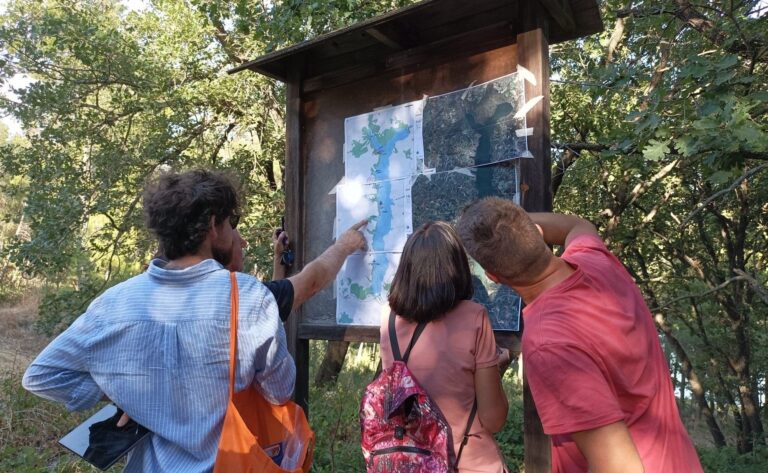
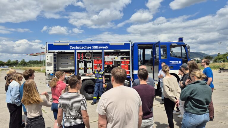
Two weeks ago, as part of a seminar on GIS for Disaster Risk Reduction led by HeiGIT employees, students from Heidelberg University tested several HeiGIT services in a field test….
The OpenStreetMap (OSM) and openrouteservice (ORS) provide free geospatial data that serve a multitude of research and practical applications. OSM thrives on its community-driven approach, ensuring its data is always…
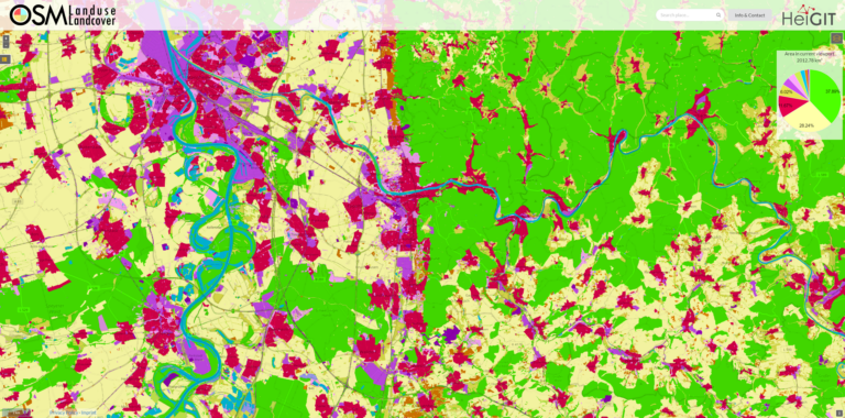
We are excited to announce that the data displayed on OSM – Landuse is now freely accessible. These data sets offer valuable insights and can be utilized for various applications….
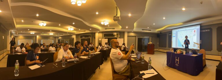
The YouthMappers network recently held its 2024 Leadership Fellows Workshop, an inspiring event that brought together a top cohort of university students from around the globe. This year’s workshop, held…
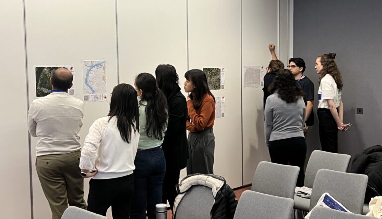
HeiGIT and Urban Big Data Centre (UBDC) hosted a successful international workshop entitled ‘Mapping with Communities’ at the AGILE 2024 conference in Glasgow, Scotland, UK. Responding to the conference theme…
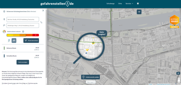
Open-source tools that incorporate open geospatial data, such as openrouteservice (ORS), prove to be beneficial for both academic research and practical applications. These tools enable researchers to pursue innovative approaches…