Together with collaborators from Urban Analytics Lab Singapore and CICI Lab, we are organising a special issue in Environment and Planning B: Urban Analytics and City Science, on the topic…
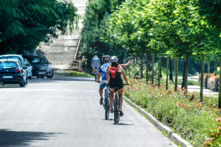
The HeiGIT team is delighted to be part of the STADTRADELN initiative, a competition that has been promoting environmentally friendly mobility since 2008. For 21 days, participants try to cycle…
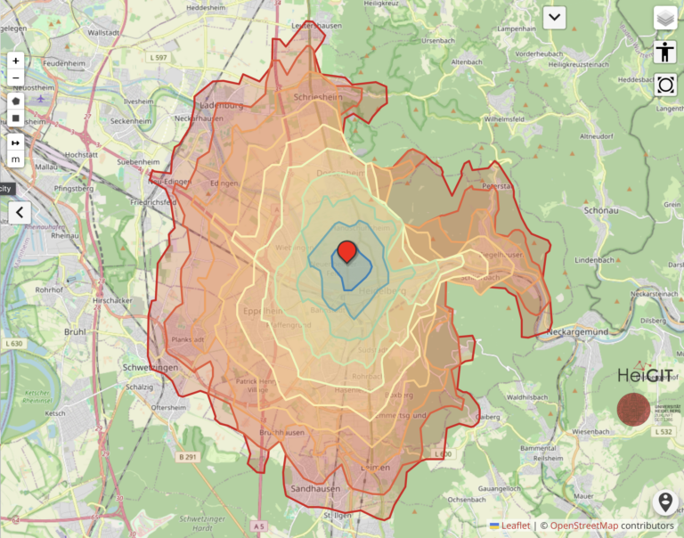
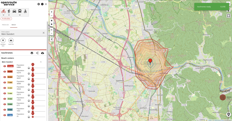
The openrouteservice (ORS) QGIS plugin continues to evolve, bringing a suite of new features, improvements, and fixes that enhance its functionality and user experience. This update incorporates significant changes that…
No matter where you are or which device you are using, you can now do voluntary work and make a difference, all from your browser with MapSwipe Web App! Since…
The 17th Rhine-Neckar Modellierungstag (Modelling Day) at Heidelberg University will take place on June 13, focusing on the themes of optimization and sustainability. The event is organized by the Graduate…
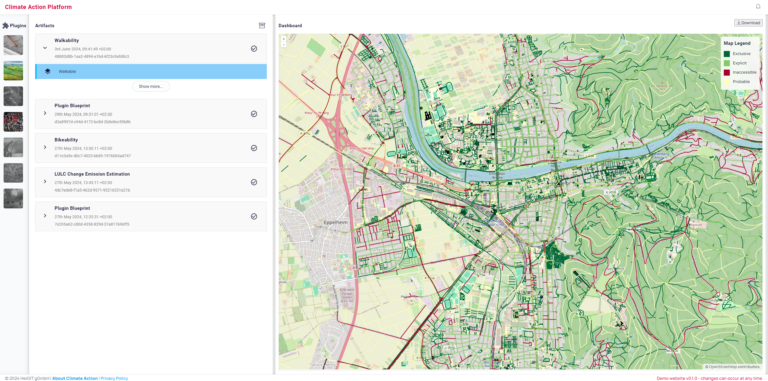
At HeiGIT, we are committed to raising awareness about the climate crisis and taking action to support stakeholders with knowledge and actionable know-how to drive the transformation of our society…
Free open geodata are of increasing importance. They are used in research or case studies and can lead to important insights on social, economic or environmental topics. A problem that…
Recent studies primarily view Large Language Models (LLMs) in geography as tools for linking natural language to geographic information systems. However, Roberts et al. (2023) demonstrated GPT-4’s inherent ability to…
Insights from Steffen Knoblauch’s talk at The Program of Scientific Computing (PROCC) at FIOCRUZ On May 15th, the Program of Scientific Computing (PROCC) at Fiocruz hosted Steffen Knoblauch, a GIScience…
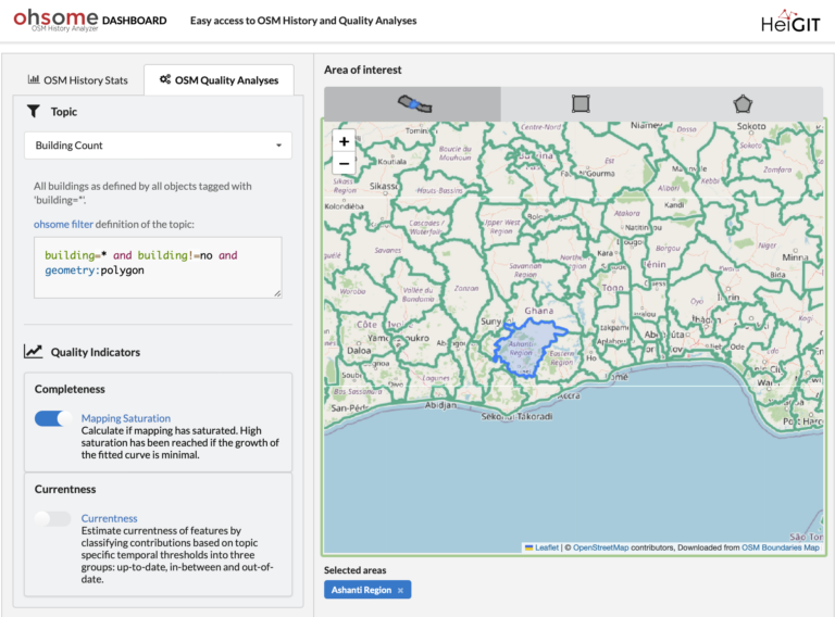
Are you ready to take your OpenStreetMap (OSM) data analysis to the next level? We’re excited to showcase the latest features of our ohsome Dashboard, designed to provide you with…
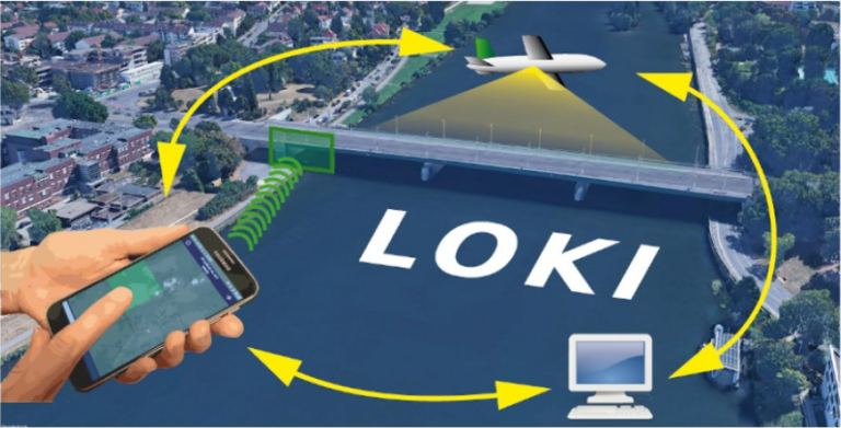
In the aftermath of earthquakes, rapid and accurate assessment of infrastructure damage is crucial. The LOKI project (Airborne Observation of Critical Infrastructures), funded by the Federal Ministry for Education and…
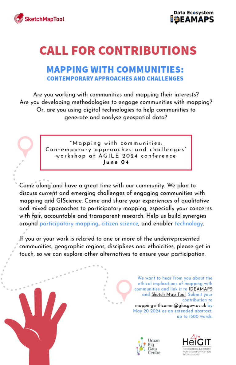
Excited to announce the CALL FOR CONTRIBUTIONS! Are you passionate about mapping with communities? Join us at the “Mapping with communities: Contemporary approaches and challenges” workshop at AGILE 2024 conference…
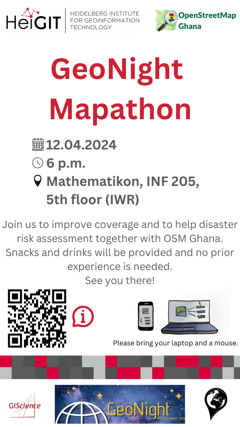
Our next Mapathon is just around the corner, and this time, we’re joining forces with OpenStreetMap Ghana to improve coverage and to help disaster risk assessment. Join us and be…
The research team of the transdisciplinary project HEAL (Heat Adaptation for Vulnerable Population Groups), focusing on providing heat adaptation measures for vulnerable groups in Heidelberg, has published a research paper…
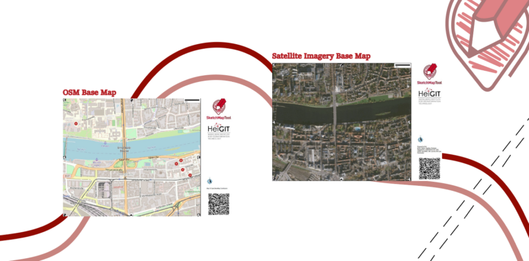
The HeiGIT gGmbH (Heidelberg Institute for Geoinformation Technology) team has just released a version 2.0 of the Sketch Map Tool, a low-tech solution for participatory sketch mapping through offline data…
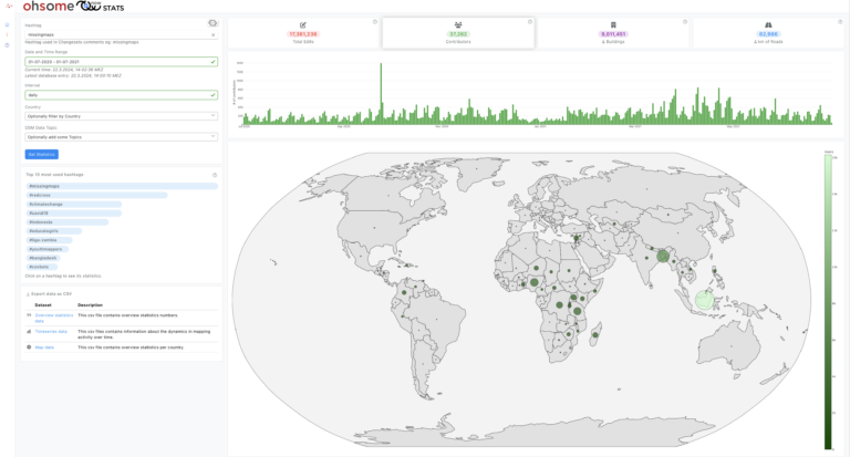
OhsomeNow stats makes it possible to monitor contributions to OpenStreetMap (OSM) in real time. We developed this new dashboard as part of our long-term cooperation with the Humanitarian OpenStreetMap Team…
We’re thrilled to announce the release of openrouteservice (ors) version 8.0, designated “Wilfried”, as a tribute to Prof. Dr. Wilfried Juling, whose steady support and advice fundamentally shaped the growth…
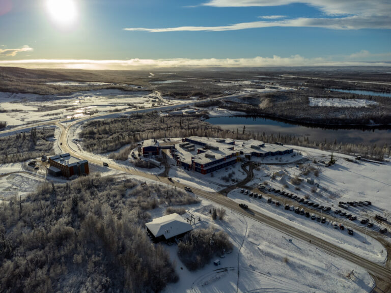
In 2022, we embarked on an insightful expedition to Aklavik, Canada, in collaboration with our partners, the Alfred Wegener Institute (AWI) Helmholtz Center for Polar and Marine Research and the…
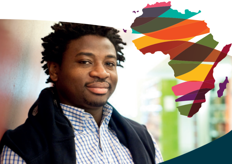
The Robert and Christine Danziger Scholarship application window is open until August 31st, 2024, offering a unique opportunity for doctoral candidates from Africa, particularly Ghana or West and Central Africa….
The use of open-source geospatial data, exemplified by services like openrouteservice (ORS), proves to be beneficial for both academic research and use case studies. Witnessing our technologies applied in unanticipated…