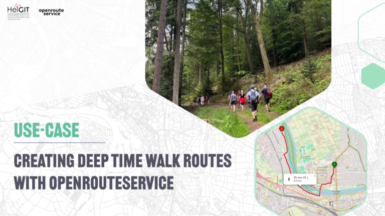
We are happy to announce a revamped openrouteservice maps client for disaster management. It was built based on the new openrouteservice maps client, that is an open source route planner with plenty of features. Specific disaster features were incorporated via the development of developing plugins. It was developed and is maintained by the Heidelberg Institute for Geoinformation Technology (HeiGIT gGmbH) together with the GIScience Research Group at Heidelberg University.
Thanks to the work of the Humanitarian OpenStreetMap Team and the Missing Maps project, in disaster situations the OSM data is continually updated and enriched with critical information. Thus the road network is constantly enlarged by thousands of volunteers. The Openrouteservice for Disaster Management has the exceptional ability to take this data source update into account and recalculates the routing graph once an hour on basis of the most current OSM data. Furthermore, it considers as passable and impassable tagged ways (impassable=yes or status=impassable) and dynamically adjusts the graph weights of OSM streets accordingly. This allows disaster responders to navigate on basis of the most current road network. Additionally, Openrouteservice for Disaster Management also provides an accessibility analysis service for a given location and the possibility to export for exporting and importing files that can be used offline in mobile devices.
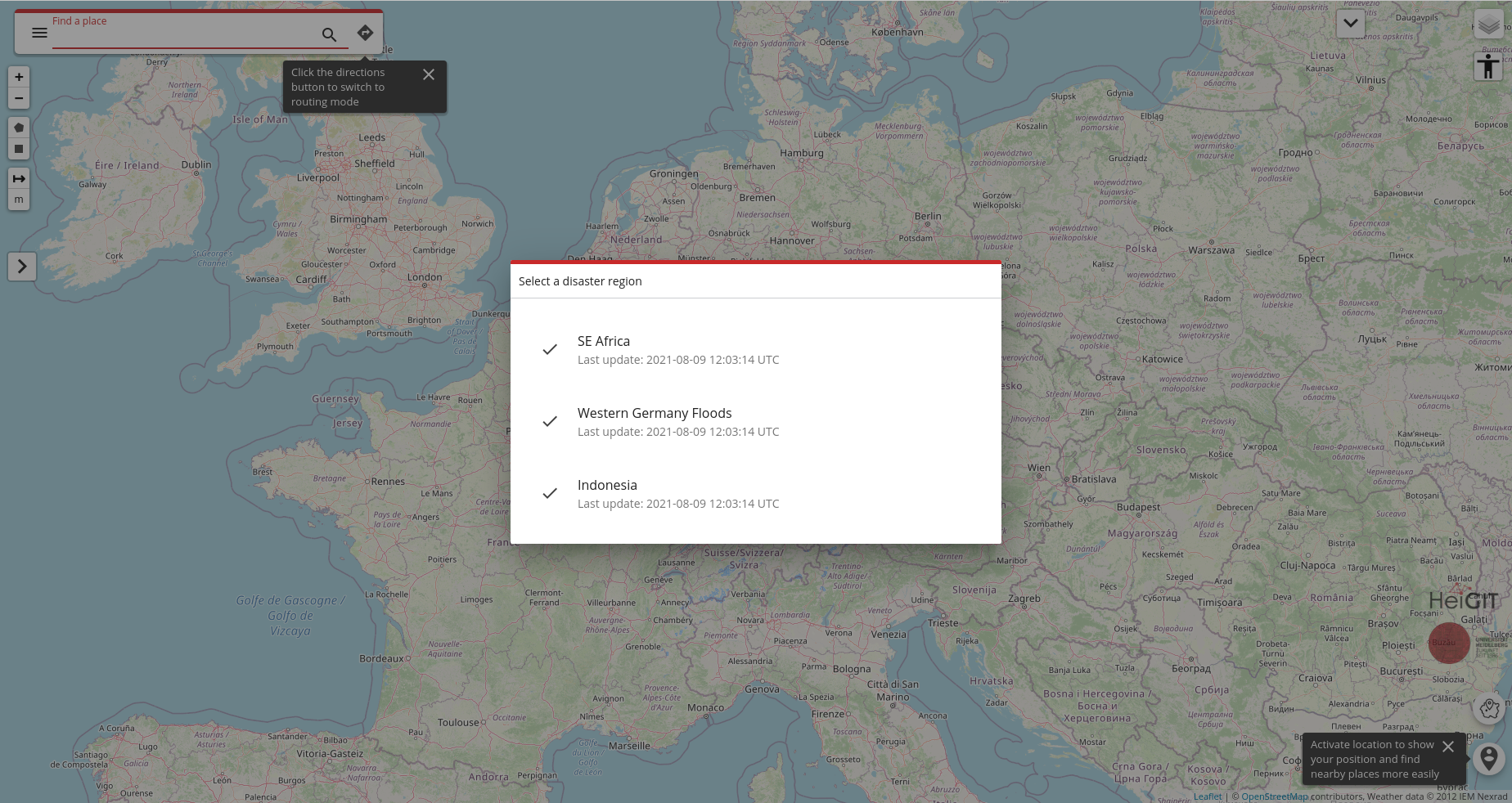
Fig. 1: New ORS for disaster management maps client
A new disaster client, with new features
The new disaster maps client is a brand-new piece of software that uses a modern and progressive JavaScript framework (VueJS) and up-to-date components. Besides the rewriting of the client, several new features were introduced, if we take as reference the previous disaster client. Many of the new features available were brought about by the new ORS base maps client, on which the new disaster client is based.
New features that are specific to the new disaster client:
Improved region selector
In the new disaster client, on the first app load the user will be asked to select a disaster region and once one is selected, the modal window will be automatically closed and the target region will be focused. After a region is defined, an smaller region selector button is available on the bottom-left corner. This button uses less space then then the previous client region selector that was permanently placed over the map.
Selected region synchronized with URL
When a disaster region is selected, and a route or isochrone is calculated, the target region is synchronized with the application URL so that if the app is reloaded or the URL is shared, the application can automatically (re)select the disaster region, calculate a route/isochrone and then display the exact same view that was visualized with the same URL. In the previous disaster client this would not work.
Plugin-based features
In the new disaster client, the features that differentiate it from the base maps client are implemented via the creation of plugins. These plugins do not affect the base maps client code, but listen to existing hooks and add custom features in certain key-points. This architecture allows the new disaster client to get frequent updates from the base client with minimum effort.
New features brought about by the new base maps client:
Embedded mode
The embedded mode allows the embedding of any map view (place, directions, isochrones). It is mode is designed to allow developers or website editors to embed a map view that is semi-interactive in a view-only mode. The users can go to a full interactive map via a “view on ORS” button.
Friendly and meaningful URL
Use a URL structure that is more friendly ad meaningful allowing users to easily understand the app mode (place, directions and isochrones) and the places that are being used.
Search mode
Allows searching for nearby places given a center. It provides a way to see more results for a given input when the suggestions don’t contain what the user is looking for, or when a map view is more useful to decide which venue/place matches the user needs.
Place mode
Allow to search, select and show only a place on the map view. This place centered view can be shared and it also uses and auto zoom strategy that is based on the place layer type (a bigger zoom for a street and a smaller one for a country, for example). The place view also shows the boundaries of the selected place if it is a city, a region/state or a country.
Enhanced search suggestions
The places shown on the suggestion list as the user types something on the place input uses an enhanced strategy to display the items that is expected to match the expectations of most of the users by combining venues, address and cities with different levels of priority.
More advanced settings
Some additional settings were added, allowing the user to have more control of some behaviors of the app, like custom tiles provider, compress URL data and auto-fit bounds when route changes. Check the settings/advanced to see all the options.
URL shortcuts
Provide shortcuts to the settings and about pages, so that the user can receive some instructions that start with the settings page open. It is also helpful when explaining how to adjust some app settings to new users. To access settings just go to https://maps.openrouteservice.org/#/settings.
Auto select the only address
When the user types a full address and only one result is expected to be returned, the user can immediately hit enter/return and the app will then run a geocode search, convert the address text to a coordinates based place and auto select the place as the origin/destination/stop according to the context. This is useful for cases when the users are not searching for places, but know which exact address they are looking for and want to skip some steps.
Rebuild avoid polygons on URL reload
The avoid polygons created via avoid polygon drawing tool are rebuild and displayed again when a directions URL is reloaded or shared with someone else.
Accessibility mode
Allow users to move the map view with arrow buttons and highlight the active inputs visually. It is intended to be used by users with special needs.
Instant dragging visual feedback
When a route is shown on the map the users can interact with it by dragging a point and an instant visual feedback will be displayed according to the move. Although the contour of the dragged route might not be kept after a new route is calculated by the service when the user finishes editing it, it works like a white noise, showing that the app is responding to the user commands.
Distinct iconography for some types of place
Some results displayed in the list of suggestions when something is typed have specific iconography so that the users can easily distinct between some types of places, like cities, regions/states and countries.
Map view markers interactivity
The markers plotted on the map view offer some actions that can be accessed via mouse when they are clicked, like delete (a new route is calculated or the app goes to place mode if only one marker is left) and toggle direct, that will skip a calculated route between the selected place and the next point of the route.
Save last active profile
When the user changes the active profile (like bike, car, wheelchair) this profile is saved in the browser’s local storage and the same profile will be loaded/set as active when the maps client is loaded again. So users that uses more often a profile will not have to re-select a profile every time s/he wants to load the app and calculate a route.
https://disaster.openrouteservice.org/
References:
Neis, P. & Zipf, A (2008): OpenRouteService.org is three times “Open”: Combining OpenSource, OpenLS and OpenStreetMaps. GIS Research UK (GISRUK 08). Manchester.
Ludwig, C., S. Fendrich, T. Novack, S. Marx, A. Oleś, S. Lautenbach, A. Zipf (2020): Optimal ans Ziel: Routing-Dienste auf Basis nutzergenerierter Geodaten – Herausforderungen und Lösungsansätze für globale Datensätze, In: Zagl, Loidl (Hrsg.): Geo-IT in Mobilität und Verkehr, Geoinformatik als Grundlage für moderne Verkehrsplanung und Mobilitätsmanagement. VDE Wichmann Verlag. S. 89-106.