Conceptual compliance measures to what degree contributors of volunteered geographic information (VGI) are using proposed tagging-standards. Here, we look into OpenStreetMap (OSM) as the most well-known example for VGI. In…
Conceptual compliance measures to what degree contributors of volunteered geographic information (VGI) are using proposed tagging-standards. Here, we look into OpenStreetMap (OSM) as the most well-known example for VGI. In…
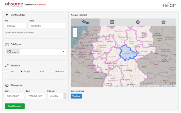
Our new ohsome dashboard is another preview on what is and will be possible with our ohsome OpenStreetMap history analytics platform. Behind the scenes, we added support for the Apache…
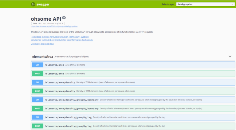
In a previous blog post we introduced the REST-based interface of our framework Ohsome (the OpenStreetmap History Analytics plattform) and gave an example link of a request. This blog post…
In this example we show you how to use a Jupyter Notebook with the ohsome API to analyse mapping efforts for a HOT Tasking Manager project in Nepal! [nbconvert url=”https://github.com/GIScience/ohsome-examples/blob/master/python/jupyter-notebooks/ohsome_api_hot_tm_project1008.ipynb”]
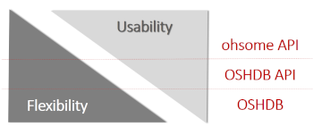
Recently we introduced the ohsome platform for OSM History Analytics. Now we want to give you a high-level overview of the ohsome platform and the components it consists of. Ohsome…
The Ohsome API, developed at HeiGIT, is part of the ohsome OSM history analytics platform (and yes, it is pronounced like the word “awesome” 😉. It serves as the connection…
The big spatial data analytics team at HeiGIT is currently developing the ohsome OpenStreetMap history analytics platform. Our aim is to make OSM’s full-history data more easily accessible for various…
We are happy to hereby announce the official partnership of the HeiGIT/GIScience Research Group Heidelberg and the Humanitarian OpenStreetMap Team (HOT)! The GIScience Research Group at Heidelberg University has been…