A workgroup of the World Bank is researching and evaluating the key spatial factors affecting women’s employment opportunities in the renewable energy sector. Their research aimed to develop an analytical tool, the Gender Enabling Environments Spatial Tool (GEEST), designed to assess localities based on how supportive they are in enabling women to access employment or business opportunities in the renewable energy sector. To achieve this, the tool analyzes 15 key spatial factors, ranging from accessibility to public transportation, availability of educational and training opportunities, safety, access to healthcare, and the presence of support services such as childcare. The GEEST was successfully tested in Saint Lucia, offering a comprehensive evaluation of the local environment’s ability to support gender equality in the workforce.
The study was presented at the RGS Annual Conference during the session “Geographies of Energy Justice and Energy Futures,” held at the Imperial College London, on Friday, August 30. The feedback from was overwhelmingly encouraging, particularly regarding the versatility and innovation of the Geospatial Gender Employment Analytical Framework.
Our task was to conduct a data quality assessment of Open Source Data, such as OSM (OpenStreetMap) and Mapillary, as a potential validation for further spatial analysis. For this, the ohsome quality API (OQAPI) tool was used to compute various quality indicators. We divided our assessment into three parts:
First Analysis: Base OSM Objects (Buildings and Roads)
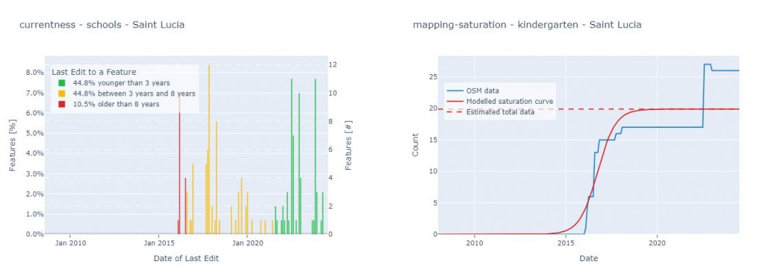
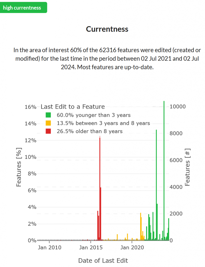
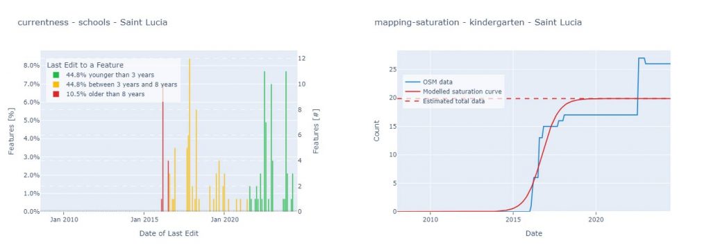
The objective of the first analysis was to gain initial insights into the quality of base OSM objects, such as buildings and roads. Assessing these could provide preliminary results regarding the reliability of OSM data in St. Lucia. We analyzed aspects such as currentness, completeness, comparison with external datasets, and the activity of OSM contributors. The results indicated a moderate to good quality of base OSM data. The completeness of roads and buildings, as well as OSM user activity, was moderate but still sufficient to be considered reliable.
Second Analysis: Mapillary Data in St. Lucia
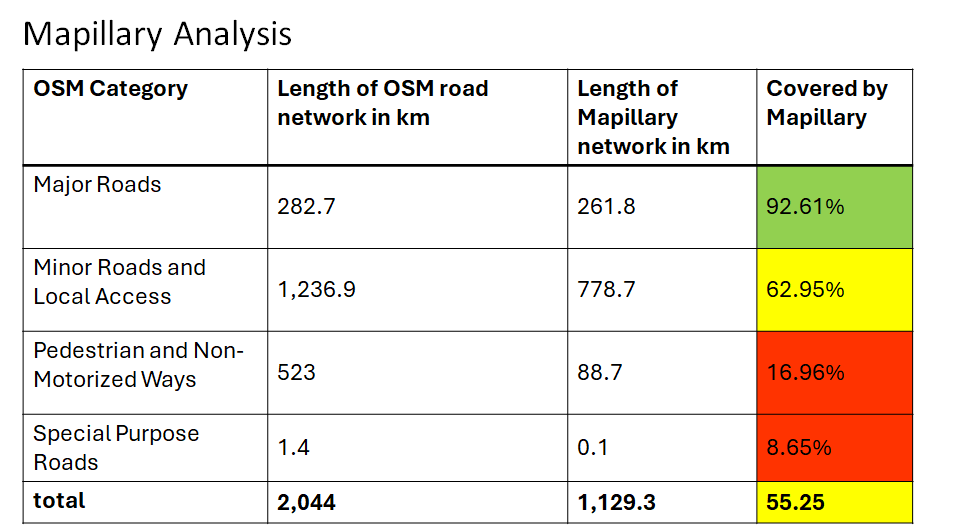
The second analysis focused on Mapillary data in St. Lucia and how complete it is compared to OSM data. We aimed to determine whether Mapillary data could be considered for future use in St. Lucia. The results were more heterogeneous. Roads covered by Mapillary data were categorized into major and minor roads, with good to moderate coverage. However, pedestrian and non-motorized pathways were poorly covered by Mapillary. Thus, the final result is ambiguous, ranging from poor to good coverage.
Third Analysis: Specific OSM Objects Related to Accessibility and Place Characterization
The third analysis involved a detailed examination of specific OSM objects related to accessibility and place characterization, which are connected to travel patterns, daily activities, or medical opportunities. The results were also ambiguous. Some objects, such as the locations of kindergartens, green groceries, pharmacies, street crossings, and water sanitation, were not well mapped in OSM for St. Lucia. On the other hand, the locations of primary schools, public transport, hospitals and clinics, financial services, and administrative divisions were well mapped.
Conclusion
As a final result of the data quality assessment, it can be said that both OSM data and Mapillary data are sufficiently mapped for St. Lucia. However, it is important to consider that not all OSM objects are reliable for further spatial analysis.
To keep up with future developments and releases related to this project as well as other efforts to advance geospatial technology in the mobility, humanitarian aid, and data analytics space, follow our social media channels and stay up to date on our blog.