In the case of a disaster fast response is important and life saving. Information on blocked streets is crucial, but a the same time this infornations needs to be considered by routing engines in real-time. However, many routing engines use street network data which is at best updated once a week or even less often. For many proprietary routing engines which do not use OpenStreetMap data it is also hardly possible to figure out when the data was updated for the last time.
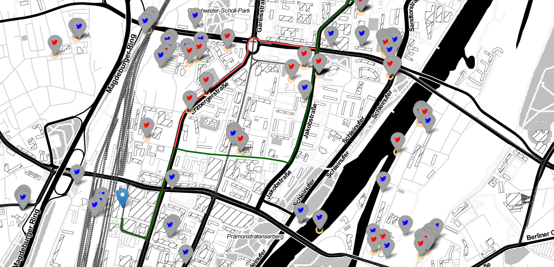
To tackle this issue, we created a new jupyter notebook which shows how the direction feature avoid_polygons of the OpenRouteService API can be used for this purpose. It allows to avoid certain areas (e.g. flood affected regions) and to request the fastest or shortest route for different kind of travel profiles (e.g. car, pedestrian or truck). We used Twitter data which offers real time location based point data which can be used as a fast ground truth information.
We apply our method to the 2013 River Elbe Flood event. This severe flood affected many cities in the eastern part of Germany, and also the city of Magdeburg, which is our study region
For further reading regarding the use of social media data in disaster situations take a look at our related publication.
Porto de Albuquerque, J., B. Herfort, A. Brenning, A. Zipf (2015): A Geographic Approach for Combining Social Media and Authoritative Data towards Improving Information Extraction for Disaster Management: A Study on the Twitter usage in the River Elbe Flood of June 2013. International Journal of Geographical Information Science, 29(4): 667-689. Taylor & Francis. DOI: 10.1080/13658816.2014.996567