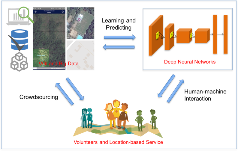
Recently, deep learning has been widely applied in pattern recognition with satellite images. Deep learning techniques like Convolutional Neural Network and Deep Belief Network have shown outstanding performance in detecting ground objects like buildings and roads, and the learnt deep … Read More
Deutsch
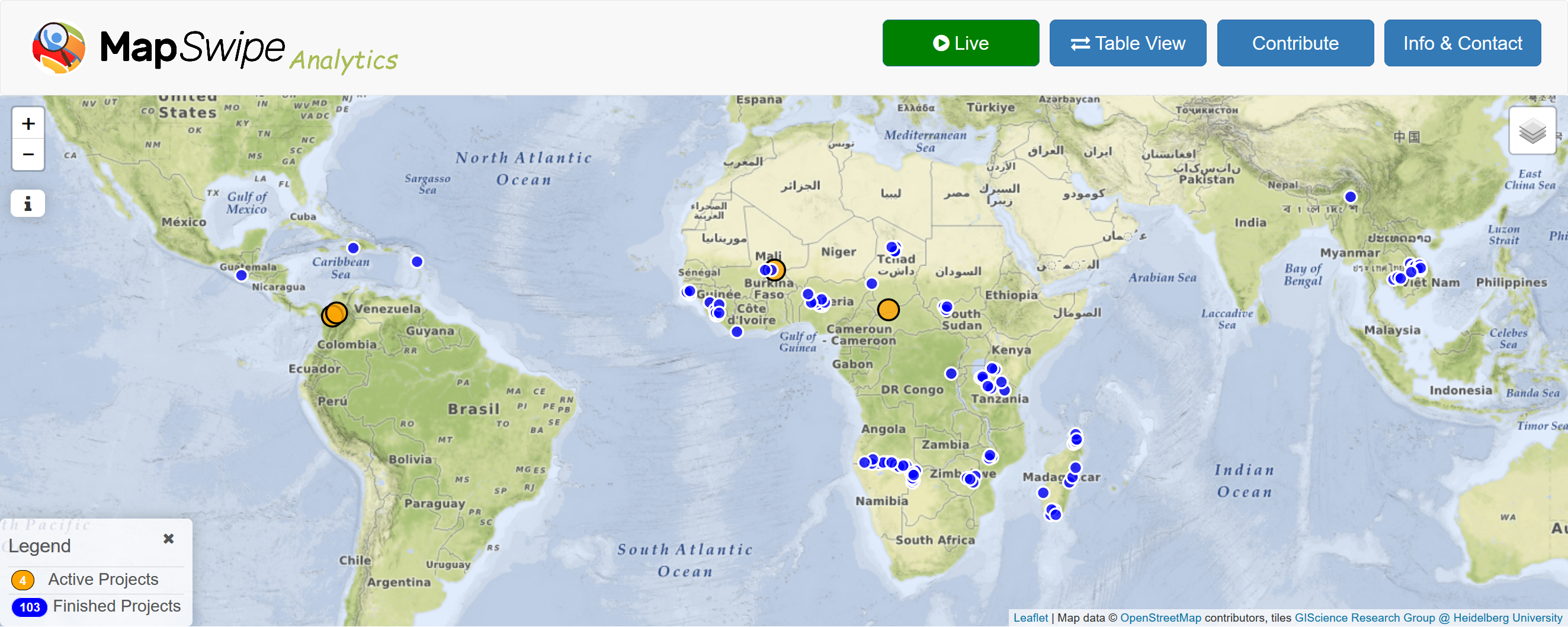
MapSwipe Analytics: Map each Swipe and Tap
Since the launch of the MapSwipe Analytics webpage three month ago we were able to improve our service and offer more detailed information on each project in MapSwipe. MapSwipe is a mobile App for crowdsourcing geographic information needed by humanitarian … Read More