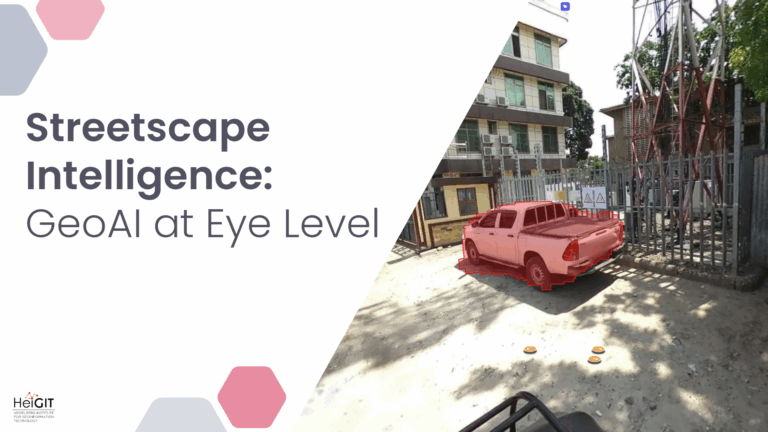
Crowdsourced street-level imagery can be used to detect and map humanitarian-relevant features in near real time. We have developed a machine-learning-based analytical pipeline that integrates with the open-source imagery catalogue…
Humans rely on clean water for their health, well-being, and various socio-economic activities. During the past few years, the COVID-19 pandemic has been a constant reminder of about the importance…
Accurate and complete geographic data of human settlement is crucial for humanitarian aid and disaster response. OpenStreetMap (OSM) can serve as a valuable source, especially for global south countries where…
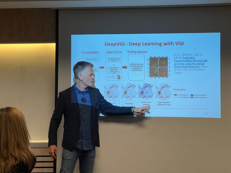
Recently, a new research paper “Detecting OpenStreetMap missing buildings by transferring pre-trained deep neural networks” (Pisl, J., Li, H., Herfort, B., Lautenbach, S., Zipf, A. 2021) has been accepted at…
After more than a decade of rapid development of volunteered geographic information (VGI), VGI has already become one of the most important research topics in the GIScience community. Almost in…
Today we celebrate the International Day for #DisasterRiskReduction. HeiGIT offers a growing set of tools and services that support humanitarian aid during and before disasters. Examples include work in the…
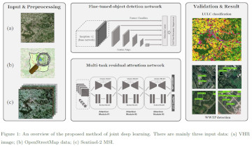
Our new paper on Machine Learning and Humanitarian Mapping Nowadays, Machine Learning and Deep Learning approaches are steadily gaining popularity within the humanitarian (mapping) community. New tools such as the…
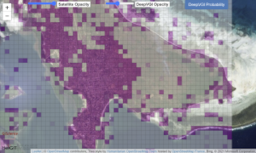
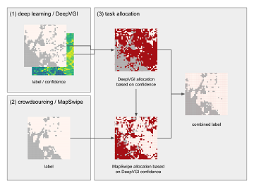
The Humanitarian OpenStreetMap Team (HOT) , the Heidelberg Institute of Geoinformation Technology (HeiGIT) , and the wider MapSwipe Community started working on an MapSwipe extension to monitor changes in satellite…
Recently, earth observation by satellites has shown great capability in supporting a range of challenges such as disaster assessment, agriculture monitoring, and humanitarian mapping. MapSwipe, as a humanitarian mapping app,…
Humanitarian organizations can’t help people if they can’t find them. This was the simple reason to create MapSwipe back in 2016 and it is still as pressing as in the…