
During the EuroSDR workshop we will present our OSMlanduse product (earlier post) to the land use (LU) and land cover community (LC) and highlight class accuracies and a benchmark comparison towards existing national authoritative products. Accuracy estimated to be presented … Read More
Deutsch

OSMlanduse European Union validation effort
We launched a validation campaign of our new 10meter resolution OSMlanduse product for the member states of the European Union. Please contribute to the validation here. A technique where contributions are checked against each other is implemented to promote quality … Read More
MeinGrün – project proposal approved (mFund BMVI)
Informationen und Navigation zu urbanen Grünflächen in Städten – meinGrün Neues mFund Kooperations-Projekt meinGrün wird vom BMVI gefoerdert. Problemstellung Um in Städten trotz Wachstum und Nachverdichtung eine hohe Lebensqualität zu sichern, spielen Grünflächen eine essentielle Rolle, da sie sich positiv … Read More
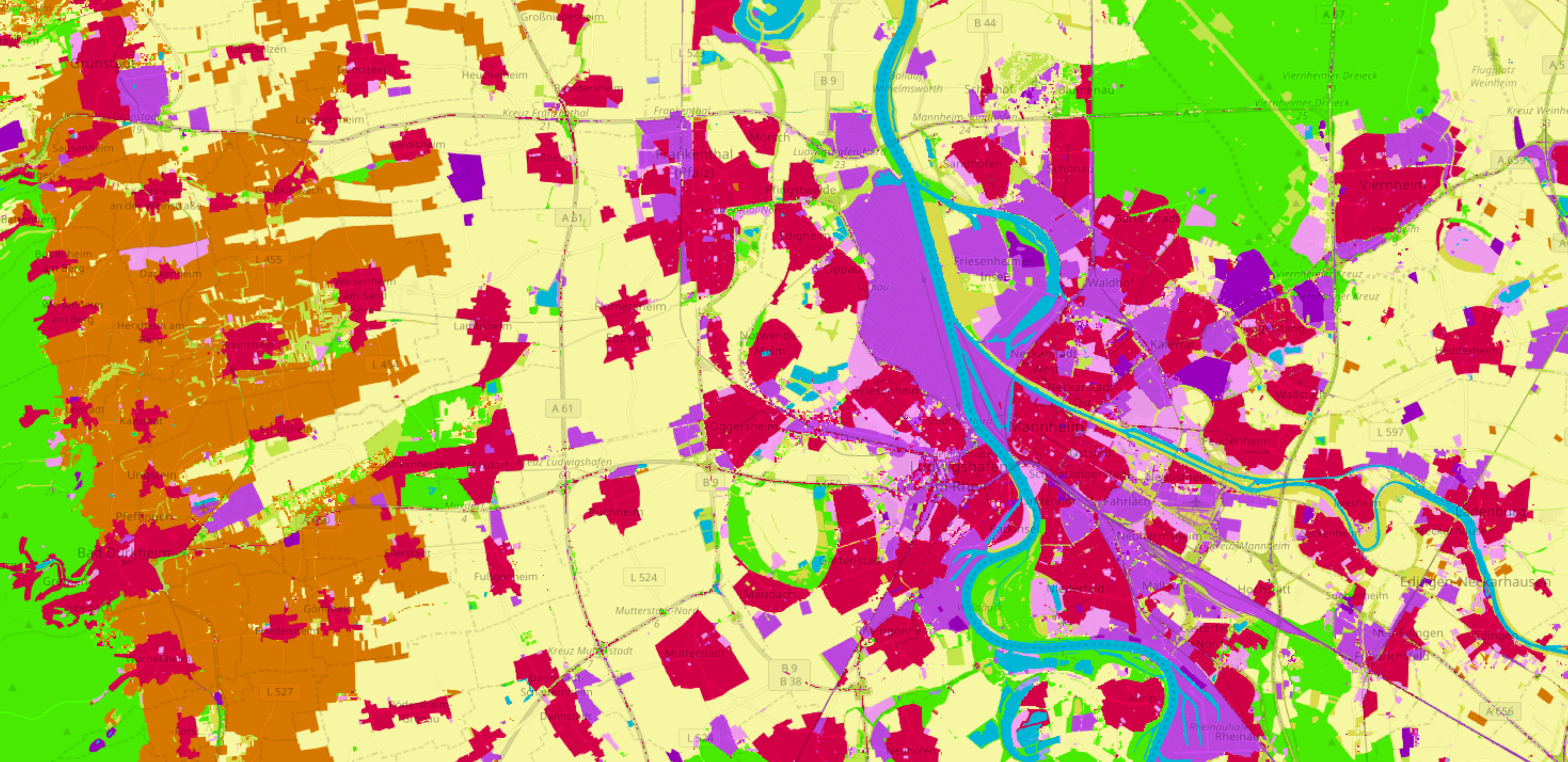
OSMlanduse.org + Remote Sensing = New conterminous land use data set for Germany released – filling gaps in OSM through machine learning
Land use data created by humans (OSM) was fused with satellite remote sensing data, resulting in a conterminous land use data set without gaps. The first version is now available for all Germany at OSMlanduse.org. When human input (OSM data) … Read More