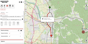
We are happy to announce that the new openrouteservice maps client has been finished and released. It is an open source route planner with plenty of features for car, heavy vehicles, hiking, cycling and wheelchair, designed to be mobile friendly … Read More
Blog
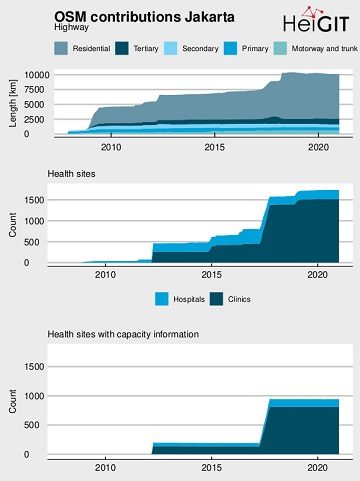
Flood Impact Assessment on Road Network and Healthcare Access at the example of Jakarta, Indonesia
Extreme natural events create catastrophic situations for cities and their populations. Due to climate change and anthropogenic activities, the number and intensity of these events has steadily increased at the global scale. Floods are the most common natural disaster worldwide, … Read More
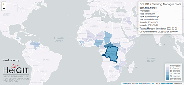
Humanitarian OSM Stats: How to monitor humanitarian mapping in the HOT Tasking Manager? – Part 4
Since 2010, organized humanitarian mapping has evolved as a constant and growing element of the global OpenStreetMap (OSM) community. With more than 7,000 projects in 150 countries, humanitarian mapping has become a global community effort. Due to this large amount … Read More
Successful PhD Defense by Amin Mobasheri on OSM quality enrichment for wheelchair routing
Last Friday Amin Mobasheri of the GIScience Research Group Heidelberg University successfully defended his PhD in Geoinformatics. Due to the Corona pandemy the defense was conducted in hybrid mode with the committee members participating virtually and only Prof. Zipf and … Read More
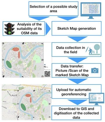
New paper published about the OSM Sketch Map Tool
The Sketch Map Tool supports participatory mapping approaches and risk communication. An new paper presents the different functionalities of the tool. OSM data quality can be evaluated regarding the fitness for the sketch-map-approach. Based on the great idea of Field … Read More
Wanna give feedback about HeiGIT services? Survey Deadline extended to 05.03.
HeiGIT wants to serve you better. Therefore we are conducting user feedback surveys regarding our various services. The Deadline has been extended to March 05rd! Take your chance! If you have ever used one of our OpenStreetMap based Online Services … Read More
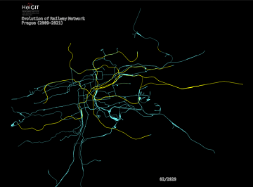
An ohsome Railway Network Visualization and Analysis
Welcome back to another #ohsome blog post written by our awesome student assistent Sarah! This time we will look at the completeness of railway network data of one specific city in OpenStreetMap, as well as its development. For this we … Read More
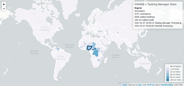
Humanitarian OSM Stats: How to monitor humanitarian mapping in the HOT Tasking Manager? – Part 3
Since 2010 organized humanitarian mapping has evolved as a constant and growing element of the global OpenStreetMap (OSM) community. With more than 7,000 projects in 150 countries humanitarian mapping has become a global community effort. Due to this large amount … Read More
HeiGIT Services User Feedback Survey – only one more week!
HeiGIT wants to serve you even better. Therefore we are conducting user feedback surveys regarding our various services. If you have ever used one of our OpenStreetMap based Online Services (or will do so now) for whatever purpose, we’d be … Read More
AUF DIREKTEM WEG ZUR CORONA-IMPFUNG – Meldung der Universität Heidelberg
Die Universität Heidelberg berichtet aktuell über impfzentrum.openrouteservice.org NEUER ROUTENPLANER ERMITTELT DEUTSCHLANDWEIT DIE SCHNELLSTE ROUTE ZUM NÄCHSTEN IMPFZENTRUM Wo kann ich mich gegen das Coronavirus impfen lassen und wie komme ich dorthin? Diese Frage beantwortet ein von Geoinformatikern der Universität Heidelberg … Read More
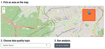
Introducing the Ohsome Quality analysT (OQT)
The Ohsome Quality analysT (short OQT) is the name of a new software implemented by HeiGIT that is based on the #ohsome framework. Its main purpose is to compute quality estimations on OpenStreetMap (OSM) data. Any end user such as … Read More
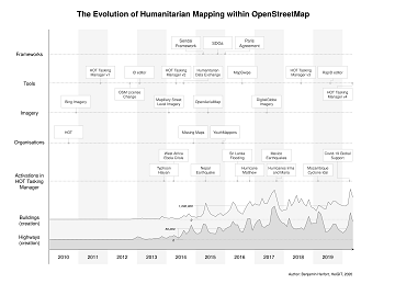
The evolution of humanitarian mapping within the OpenStreetMap community
In the past 10 years, the collaborative maps of OpenStreetMap (OSM) have been used to support humanitarian efforts around the world as well as to fill important data gaps for implementing major development frameworks such as the Sustainable Development Goals … Read More
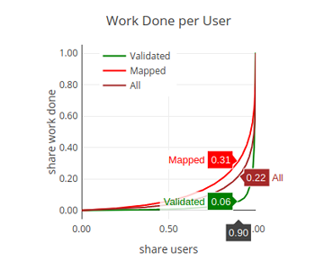
Humanitarian OSM Stats: How to monitor humanitarian mapping in the HOT Tasking Manager? – Part 2
Since 2010 organized humanitarian mapping has evolved as a constant and growing element of the global OpenStreetMap (OSM) community. With more than 7,000 projects in 150 countries humanitarian mapping has become a global community effort. Due to this large amount … Read More
German radio report on OpenStreetMap in WDR5 Quarks – Wissenschaft und mehr
The German radio station WDR 5 broadcasted a short report about OpenStreetMap with a focus on basics and navigation in the science programme “Quarks – Wissenschaft und mehr” last month on 19.01.2021. One of the German pioneers of OpenStreetMap – … Read More
Vortrag zu Humanitärem Mapping in OpenStreetMap bei Begabtenförderung des Heidelberger Life‐Science Lab
Das Heidelberger Life‐Science Lab ist eine Einrichtung des Deutschen Krebsforschungszentrums (DKFZ, Heidelberg) und hat die Förderung mathematisch und naturwissenschaftlich-technisch besonders interessierter und begabter Mittel- und Oberstufenschüler und Studenten zur Aufgabe. Der Schwerpunkt ist auf die Life-Sciences gerichtet, die den Standort … Read More
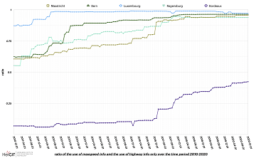
ohsome street network analysis part 2
Welcome to part 2 of the #ohsome street network analysis. If you haven’t read the first part yet, you can do so following this link. As promised, this week we are performing a simple tag completeness analysis, where we are … Read More
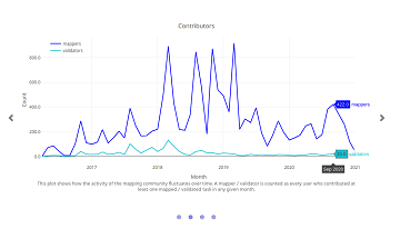
Humanitarian OSM Stats: How to monitor humanitarian mapping in the HOT Tasking Manager? – Part 1
Since 2010 organized humanitarian mapping has evolved as a constant and growing element of the global OpenStreetMap (OSM) community. With more than 7,000 projects in 150 countries humanitarian mapping has become a global community effort. Due to this large amount … Read More
Erstes Handbuch zur Veranstaltung von Mapathons im Deutschen Roten Kreuz
Das Handbuch zur Veranstaltung von Mapathons im Deutschen Roten Kreuz (DRK) ist da! In dem Handbuch wird beschrieben, was bei der Durchführung eines Mapathon zu beachten ist. Es beginnt mit der Frage, was überhaupt ein Mapathon ist und erklärt warum … Read More
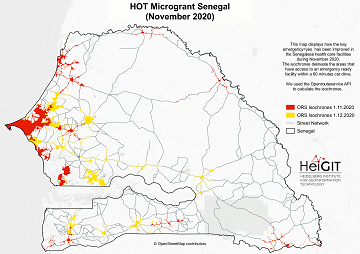
Updated OSM Healthcare in Senegal (2020)
OpenStreetMap (OSM) offers many possibilities and holds potential in the area of freely available infrastructure data for the health sector. Nevertheless, it is important to underline that the quality of the information is different in each country, since the mapping … Read More
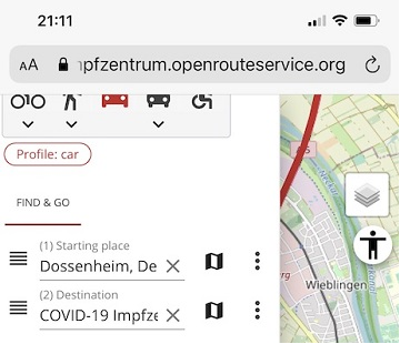
Find the route to your nearest Covid-19 vaccination center in Germany — new App by HeiGIT based on OpenStreetMap and openrouteservice
Where is is the closed Covid-19 vaccination center and what is the best way to get there? A new route planning app helps you answer this questions by suggesting ways to the nearest vaccination center. You can use this route … Read More

