Recently openrouteservice has been updated to version 6.2 which has brought some pretty useful features to routing. One of the main “new” features is the re-introducing of the maximum_speed parameter where users can set the maximum speed their vehicle can … Read More
Blog
A revamped ORS map client to celebrate the 16th OpenStreetMap anniversary
#OpenStreetMap is turning 16! Happy Birthday from the HeiGIT team. After 16 years OSM is a reference of collaborative work and how we can give our best to create and maintain global, free and multipurpose projects that bring benefits to … Read More
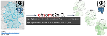
We wish you an ohsome birthday OpenStreetMap! Our gift: the new ohsome2X time-series tool
#OpenStreetMap is turning 16! Happy Birthday from the HeiGIT team. 16 years of OSM activity has created the most feature rich and global free multi purpose map that the world has ever seen. The ohsome team at HeiGIT has created … Read More
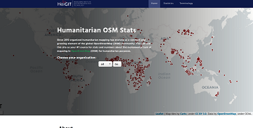
Introducing the humstats.heigit.org dashboard about Humanitarian Mapping in OpenStreetMap
Since 2010 organized humanitarian mapping has evolved as a constant and growing element of the global OpenStreetMap (OSM) community. With more than 7,000 projects in 150 countries humanitarian mapping has become a global community effort. Mappers have added more than … Read More
How to become ohsome part 7 different ways to access the ohsome API
A new month – a new post of the how to become #ohsome blog series. Welcome to part 7, in which we will show you 7 different ways how you can send a request to the ohsome API using different … Read More
Do you need a shady route because it is too hot?
IT IS REALLY HOT! Again! So it seems, we need to repeat an updated version of a Blogpost from exactly one year ago: You are looking for a more shady pedestrian route through the urban jungle? You might then prefer … Read More

Karlsruhe relies on openrouteservice – ESRI client plugin developed
Since some time the City of Karlsruhe uses the API of Openrouteservice (ORS) by HeiGIT for routing of pedestrians, bicycles and cars in the new online city plan and the citizen GIS app for the general public, i.e. the citizens … Read More

New function in the ohsome API for checking query parameters
As you may already know from the latest blog posts, new advancements are brought with the release 1.0 of the #ohsome API. One minor function involves the correctness of parameters that you can use in your queries, which was developed … Read More
GIScience for physical activity research
GIScience methods are becoming more and more widespread in different domains. A current review article under involvement of HeiGIT researchers discusses the potential of ambulatory assessments and GIScience approaches for physical activity research. The article is on of the outcomes … Read More

Introducing ohsome2label tool to generate training samples from OpenStreetMap for geospatial deep learning
After more than a decade of rapid development of volunteered geographic information (VGI), VGI has already become one of the most important research topics in the GIScience community. Almost in the meantime, we have witnessed the ever-fast growth of geospatial … Read More
Quiet route planning for pedestrians in traffic noise polluted environments
#Noise #pollution is one of the main stressors in urban environments, having negative impacts on people’s quality of life and health. For some groups of citizens, such as school children, patients, and elders, there is a need to support them … Read More
Physische Erreichbarkeiten von Krankenhäusern in Subsahara Afrika – Analyse und Ergebnisse bei COVID-19 Symposium vorgestellt
Vom 06. bis zum 08. Juli fand das Online Symposiums “COVID-19 als Zäsur? Geographische Perspektiven auf Räume, Gesellschaften und Technologien in der Pandemie” statt. Teilnehmer aus Geographie, Medizin, Public health und meidizinischer Geographie diskutierten über drei Tage in sechs verschiedenen … Read More

How to become ohsome part 6: Introducing the magical filter parameter
We are back again with a fresh part of the How to become ohsome blog series. In case this 6th part of the series is your first one, or you have not heard from our awesome OpenStreetMap History Data Analytics … Read More

Einführung in OpenStreetMap und humanitäres Mapping bei der AGIT 2020
HeiGIT unterstützt Workshops zu OpenStreetMap und humanitärem Mapping auf der AGIT 2020 In dieser Woche findet die jährliche AGIT-Konferenz und das parallele GI Forum statt. Während die Konferenz bereits seit mehr als 30 Jahren erfolgreich Vertreter aus Wissenschaft, angewandter Forschung … Read More
Jugend präsentiert zu Besuch bei HeiGIT
Am 02.07. besuchte eine Delegation von Alumni von “Jugend präsentiert” im Rahmen der diesjährigen Summer School REMOTE von “Jugend präsentiert” das Heidelberg Institute for Geoinformation Technology (HeiGIT gGmbH) an der Universität Heidelberg. Aufgrund der Corona-Pandemie fand der Besuch allerdings nur … Read More
Kick off of the 25 Mapathon project
We are proud to announce the successful Kickoff of the 25 Mapathons project. On June, 22th a joint team of HeiGIT and the German Red Cross (GRC) carried out the first mapathon of the 25 Mapathons series. The mapathon was … Read More

meinGrün Schnitzeljagd in Heidelberg gestartet
Wo befindet sich dieser Spielplatz in Heidelberg? Wie komme ich zum nächst gelegenden Park und das möglichst auf einer Route mit viel Grün oder wenig Lärm? Wer das herausfinden möchte, sollte an der meinGrün Schnitzeljagd teilnehmen. Nachdem die Schnitzeljagd in … Read More

HeiGIT gGmbH is One Year Old Today!
Today (1st July 2020) marks the first birthday of HeiGIT gGmbH! Over this first year, HeiGIT has been involved a large number of events, projects, publications, and press coverage. Founded on the 1st July 2019, HeiGIT is a non-for-profit organisation … Read More
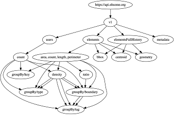
Sphinx is ohsome – new documentation of the ohsome API
What does the tool behind the recently published documentation of the ohsome API have in common with a statue made of stones in Egypt? – Apart from the name, both are of course awesome (and now also ohsome). As previously … Read More
Humanitarian OpenStreetMap Team has been selected by the Audacious Project
The Humanitarian OpenStreetMap Team (HOT) has announced major financial support from the Audacious Project, which will be provided over the next five years. HOT aims to use this funding to grow OpenStreetMap (OSM) communities in 94 countries. By engaging one … Read More
