The latest release of ohsome-planet introduces Parquet files continuously derived from OpenStreetMap replication data. This eliminates costly reprocessing and allows seamless analysis of the full lifecycle of OSM data in…
At State of the Map Europe 2025, we have introduced ohsomeDB, the successor to the OpenStreetMap History Database (OSHDB), which offers a faster, more flexible foundation for analyzing OpenStreetMap (OSM)…
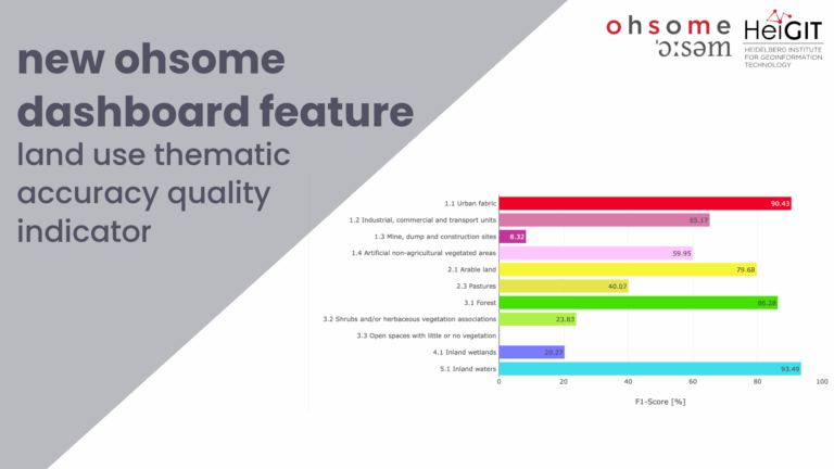
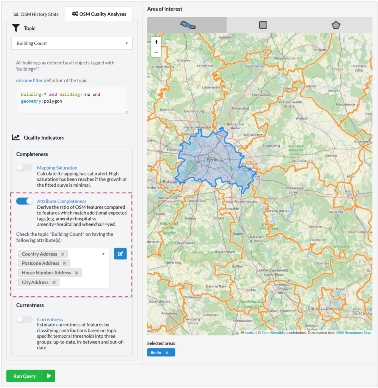
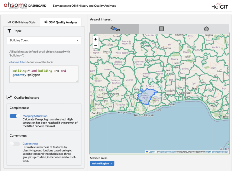
Together with the German Federal Agency for Cartography and Geodesy (BKG) we released a new version of the ohsome dashboard, introducing a new indicator for assessing the thematic accuracy of…
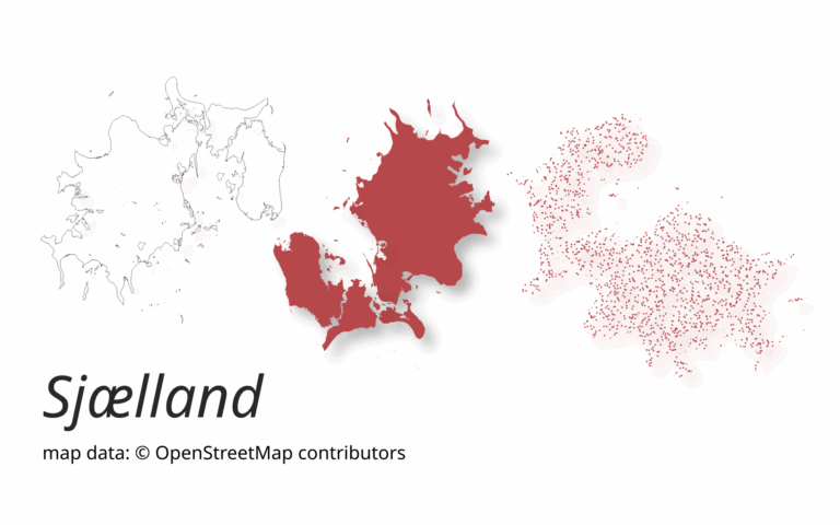
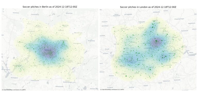
A new version of ohsome-planet (codename “Sjælland”) has been released. It is the newest version of HeiGIT´s command line tool, which transforms OpenStreetMap (history) PBF files into into an analysis-ready…
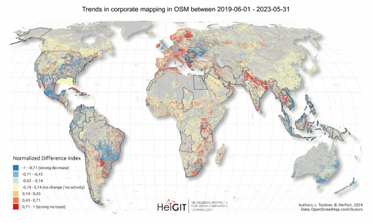
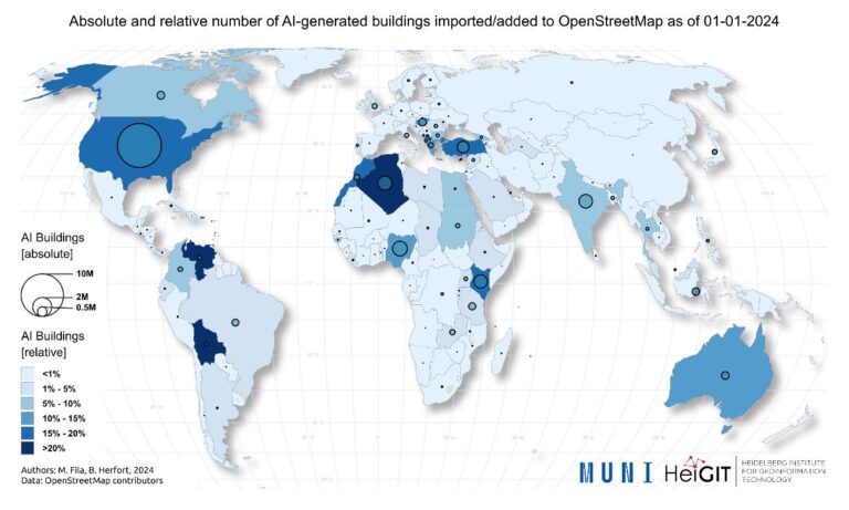
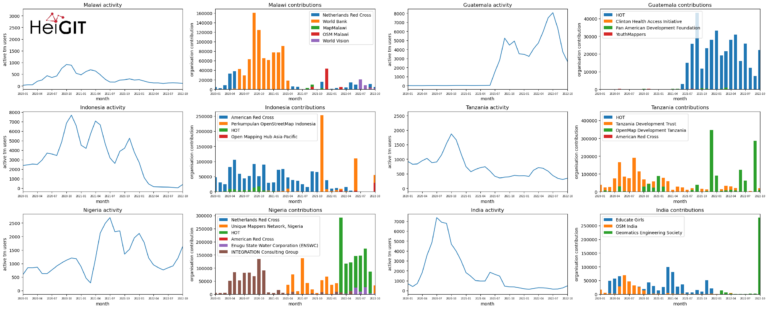
Since 2016, corporate involvement in OpenStreetMap (OSM) has grown significantly, with major contributors such as Apple, Microsoft, Meta, and Amazon making substantial edits to the map on a global scale….
We are excited to share the release of the ohsome-planet – a new software library on GitHub, marking a significant step toward the development of ohsome 2.0. This tool is…
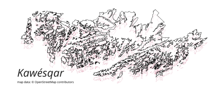
The concept of a “Digital Earth” has long envisioned a future where technological advancements enable the large-scale collection and visualization of spatial and environmental data. Today, open data sources such…
We recently added the attribute completeness indicator to the ohsome Dashboard, and we’re now happy to introduce major upgrades to its functionalities. The ohsome quality API (OQAPI) and the ohsome…
Explore some of metrics from ohsome tools and impact of OpenStreetMap (OSM) in 2024. From building data coverage in Baden-Württemberg to millions of API requests and contributions, these figures showcase…
The ohsome-py Python package is a client for the ohsome API, designed to facilitate the extraction and analysis of historical OpenStreetMap (OSM) data. The package simplifies handling API requests and…
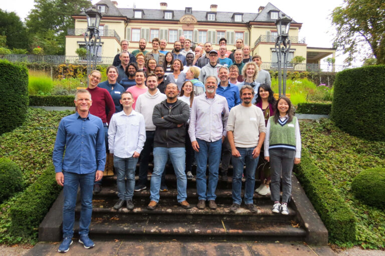
HeiGIT is celebrating its fifth anniversary today, July 1st! To commemorate this occasion, we invite you to join us on a little walk down memory lane….
Are you ready to take your OpenStreetMap (OSM) data analysis to the next level? We’re excited to showcase the latest features of our ohsome Dashboard, designed to provide you with…
During GeoNight 2024, HeiGIT partnered with Mannheimer Mapathons to host a mapathon together. Mapathons are events where volunteers come together to map crucial features like roads, buildings or waterways on OpenStreetMap, often…
We’re proud to share our recent conference experience with you! Our HeiGIT Product Owners for Big Data and Smart Mobility, @Benjamin Herfort and Julian Psotta, had the privilege of attending…
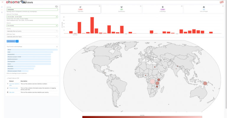
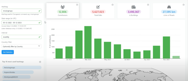
OhsomeNow stats makes it possible to monitor contributions to OpenStreetMap (OSM) in real time. We developed this new dashboard as part of our long-term cooperation with the Humanitarian OpenStreetMap Team…
Context During natural disasters and other catastrophic events, quickly identifying and distributing resources is essential. Even a brief delay in evacuating residents or sourcing water can significantly hamper relief efforts…
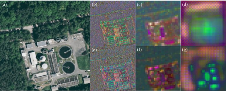
Introduction In an era where technology continuously reshapes our world, the fusion of artificial intelligence and geospatial data offers exciting possibilities. HeiGIT (Heidelberg Institute for Geoinformation Technology), a pioneering research…
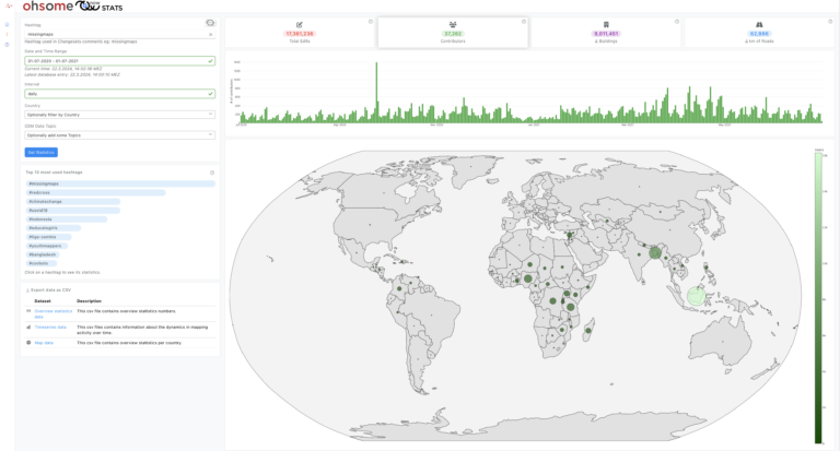
Today, we’d like to shine a light on the online tool OhsomeNowStats. OhsomeNowStats allows users to take a look at the mapping activity in OpenStreetMap. This is especially useful for…
Introduction In this blogpost we are taking a look at humanitarian mapping through the Tasking Manager (HOT-TM) that is operated by the Humanitarian OpenStreetMap Team (HOT). At HeiGIT we work…
The completeness of the OpenStreetMap (OSM) road network has been an ongoing focus for researchers for more than 15 years. For instance, Neis et al. (2011) investigated the OSM street…