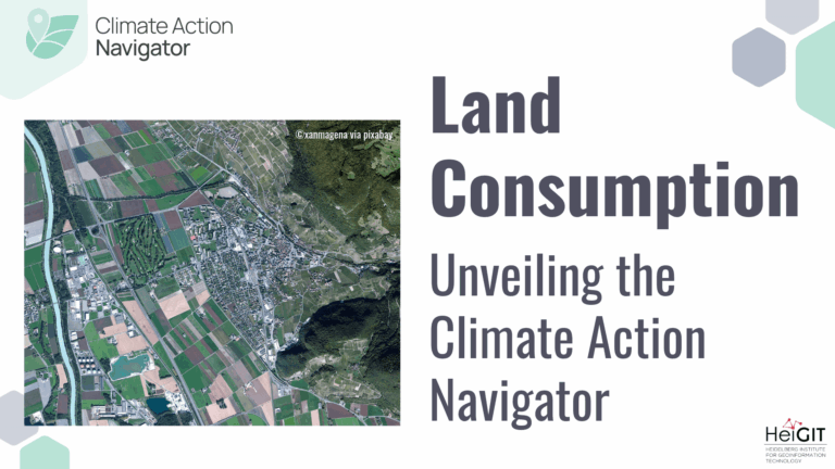
In May this year we officially launched the Climate Action Navigator (CAN): HeiGIT’s new dashboard offering high-resolution, open data-based insights into key climate action indicators. From assessing CO2 emissions from…
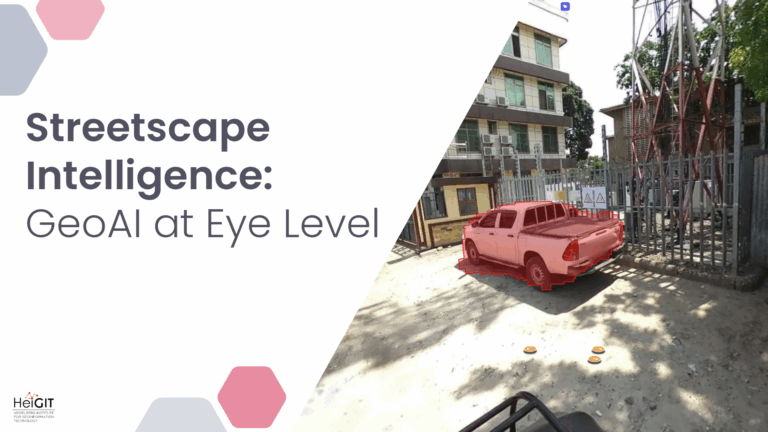
Crowdsourced street-level imagery can be used to detect and map humanitarian-relevant features in near real time. We have developed a machine-learning-based analytical pipeline that integrates with the open-source imagery catalogue…
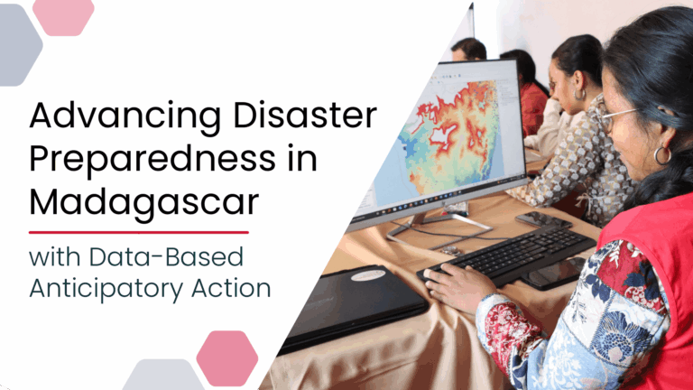
Anticipatory Action (AA) is becoming an increasingly vital approach in humanitarian and disaster risk management. By leveraging forecasts and risk data, AA enables timely interventions before extreme events occur. Geoinformation…
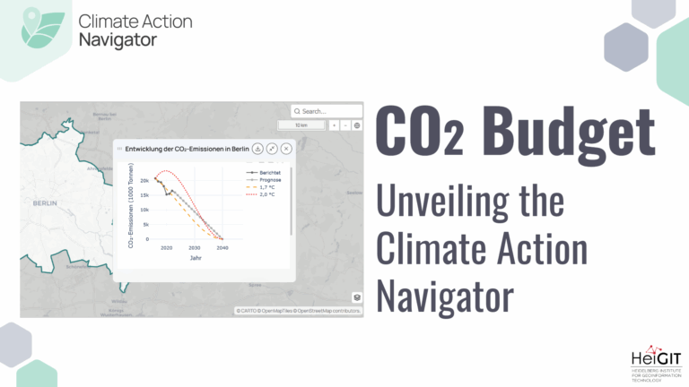
Thanks to the newest addition to the Climate Action Navigator, it is now possible to calculate the remaining CO₂ budget for several German cities (Berlin, Bonn, Hamburg, Heidelberg, and Karlsruhe)…
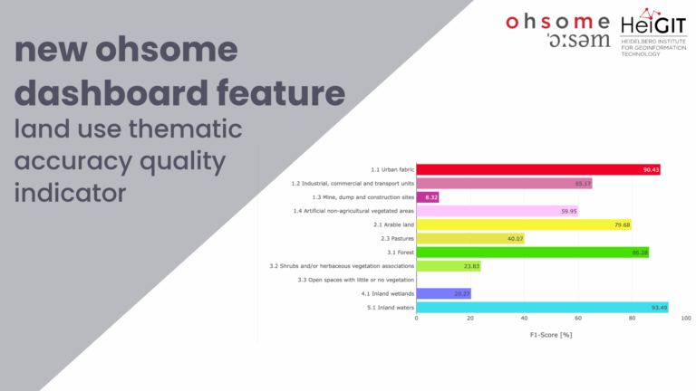
Together with the German Federal Agency for Cartography and Geodesy (BKG) we released a new version of the ohsome dashboard, introducing a new indicator for assessing the thematic accuracy of…
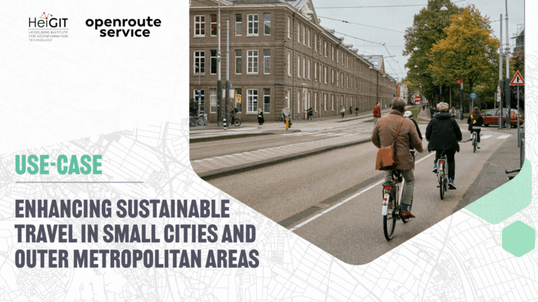
The ENHANCE project explores how 15-minute city principles can be applied beyond dense urban hubs, using mapping, behavioral research, and simulation tools to design more sustainable and inclusive mobility systems….
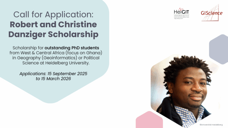
The Robert and Christine Danziger Scholarship supports outstanding doctoral students from West and Central Africa (with particular emphasis on applicants from Ghana), who intend to pursue a doctoral degree in…
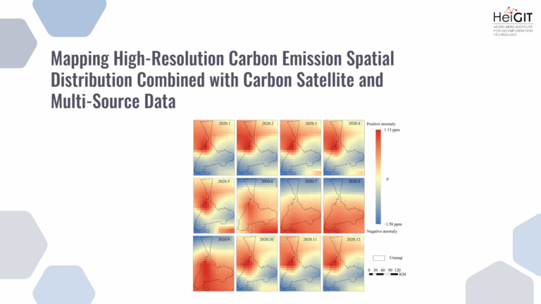
This study develops a framework integrating satellite observations with spatial proxy data to produce high-resolution urban carbon emission maps. The method is applied to Urumqi, China, demonstrating accurate and timely…
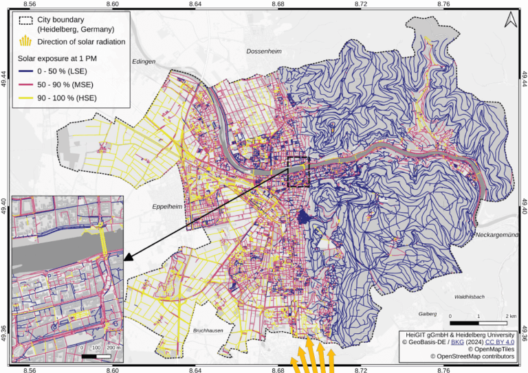
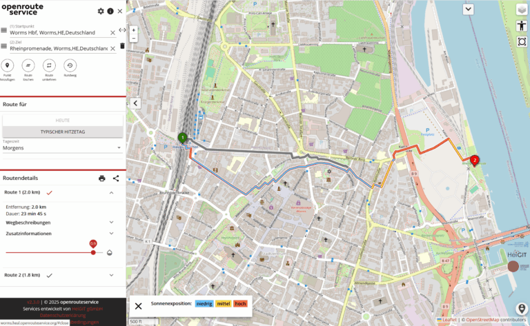
Using Heidelberg as a case study, researchers modeled time-dependent solar exposure for the entire pedestrian network by combining high-resolution DEM/DSM building and vegetation data with OpenStreetMap road data. Adapting to…
The Sketch Map Tool was used in Cartagena, Chile, to collect geographic information for effective disaster risk reduction. It is an easy-to-use tool for participatory sketch mapping through offline collection,…
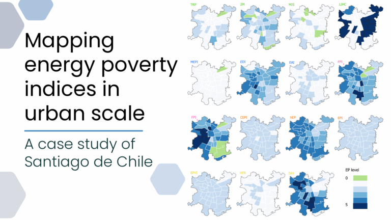
This study evaluates the applicability of macro-scale energy poverty indices in an urban context, using Santiago de Chile as a case study. Energy poverty (EP), understood as the inability of…
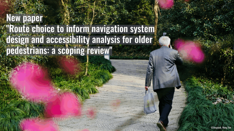
Walking supports healthy aging, but older adults often prioritize safety and comfort over speed. This study uses a scoping review to examine these preferences and guide age-inclusive routing systems. Walking…
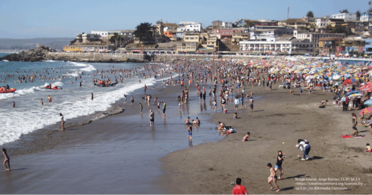
As summer temperatures soar, being outdoors poses rising health risks, especially in urban areas and for vulnerable groups like the elderly, children, and citizen with pre-existing conditions. The HEAL project…
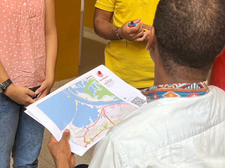
In June 2025, researchers from the Urban Big Data Centre (UBDC) and HeiGIT (Heidelberg Institute for Geoinformation Technology) carried out a joint field trip to Colombia to strengthen participatory mapping…
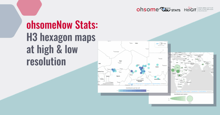
The ohsomeNow Stats dashboard has been updated to enhance its visual and functional elements. This facilitates the exploration of OpenstreetMap (OSM) mapping activities across space and time. New H3 hexagon…
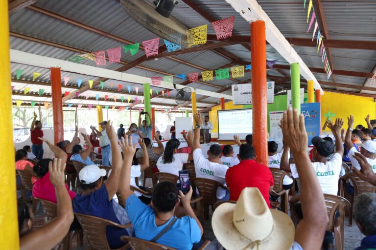
The Sketch Map Tool was used in a joint effort between the Honduran Red Cross and the municipal government to update the municipal response plan and develop an annex focused…
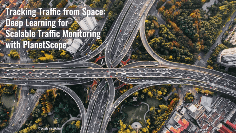
A recent study has demonstrated a novel approach to the large-scale monitoring of road traffic. Rather than relying on radar or mobile sensors, the team used PlanetScope’s Super Dove satellite…
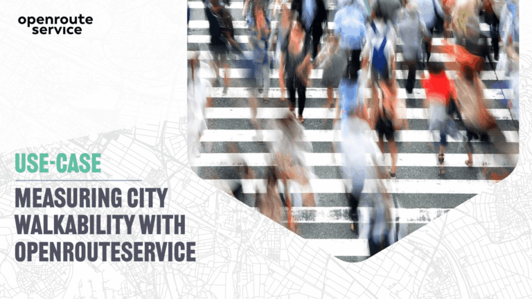
The study presents a detailed analysis of walking access to key built environment assets linked to the social determinants of health. Using openrouteservice, it examines spatial inequalities in access to…
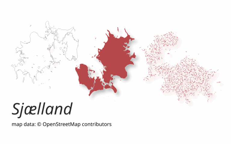
A new version of ohsome-planet (codename “Sjælland”) has been released. It is the newest version of HeiGIT´s command line tool, which transforms OpenStreetMap (history) PBF files into into an analysis-ready…
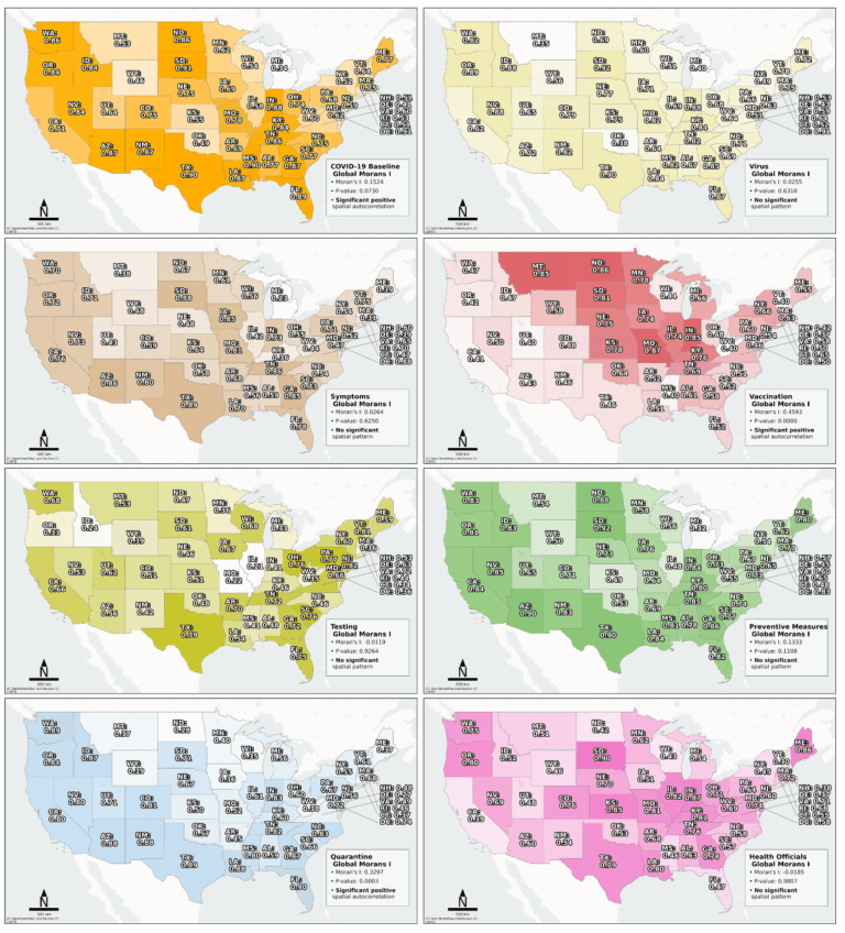
Searching for early warning systems during the COVID-19 pandemic, the researchers explored how digital data sources such as geo-social media (e.g. posts on platforms like X, formerly Twitter, that include…