Together with the German Federal Agency for Cartography and Geodesy…
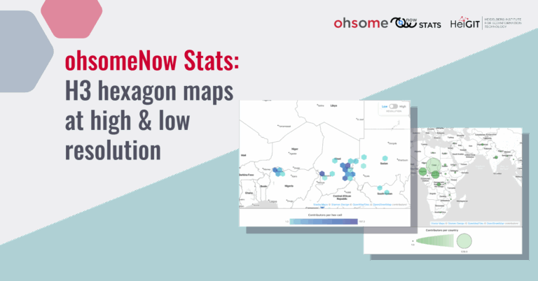
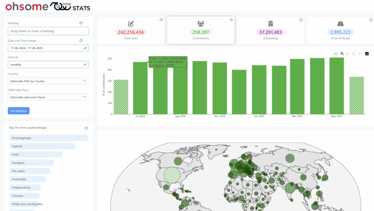
The ohsomeNow Stats dashboard has been updated to enhance its…
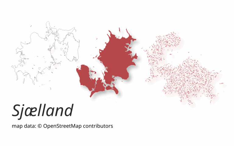
A new version of ohsome-planet (codename “Sjælland”) has been released….
The enhanced ohsomeNow Stats dashboard now provides near real-time access…
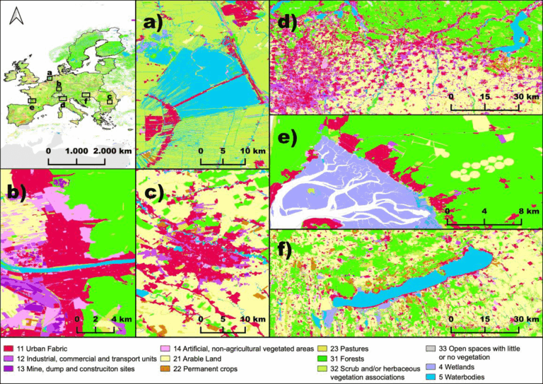
This project explores how OpenStreetMap data can complement satellite imagery…
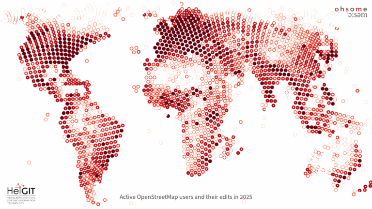
The paper, published in Nature Scientific Data, presents the first…
We are excited to share the release of the ohsome-planet…
The concept of a “Digital Earth” has long envisioned a…
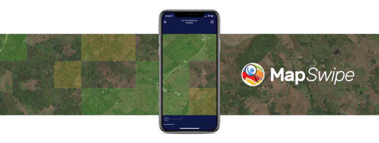
The crowdmapping app MapSwipe now integrates also street-level imagery. This…
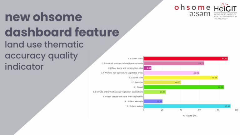
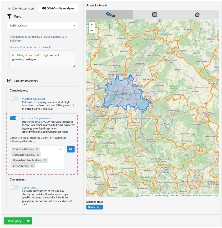
We recently added the attribute completeness indicator to the ohsome…
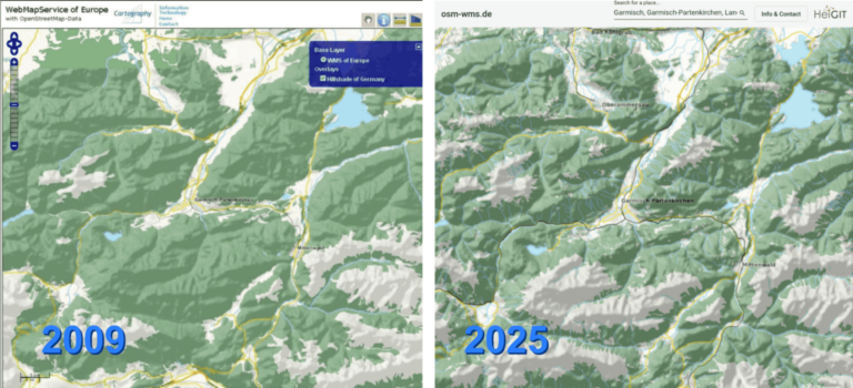
After 16 years, the OSM WMS – osm-wms.de website and…