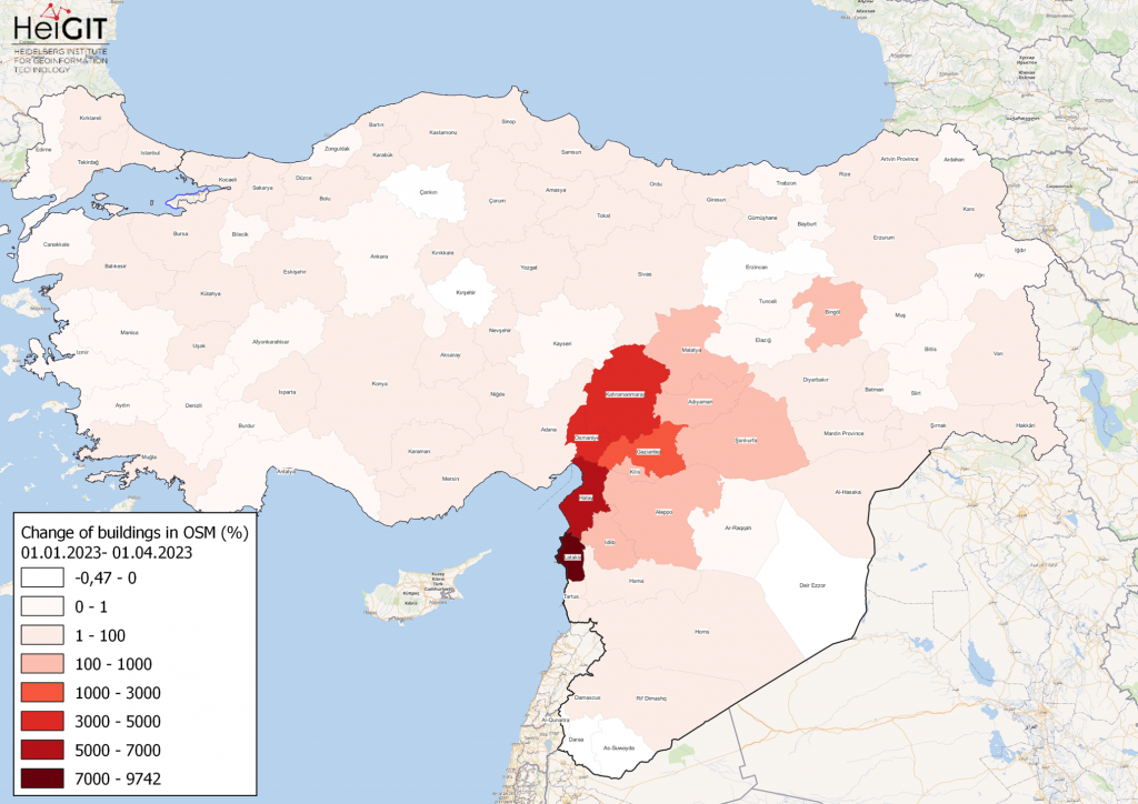
Gezeigte Karte: Prozentuale Veränderung von Gebäuden in jeder Provinz der Türkei und Syriens in OSM. Daten von OpenStreetMap, visualisiert mit QGIS und dem ohsome API Plugin. Willkommen zurück zu unserer how to become ohsome- Serie! Wenn Sie neu dabei sind, schauen … Read More
Deutsch
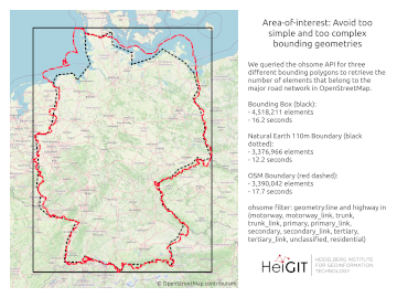
A basic guide to OSM data filtering
Working with OpenStreetMap data is an exciting topic that often reveals astonishing insights. The free and open nature of the project allows a plethora of analyses topics. We at HeiGIT often concentrate on global quantitative analyses and visualisations powered by … Read More
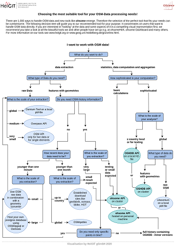
The future of working with OSM data
The open, flexible and collaborative nature as well as the benefits and advantages of OpenStreetMap (OSM) lead to the creation of a whole new ecosystem evolving around the project. They range from local and global communities of data and software … Read More
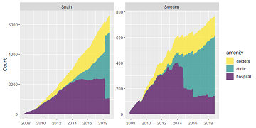
Exploring OSM history: the example of health related amenities
Introduction Exploring how OpenStreetMap data developed over time across different administrative units might reveal interesting insights into the self organizing approach of the OSM communities and can potentially be used to derive intrinsic data quality indicators. It might even be … Read More