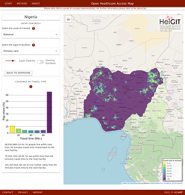
Open Healthcare Access Map is a new web application by HeiGIT to provide insights into healthcare supply on different spatial scales for many countries worldwide. The web application is available here: https://apps.heigit.org/healthcare_access/. Please note that this is a prototype and … Read More
Deutsch
Open Position @ HeiGIT: Software Engineer OSM Routing Services – Backend & Algorithms
Sie lieben Open-Source-Geoinformationsdienste zu entwickeln, die täglich von Tausenden genutzt werden? Sie sind ein hochmotivierter Java Backend-Entwickler und Algorithmen-Designer? Und Sie wollen OpenStreetMap für leistungsstarke GI-Dienste mit globaler Abdeckung einsetzen und verbessern? Dann haben wir vielleicht einen passenden und interessanten … Read More
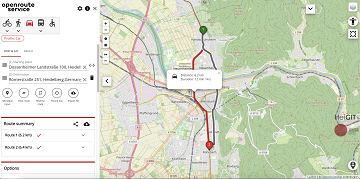
A fresh new ORS maps client
We are happy to announce that the new openrouteservice maps client has been finished and released. It is an open source route planner with plenty of features for car, heavy vehicles, hiking, cycling and wheelchair, designed to be mobile friendly … Read More
AUF DIREKTEM WEG ZUR CORONA-IMPFUNG – Meldung der Universität Heidelberg
Die Universität Heidelberg berichtet aktuell über impfzentrum.openrouteservice.org NEUER ROUTENPLANER ERMITTELT DEUTSCHLANDWEIT DIE SCHNELLSTE ROUTE ZUM NÄCHSTEN IMPFZENTRUM Wo kann ich mich gegen das Coronavirus impfen lassen und wie komme ich dorthin? Diese Frage beantwortet ein von Geoinformatikern der Universität Heidelberg … Read More
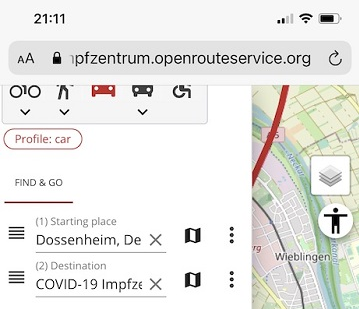
Find the route to your nearest Covid-19 vaccination center in Germany — new App by HeiGIT based on OpenStreetMap and openrouteservice
Where is is the closed Covid-19 vaccination center and what is the best way to get there? A new route planning app helps you answer this questions by suggesting ways to the nearest vaccination center. You can use this route … Read More
Update on “Accessibility of COVID-19 vaccination centers in Germany”
Based on newly available locations for missing COVID-19 vaccination centers the accessibility analysis has been updated.
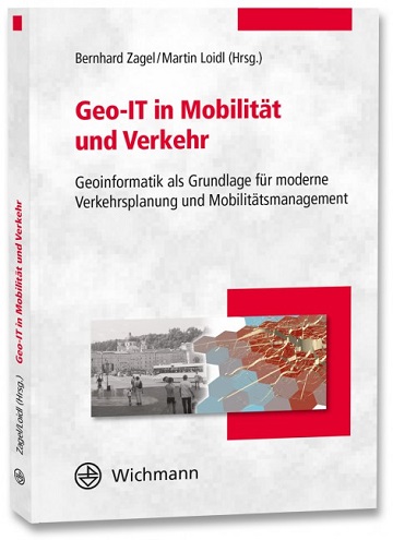
Optimal ans Ziel: Routing-Dienste auf Basis nutzergenerierter Geodaten
Ein neues Buch gibt in einem Buchkapitel einen Überblick der vielfältigen Aktivitäten von HeiGIT und GIScience im Bereich Routenplanung und Navigation. Neben Grundlagen (wie schnelle Routing-Algorithmen) zur Umsetzung werden vor allem diverse Anwendungsbeispiele für flexible Routing-Dienste in Spezialanwendungen vorgestellt. Hierzu … Read More
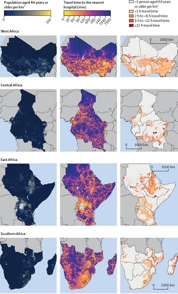
Mapping physical access to health care for older adults in sub-Saharan Africa and implications for the COVID-19 response: a cross-sectional analysis
New paper published on healthcare access in Sub-Saharan Africa It is almost a year since SARS-CoV-2 first emerged in China. The virus spread all over the world. Countries south of the Sahara did not receive much attention. Although outbreaks here … Read More

HeiKA Autumn school Urban Data Science
This week 19.-23.10. the autumn school Urban Data Science takes place as a online course set up together by GIScience Heidelberg and the Institute for Transport Studies (IfV), KIT. It is part of an ongoing application for a HeiKA (Heidelberg … Read More
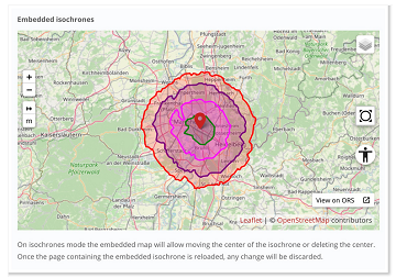
New embedded mode for OpenRouteService map client available
The new openrouteservice map client development is in the final phase and has now a new feature that allows to show routes, isochrones and other features from openrouteservice (ORS) integrated on other websites. This allows webmasters and editors to embed … Read More
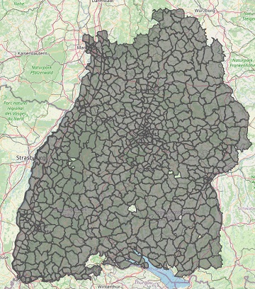
Improved Isochrone Calculation released in openrouteservice v6.3.0
With the release of openrouteservice v6.3.0 at HeiGIT, we are presenting a new and improved speed-up technique that makes it possible to calculate much larger isochrones than with the existing algorithm. An isochrone is an area on the map that … Read More
Disy integriert openrouteservice in Cadenza
Das Karlsruher Softwareunternehmen Disy Informationssysteme GmbH stellt die neue Version der Data-Analytics-, Reporting- und GIS-Plattform “Cadenza” vor. Die Erweiterung der Analytics-Funktionalitäten mit der Bereitstellung einer integrierten Routingfunktion und der POI-Suche sind zwei der wesentlichen Neuerungen. Realisiert wurde das Routing in … Read More

Long Distance Bike and Foot Routing With Restrictions released in ORS Version 6.2.1
After the latest update of openrouteservice to v6.2.1, we are pleased to announce that it is now possible to calculate long distance routes using all bike and pedestrian profiles whilst taking into account of restrictions such as avoiding ferries. Previously, … Read More
Setting maximum speed is back in openrouteservice
Recently openrouteservice has been updated to version 6.2 which has brought some pretty useful features to routing. One of the main “new” features is the re-introducing of the maximum_speed parameter where users can set the maximum speed their vehicle can … Read More
Do you need a shady route because it is too hot?
IT IS REALLY HOT! Again! So it seems, we need to repeat an updated version of a Blogpost from exactly one year ago: You are looking for a more shady pedestrian route through the urban jungle? You might then prefer … Read More

Karlsruhe relies on openrouteservice – ESRI client plugin developed
Since some time the City of Karlsruhe uses the API of Openrouteservice (ORS) by HeiGIT for routing of pedestrians, bicycles and cars in the new online city plan and the citizen GIS app for the general public, i.e. the citizens … Read More
Quiet route planning for pedestrians in traffic noise polluted environments
#Noise #pollution is one of the main stressors in urban environments, having negative impacts on people’s quality of life and health. For some groups of citizens, such as school children, patients, and elders, there is a need to support them … Read More

meinGrün Schnitzeljagd in Heidelberg gestartet
Wo befindet sich dieser Spielplatz in Heidelberg? Wie komme ich zum nächst gelegenden Park und das möglichst auf einer Route mit viel Grün oder wenig Lärm? Wer das herausfinden möchte, sollte an der meinGrün Schnitzeljagd teilnehmen. Nachdem die Schnitzeljagd in … Read More
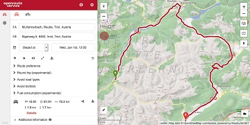
Advanced time-dependent routing soon available in Openrouteservice
We are thrilled to give you a sneak peak into routing with time-dependent road restrictions, the outcome of our collaboration with GraphHopper GmbH in the research project TARDUR supported by the mFUND initiative of the Federal Ministry of Transport and … Read More
Quota for Openrouteservice multi vehicle optimization increased to support logistics during Corona crisis
Supplying medicine and food is critical not only in disasters. Due to increased global demand due to COVIDー19 HeiGIT increased the API quota for the Openrouteservice multi vehicle route optimization endpoint! Now you can send up to 500 requests per … Read More

