
Wusstest du, dass der 13. Oktober „International Day for Disaster Risk Reduction (IDDRR)“ – der Internationale Tag für die Reduzierung des Katastrophenrisikos ist? Seit 1989 nutz das Büro der Vereinten Nationen für Katastrophenvorsorge diesen Tag, um eine globale Kultur des … Read More
Deutsch

Verstärkte Kooperation zwischen HeiGIT, Deutschem Rotem Kreuz und Deutschem Zentrum für Luft- und Raumfahrt
Titelbild: Teamvertreter von DRK, DRL und HeiGIT in dem Nachbau der europäischen Forschungskapsel COLUMBUS, die einen Teil der internationalen Raumstation (ISS) bildet. Foto: Anne Schneibel, 24.01.2023. Welche Gebäude sind nach einem Erdbeben am schwersten beschädigt? Welche Gegenden haben keinen Zugang … Read More

Aktivierung des Disaster openrouteservice für Überschwemmungen in Pakistan
In den vergangenen Wochen hat die Monsunflut in Pakistan über 1.000 Tote gefordert und Millionen Menschen ohne Dach über dem Kopf hinterlassen. Da Berichte und Fotos von rapide steigenden Lebensmittelpreisen, Bewohnern, die durch schultertiefes Wasser waten und Satellitenbilder von überfluteten … Read More

OpenRouteService for disaster management instance for the Philippines after Typhoon Rai
Just a couple of days ago, on December 16th, large area of the Philippines were hit by Typhoon Rai (local name Odette). The typhoon not only caused vast destruction but also hit many of the communities that already suffered most … Read More
HGG Vortrag: Digitale Geographie im Katastrophenmanagement
Einladung Vortrag Online: Dienstag, 14. Dezember 2021, 19:15 Uhr Melanie Eckle-Elze, Benjamin Herfort, Dr. Carolin Klonner Digitale Geographie im Katastrophenmanagement Klimawandel, Bevölkerungswachstum, Verstädterung und weitere zunehmende Landnutzungsveränderungen führen dazu, dass immer mehr Menschen in Risikogebieten leben. Um die vorhandenen Risiken … Read More
Revamped openrouteservice client for disaster management
We are happy to announce a revamped openrouteservice maps client for disaster management. It was built based on the new openrouteservice maps client, that is an open source route planner with plenty of features. Specific disaster features were incorporated via … Read More
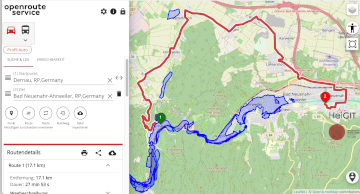
Routenplanung im Überflutungsgebiet: openrouteservice nutzt Copernicus EMS Flut-Daten in spezieller Lösung
Die aktuelle Flut in Deutschland hat zahlreiche Straßen in den betroffenen Gebieten zerstört oder temporär unpassierbar gemacht. HeiGIT arbeitet an freien und offenen, auf Geodaten-basierten Lösungen für die humanitäre Hilfe. Hierzu zählen insbesondere Routenplanung unter Berücksichtigung aktueller Katastrophendaten wie z.B. … Read More
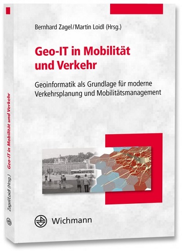
Optimal ans Ziel: Routing-Dienste auf Basis nutzergenerierter Geodaten
Ein neues Buch gibt in einem Buchkapitel einen Überblick der vielfältigen Aktivitäten von HeiGIT und GIScience im Bereich Routenplanung und Navigation. Neben Grundlagen (wie schnelle Routing-Algorithmen) zur Umsetzung werden vor allem diverse Anwendungsbeispiele für flexible Routing-Dienste in Spezialanwendungen vorgestellt. Hierzu … Read More
Humanitarian OpenStreetMap Team has been selected by the Audacious Project
The Humanitarian OpenStreetMap Team (HOT) has announced major financial support from the Audacious Project, which will be provided over the next five years. HOT aims to use this funding to grow OpenStreetMap (OSM) communities in 94 countries. By engaging one … Read More
NASA uses Openrouteservice for study on disaster response times
According to a recent post by NASA, researchers at NASA’s Goddard Space Flight Center in Greenbelt, Maryland, calculated the time that could have been saved if ambulance drivers and other emergency responders had near-real-time information about flooded roads, using the … Read More
Tools for Disaster Risk Reduction by HeiGIT – Celebrating the International Day for Disaster Risk Reduction
Today we celebrate the International Day for #DisasterRiskReduction. HeiGIT offers a growing set of tools and services that support humanitarian aid during and before disasters. Examples include work in the context of the Missing Maps initiative, like conceptualising and extending … Read More
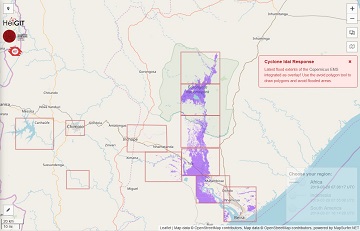
openrouteservice for Disaster Management: Response to Cyclone Idai
The Humanitarian OpenStreetMap Team (HOT) has launched an activation to support humanitarian operations responding to the impact of Cyclone Idai. These efforts were already supported by more than 1500 mappers of the global OpenStreetMap (OSM) community that contribute geodata about … Read More

HeiGIT and Humanitarian OpenStreetMap Team at the Geospatial World Forum 2019 in Amsterdam
Beginning of April, Amsterdam will become the gathering place for the global geospatial community. The Geospatial World Forum is organized for the 11th time and builds on previous successes that made it a leading event in sense of innovation, thematic … Read More
HeiGIT at German Red Cross “Digitalisation in Civil Protection” congress
HeiGIT members Melanie Eckle and Martin Hilljegerdes were invited to the “Digital in civil protection” congress of the Landesverband Westfalen-Lippe in Münster to share insights and to present current activities all around “Potentials of Open Data and Digital Humanitarians for … Read More
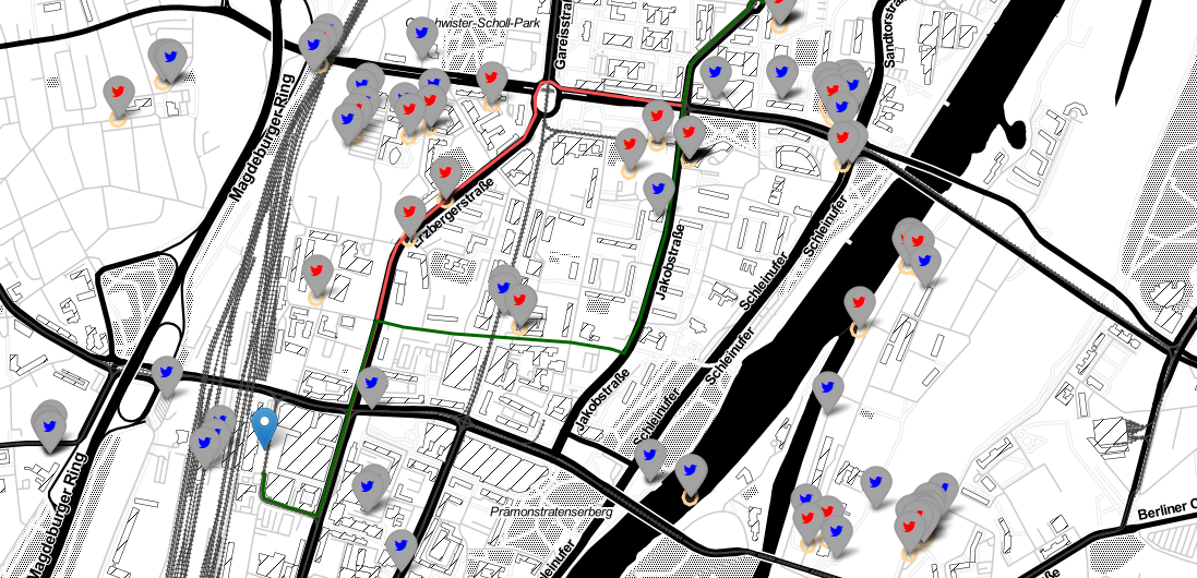
Jupyter Notebook: Combining Twitter Data and OpenRouteService Directions API
In the case of a disaster fast response is important and life saving. Information on blocked streets is crucial, but a the same time this infornations needs to be considered by routing engines in real-time. However, many routing engines use … Read More

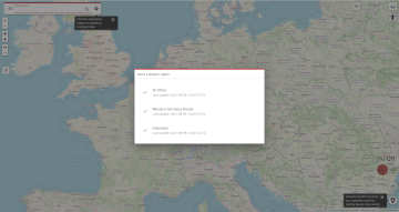
Openrouteservice for Disaster Management: Supporting Humanitarian Logistics with Hourly Updates
The Humanitarian OpenStreetMap Team (HOT) provides immediate support for disaster or humanitarian responses by coordinating and activating a global network of mappers that contribute up-to-date geodata to the OSM database. For example, after the Nepal earthquake 2015 volunteers added up … Read More