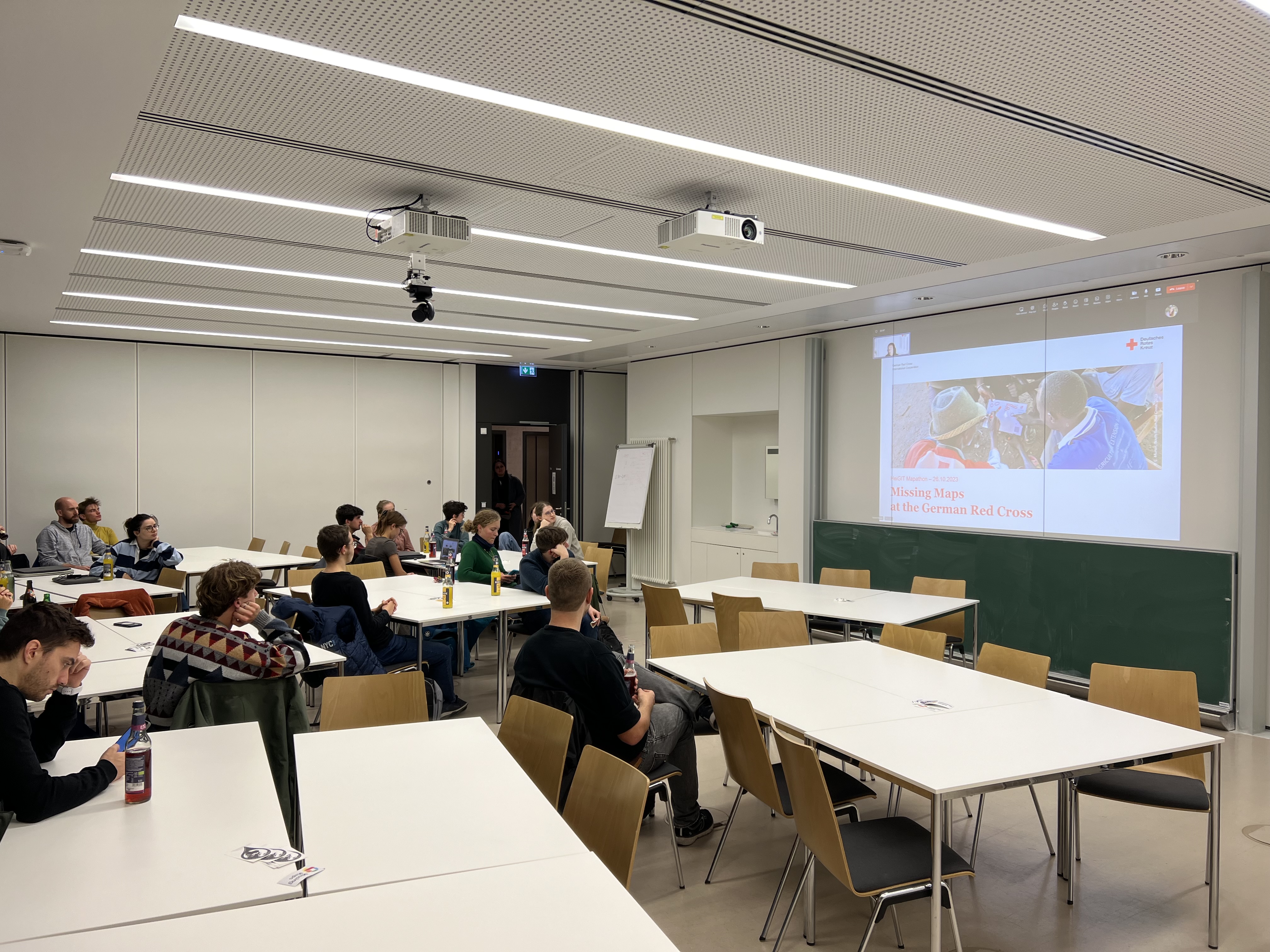
Wir haben am Donnerstag, den 26. Oktober einen Mapathon veranstaltet, an dem sowohl Forschende als auch Studierende teilgenommen haben. Nach einer kurzen Einführung durch Isabell Klipper, in der sie über die Anwendungsbereiche solcher Daten, wie zum Beispiel das Sketch Map … Read More
Deutsch
HeiGIT’s contribution to the 2nd UN Mappers Conference
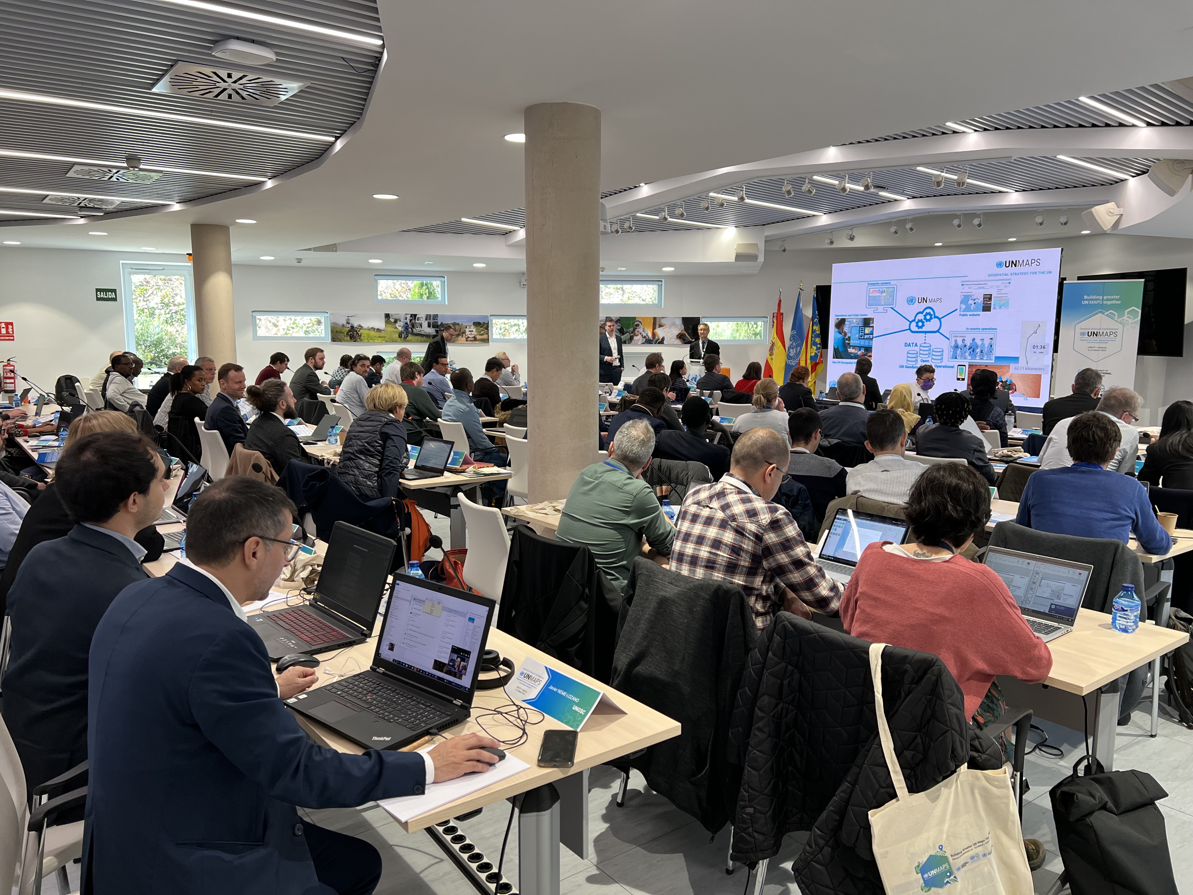
Das United Nations Maps Programm, kreiert im Jahre 2019, veranstaltete seine zweite UN Maps Konferenz, dieses mal in Valencia, Spanien. Prof. Alexander Zipf vom HeiGIT und der GIScience Forschunggruppe der Universität Heidelberg, sowie Benjamin Herfort vom HeiGIT nahmen an der … Read More

Verstärkte Kooperation zwischen HeiGIT, Deutschem Rotem Kreuz und Deutschem Zentrum für Luft- und Raumfahrt
Titelbild: Teamvertreter von DRK, DRL und HeiGIT in dem Nachbau der europäischen Forschungskapsel COLUMBUS, die einen Teil der internationalen Raumstation (ISS) bildet. Foto: Anne Schneibel, 24.01.2023. Welche Gebäude sind nach einem Erdbeben am schwersten beschädigt? Welche Gegenden haben keinen Zugang … Read More
Titel Story: Verbesserung der Erkennung fehlender Gebäude in OpenStreetMap durch Transferlernen mit wenigen Aufnahmen in sub-Saharan Afrika
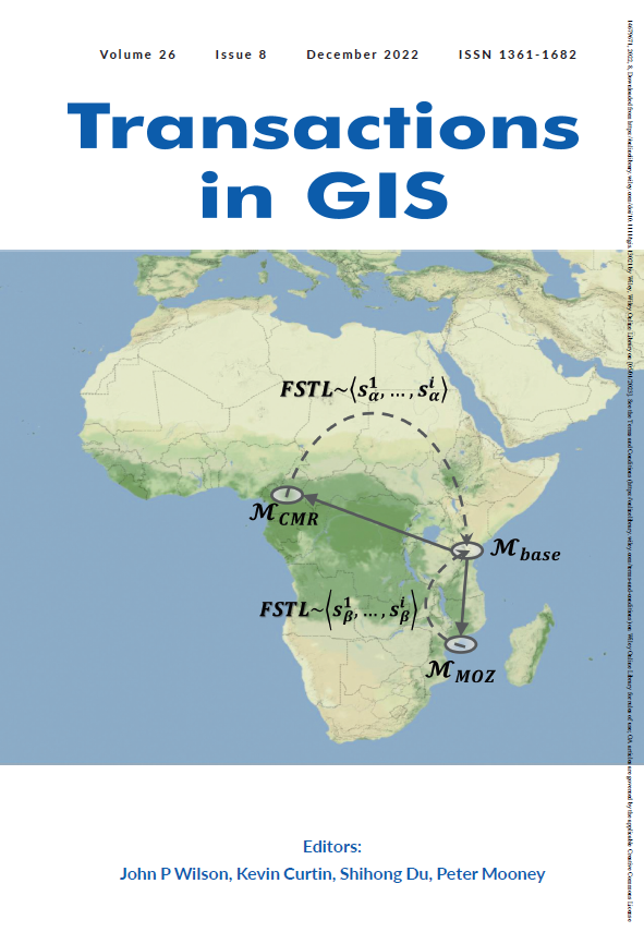
Volume 26, Ausgabe 8 von Transactions in GIS, die im Dezember 2022 erschien, hat eine Titelgeschichte, und zwar einen unserer Artikel. Wir wollen darin nicht nur unsere Liebe zur Mathematik, zur Kartographie und zu Mosambik vereinen, sondern nun auch unseren kleinen … Read More
HGG Vortrag: Digitale Geographie im Katastrophenmanagement
Einladung Vortrag Online: Dienstag, 14. Dezember 2021, 19:15 Uhr Melanie Eckle-Elze, Benjamin Herfort, Dr. Carolin Klonner Digitale Geographie im Katastrophenmanagement Klimawandel, Bevölkerungswachstum, Verstädterung und weitere zunehmende Landnutzungsveränderungen führen dazu, dass immer mehr Menschen in Risikogebieten leben. Um die vorhandenen Risiken … Read More
HeiGIT and GIScience at Virtual Conference of the Red Cross Red Crescent Urban Collaboration Platform 2021
On Friday, November 26th, Dr. Carolin Klonner (GIScience Research Group) and Melanie Eckle-Elze (HeiGIT) will be supporting the Urban Context Unit of German Red Cross (GRC) in the “Data and Digitalisation in Urban Humanitarian Action” session at the Virtual Conference … Read More

HeiGIT participation at HOT Summit 2021
Also this year HeiGIT is participating at the HOT summit with the topic of “The Evolution of Local Humanitarian Open Mapping Ecosystems: Understanding Community, Collaboration, and Contribution”. Again the conference will be virtual and is organized in three blocks across … Read More
FOSS4G 2021 Videos with HeiGIT contributions online – OSM data quality and MapSwipe
Recently videos with our contributions by HeiGIT to the FOSS4G conference were put online. Did you miss the event? Now you can watch whenever you like 🙂 Benni by HeiGIT explains who to use the ohsome.org framework to develop an … Read More
Successful end of the 25 Mapathon Project
On October 12th the “25 Mapathon project” was finalized with an exceptionally successful public online mapathon. Around 20 participants with various professional backgrounds mapped 2273 buildings in three hours to support a flood preparedness project of the GRC in Togo. … Read More
World Refugee Day: Mapathon by CartONG
Whether you are a beginner or an advanced mapper, or just curious to learn more about why mapping is so important for humanitarian work, join us on 21 June. Support the mapping of refugee locations on World Refugee Day. It … Read More
HeiGIT und das Deutsche Rote Kreuz beim Digitaltag 2021
Am 18.06.2021 findet der Bundesweite Digitaltag 2021 der Initiative „Digital für alle“ statt. Der Digitaltag ist eine Plattform, auf der digitale Projekte und Aktionen aus der Zivilgesellschaft vorgestellt werden und das Thema Digitalisierung von verschiedenen Seiten beleuchtet wird. Mit dem … Read More

Detecting OpenStreetMap missing buildings by transferring pre-trained deep neural networks
Recently, a new research paper “Detecting OpenStreetMap missing buildings by transferring pre-trained deep neural networks” (Pisl, J., Li, H., Herfort, B., Lautenbach, S., Zipf, A. 2021) has been accepted at the the 24th AGILE conference 2021. The conference will take … Read More
MapAction and HeiGIT partner to further geoinformation innovation
The Heidelberg Institute for Geoinformation Technology (HeiGIT) and the international humanitarian geospatial charity MapAction have signed a Memorandum of Understanding (MoU) outlining their plans to collaborate in a number of areas. Both organisations share a common vision to support humanitarian … Read More
Two-part Mapathons for better new user retention?
The project “25 Mapathons“ goes into the next phase. Based on the experience of until today 17 OSM mapathons with German Red Cross (GRC) chapter and an extensive literature review on the success of mapathons, the “25 Mapathons” team has … Read More
Towards a framework for the analysis of local OSM contributions
Volunteered Geographic Information (VGI) such as OpenStreetMap (OSM) is often defined as the collaborative acquisition of geographic information and local knowledge by volunteers, amateurs or professionals (Goodchild, 2007). The increasing availability and importance of local data in OSM is largely … Read More
HeiGIT und DRK veröffentlichen weiteres Trainingsmaterial zu Mapathons
Gemeinsam mit dem Deutschen Roten Kreuz (DRK) hat das HeiGIT heute das Dokument “Die häufigsten Fehler beim „mappen“ mit dem iD-Editor & deren Lösung” veröffentlicht. Das Dokument ist komplementär zum Handbuch zur Veranstaltung von Mapathons, welches bereits 2020 veröffentlicht wurde. … Read More
Mapathon “Mapping for International Solidarity” on 06.04
Hello dear friends of the disastermappers heidelberg! At the moment, the Heidelberg International Weeks against Racism 2021 are running – and the disastermappers are also taking part! Why? The unequal distribution of resources is often a consequence of historical (and … Read More
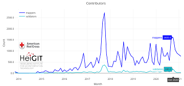
Humanitarian OSM Stats: How to monitor humanitarian mapping in the HOT Tasking Manager? – Part 5: the American Red Cross
Since 2010 organized humanitarian mapping has evolved as a constant and growing element of the global OpenStreetMap (OSM) community. With more than 8,000 projects in 150 countries humanitarian mapping has become a global community effort. Due to this large amount … Read More
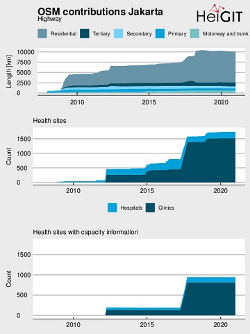
Flood Impact Assessment on Road Network and Healthcare Access at the example of Jakarta, Indonesia
Extreme natural events create catastrophic situations for cities and their populations. Due to climate change and anthropogenic activities, the number and intensity of these events has steadily increased at the global scale. Floods are the most common natural disaster worldwide, … Read More
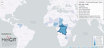
Humanitarian OSM Stats: How to monitor humanitarian mapping in the HOT Tasking Manager? – Part 4
Since 2010, organized humanitarian mapping has evolved as a constant and growing element of the global OpenStreetMap (OSM) community. With more than 7,000 projects in 150 countries, humanitarian mapping has become a global community effort. Due to this large amount … Read More