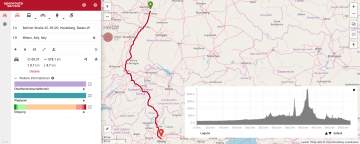
Exactly 10 years ago openrouteservice.org came online for the very first time. Back then it was the very first online routing service consuming data from OpenStreetMap.org covering larger areas. So to say it is ‘the original‘ OSM routing service. It … Read More
Blog
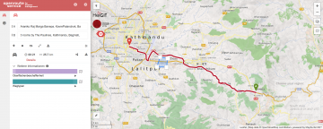
Openrouteservice for Disaster Management: Supporting Humanitarian Logistics with Hourly Updates
The Humanitarian OpenStreetMap Team (HOT) provides immediate support for disaster or humanitarian responses by coordinating and activating a global network of mappers that contribute up-to-date geodata to the OSM database. For example, after the Nepal earthquake 2015 volunteers added up … Read More

Introducing the ohsome OSM History Analytics Platform
The big spatial data analytics team at HeiGIT is currently developing the ohsome OpenStreetMap history analytics platform. Our aim is to make OSM’s full-history data more easily accessible for various kinds of data analytics tasks on a global scale. OpenStreetMap … Read More
Openrouteservice-py now available on PyPi – Easy Routing, Geocoding, Isochrones and Matrix Routing with Python!
We have finally developed a pretty handy python API for all of you pythoniasts out there. This library makes requests to the openrouteservice API extremely simple. With this you will be able to query the following services with a couple … Read More
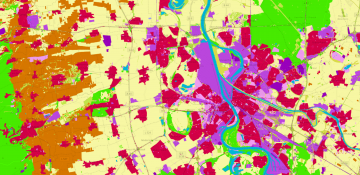
OSMlanduse.org + Remote Sensing = New conterminous land use data set for Germany released – filling gaps in OSM through machine learning
Land use data created by humans (OSM) was fused with satellite remote sensing data, resulting in a conterminous land use data set without gaps. The first version is now available for all Germany at OSMlanduse.org. When human input (OSM data) … Read More
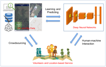
Deep Learning with Satellite Images and Volunteered Geographic Information
Recently, deep learning has been widely applied in pattern recognition with satellite images. Deep learning techniques like Convolutional Neural Network and Deep Belief Network have shown outstanding performance in detecting ground objects like buildings and roads, and the learnt deep … Read More
HeiGIT/GIScience partnership with Kathmandu Living Labs
Kathmandu Living Labs– a team of young entrepreneurs and out of the box thinkers that change the use and creation of data in Nepal. The team around Nama Budhathoki was launched in 2013 and emerged of a previous Open Data … Read More
HeiGIT/GIScience Heidelberg partnership with Humanitarian OpenStreetMap Team (HOT)
We are happy to hereby announce the official partnership of the HeiGIT/GIScience Research Group Heidelberg and the Humanitarian OpenStreetMap Team (HOT)! The GIScience Research Group at Heidelberg University has been supporting the use of OpenStreetMap for humanitarian and disaster management … Read More
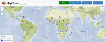
MapSwipe Analytics: Map each Swipe and Tap
Since the launch of the MapSwipe Analytics webpage three month ago we were able to improve our service and offer more detailed information on each project in MapSwipe. MapSwipe is a mobile App for crowdsourcing geographic information needed by humanitarian … Read More

HeiGIT is starting to move into Mathematikon
Recently the first few members of the Navigation Intelligence and Location Based Services group of the Heidelberg Institute for Geoinformation Technology (HeiGIT) – which is currently being established based on core funding from the Klaus-Tschira Foundation Heidelberg – moved into … Read More

