Introduction In an era where technology continuously reshapes our world, the fusion of artificial intelligence and geospatial data offers exciting possibilities. HeiGIT (Heidelberg Institute for Geoinformation Technology), a pioneering research…
UPDATE 09.11.2022: Our team took part in the newly in-person State of the Map 2022 conference in Florence. We attended workshops, talks, and had the opportunity to present our own…
In the context of the United Nations World Data Forum 2021 organised by theUnited Nations Statistics Division and UN member states a series of blogposts has been published by UNSTATS….
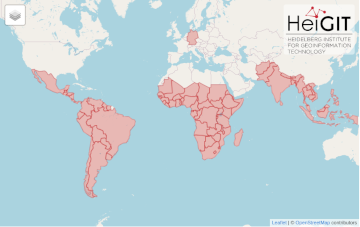
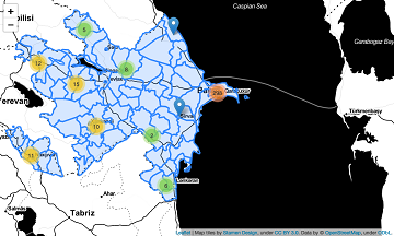
After Sub-Saharan Africa and South and Southeast Asia we have now published all countries of Central and South America on the Open Healthcare Access Map. The web application is available…
It’s been a little longer than a month since we published the Open Healthcare Access Map. Last week we rolled out all countries of Sub-Saharan Africa. Today all countries of…
Last month we started the Open Healthcare Access Map. Initially, only a few countries were featured. Gradually, more countries and regions are now being added. Today we release all countries…
Last week we introduced Open Healthcare Access Map. Our new web application for interactively sharing results of accessibility estimates based on OpenStreetMap healthcare facilities and openrouteservice isochrones. A new update…
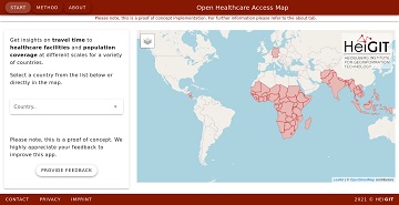
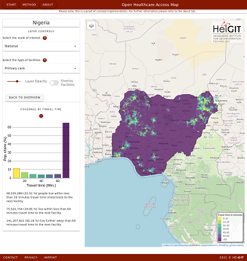
Open Healthcare Access Map is a new web application by HeiGIT to provide insights into healthcare supply on different spatial scales for many countries worldwide. The web application is available…
OpenStreetMap (OSM) offers many possibilities and holds potential in the area of freely available infrastructure data for the health sector. Nevertheless, it is important to underline that the quality of…
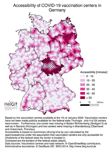
Vaccination of a sufficiently large share of the population is considered the most important action to fight the spread of SARS-CoV -2 and resulting COVID-19 infections. Germany has started together…
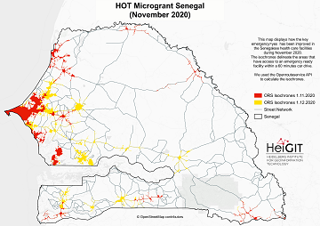
What is the idea behind the Notebook? In the case of an emergency (e.g. floods, earthquakes, political crisis) it is important to know where the health facilities are located. Furthermore,…
These days so much is different- also conferences. Carolin Klonner and Marcel Reinmuth attended the GeOnG 2020 virtually. Thanks to the organizers! It worked well and there was great exchange…
The HeiKA autumn school urban data science that took place last week was a good success with participating students varying between five and fifteen during the week. Topics covered included…
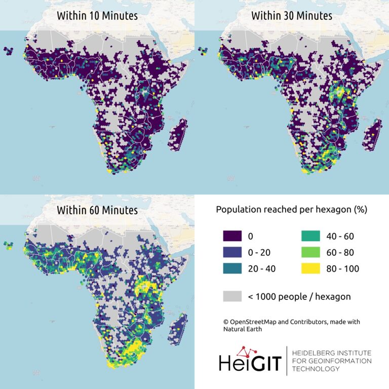
New paper published on healthcare access in Sub-Saharan Africa It is almost a year since SARS-CoV-2 first emerged in China. The virus spread all over the world. Countries south of…
With the release of openrouteservice v6.3.0 at HeiGIT, we are presenting a new and improved speed-up technique that makes it possible to calculate much larger isochrones than with the existing…
Vom 06. bis zum 08. Juli fand das Online Symposiums “COVID-19 als Zäsur? Geographische Perspektiven auf Räume, Gesellschaften und Technologien in der Pandemie” statt. Teilnehmer aus Geographie, Medizin, Public health…
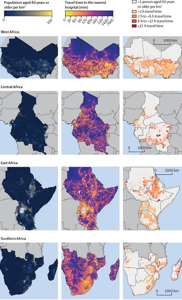
Using hospital locations and the ORS Isochrone service, we have created a method for comparing physical access to healthcare in Sub-Saharan Africa. Hospital locations were derived from OpenStreetMap and compared…
Sveriges Television AB (the public Swedish television company) has published a data journalism WebApp showing how far one can travel according to the recommendations from the Swedish Public Health Authority….
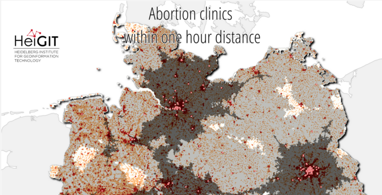
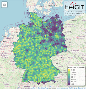
Where is the next health center? What areas show less accessibility to health centers and are therefore the most vulnerable? In 2018, the openrouteservice team already illustrated how these questions…
Finally there is a new version of the QGIS plugin for OpenRouteService: ORS Tools. It gives easy access to our directions, isochrone and matrix API’s from within QGIS. The old…