This Thursday, team members from HeiGIT will give a presentation at MSF’s Annual GIS Week. This is an internal event at MSF ( Médecins Sans Frontières (MSF) International, Doctors without Borders), which brings together all employees working on GIS and … Read More
English
How to become ohsome part 8 – complex analysis with the magical filter parameter
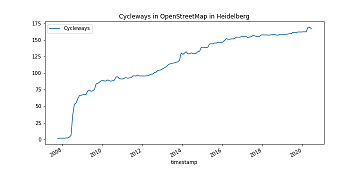
It’s CITY CYCLING time – some of you may even be involved in your municipality – a good opportunity to have a look on the OpenStreetMap (OSM) cycling ways in our city Heidelberg. Welcome to part 8 of our how … Read More
ohsome API v1.1 – changes and new functionalities
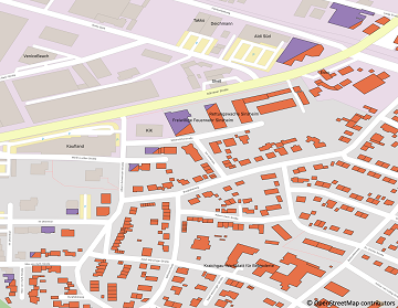
Recently we’ve had the first minor release 1.1 of the ohsome API, which brings several new features and upgrades. In the following lines we want to present to you the most important ones. Prior to 1.1, when you were requesting … Read More
A Comprehensive Framework for Intrinsic OpenStreetMap Quality Analysis among Most Cited Paper in Transactions in GIS
We are happy to share that our paper “A Comprehensive Framework for Intrinsic OpenStreetMap Quality Analysis” (Barron, Neis, Zipf 2013) belongs to the top 5 most cited papers of the international journal “Transaction in GIS” (TGIS). Only recently we became … Read More

We wish you an ohsome birthday OpenStreetMap! Our gift: the new ohsome2X time-series tool
#OpenStreetMap is turning 16! Happy Birthday from the HeiGIT team. 16 years of OSM activity has created the most feature rich and global free multi purpose map that the world has ever seen. The ohsome team at HeiGIT has created … Read More
Introducing the humstats.heigit.org dashboard about Humanitarian Mapping in OpenStreetMap
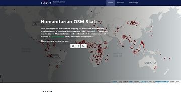
Since 2010 organized humanitarian mapping has evolved as a constant and growing element of the global OpenStreetMap (OSM) community. With more than 7,000 projects in 150 countries humanitarian mapping has become a global community effort. Mappers have added more than … Read More
How to become ohsome part 7 different ways to access the ohsome API
A new month – a new post of the how to become #ohsome blog series. Welcome to part 7, in which we will show you 7 different ways how you can send a request to the ohsome API using different … Read More

New function in the ohsome API for checking query parameters
As you may already know from the latest blog posts, new advancements are brought with the release 1.0 of the #ohsome API. One minor function involves the correctness of parameters that you can use in your queries, which was developed … Read More

Introducing ohsome2label tool to generate training samples from OpenStreetMap for geospatial deep learning
After more than a decade of rapid development of volunteered geographic information (VGI), VGI has already become one of the most important research topics in the GIScience community. Almost in the meantime, we have witnessed the ever-fast growth of geospatial … Read More
Physische Erreichbarkeiten von Krankenhäusern in Subsahara Afrika – Analyse und Ergebnisse bei COVID-19 Symposium vorgestellt
Vom 06. bis zum 08. Juli fand das Online Symposiums “COVID-19 als Zäsur? Geographische Perspektiven auf Räume, Gesellschaften und Technologien in der Pandemie” statt. Teilnehmer aus Geographie, Medizin, Public health und meidizinischer Geographie diskutierten über drei Tage in sechs verschiedenen … Read More
How to become ohsome part 6: Introducing the magical filter parameter
We are back again with a fresh part of the How to become ohsome blog series. In case this 6th part of the series is your first one, or you have not heard from our awesome OpenStreetMap History Data Analytics … Read More

HeiGIT gGmbH is One Year Old Today!
Today (1st July 2020) marks the first birthday of HeiGIT gGmbH! Over this first year, HeiGIT has been involved a large number of events, projects, publications, and press coverage. Founded on the 1st July 2019, HeiGIT is a non-for-profit organisation … Read More
Sphinx is ohsome – new documentation of the ohsome API
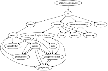
What does the tool behind the recently published documentation of the ohsome API have in common with a statue made of stones in Egypt? – Apart from the name, both are of course awesome (and now also ohsome). As previously … Read More
Humanitarian OpenStreetMap Team has been selected by the Audacious Project
The Humanitarian OpenStreetMap Team (HOT) has announced major financial support from the Audacious Project, which will be provided over the next five years. HOT aims to use this funding to grow OpenStreetMap (OSM) communities in 94 countries. By engaging one … Read More

Exploring OSM for healthcare access analysis in Sub-Saharan Africa
Using hospital locations and the ORS Isochrone service, we have created a method for comparing physical access to healthcare in Sub-Saharan Africa. Hospital locations were derived from OpenStreetMap and compared against another free available dataset. Results indicate strong similarity in … Read More

ohsome API 1.0 is here
As we’ve announced it in a previous post, the Open Source release 1.0 of the ohsome API has finally arrived. As a reminder, or for those of you that hear “ohsome” for the first time, the aim of the ohsome … Read More
Announcing release 1.0 of ohsome API
Big news from the ohsome team: the release 1.0 of one of our major services, the ohsome API for ohsome OpenStreetMap History Analytics, is on the doorstep. We are bringing three major advancements along with this version. The first one … Read More
Analysing OSM Completeness of health facilities in Sub-Sahara Africa in ohsomeHeX
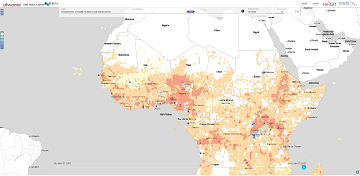
A new map in ohsomeHeX provides an overview of areas in Sub-Sahara Africa where information on health facilities is still missing in OpenStreetMap (OSM). The completeness of OSM is measured by comparing to a reference dataset on public health facilities … Read More
Colloquium Talk about healthsites.io: Building a baseline of health facility data in OpenStreetMap by M. Herringer
We are happy to invited to the presentation in the GIScience HD colloquium. Everybody interested is invited to join the presentations and the discussion afterwards. Building a baseline of health facility data in OpenStreetMap Markus Herringer, healthsites.io, Amsterdam, NL – … Read More

GIScience Contributions to the 2019 State of the Map Academic Track proceedings
Recently the SOTM 2019 Heidelberg Academic Track Proceedings have been published. GIScience Research Group Heidelberg and HeiGIT contributed several talks and posters. Below you can find an overview. Contact us if you are interested in further details on ongoing research. … Read More
