Informationen und Navigation zu urbanen Grünflächen in Städten – meinGrün Neues mFund Kooperations-Projekt meinGrün wird vom BMVI gefoerdert. Problemstellung Um in Städten trotz Wachstum und Nachverdichtung eine hohe Lebensqualität zu sichern, spielen Grünflächen eine essentielle Rolle, da sie sich positiv … Read More
English

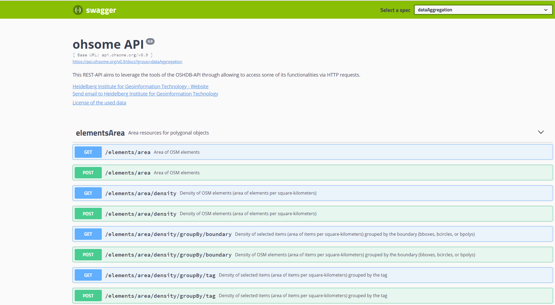
Documentation of the Ohsome API
In a previous blog post we introduced the REST-based interface of our framework Ohsome (the OpenStreetmap History Analytics plattform) and gave an example link of a request. This blog post aims to give you some further information about the documentation … Read More
OpenStreetMap Analytics Development for OpenCities Africa
Recently a consultancy and development agreement about OpenStreetMap Analytics Development has been reached with the World Bank in the context of the Open Cities Africa project and the Global Facility for Disaster Reduction and Recovery (GFDRR) Open Data for Resilience … Read More
Openrouteservice Developers Dashboard Revamped
Over the past few months the openrouteservice team has worked on a new developers dashboard in order to make the registration and usage of the API more easy and accessible. Now the developers using the openrouteservice API will experience a … Read More

Ohsome – a high level architectural overview of the OSM History Analytics platform
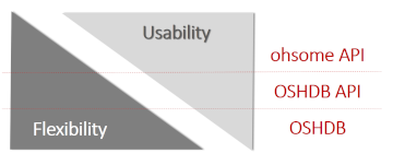
Recently we introduced the ohsome platform for OSM History Analytics. Now we want to give you a high-level overview of the ohsome platform and the components it consists of. Ohsome API The ohsome platform is based on a three-layers API … Read More

The Ohsome API: dynamic OSM statistics for real-world applications
The Ohsome API, developed at HeiGIT, is part of the ohsome OSM history analytics platform (and yes, it is pronounced like the word “awesome” 😉. It serves as the connection between the OpenStreetMap History Database (OSHDB) and possible frontends, such … Read More

Celebrating 10 Years of Openrouteservice – The First OpenStreetMap Route Planner
Exactly 10 years ago openrouteservice.org came online for the very first time. Back then it was the very first online routing service consuming data from OpenStreetMap.org covering larger areas. So to say it is ‘the original‘ OSM routing service. It … Read More

Openrouteservice for Disaster Management: Supporting Humanitarian Logistics with Hourly Updates
The Humanitarian OpenStreetMap Team (HOT) provides immediate support for disaster or humanitarian responses by coordinating and activating a global network of mappers that contribute up-to-date geodata to the OSM database. For example, after the Nepal earthquake 2015 volunteers added up … Read More

Introducing the ohsome OSM History Analytics Platform
The big spatial data analytics team at HeiGIT is currently developing the ohsome OpenStreetMap history analytics platform. Our aim is to make OSM’s full-history data more easily accessible for various kinds of data analytics tasks on a global scale. OpenStreetMap … Read More
Openrouteservice-py now available on PyPi – Easy Routing, Geocoding, Isochrones and Matrix Routing with Python!
We have finally developed a pretty handy python API for all of you pythoniasts out there. This library makes requests to the openrouteservice API extremely simple. With this you will be able to query the following services with a couple … Read More

OSMlanduse.org + Remote Sensing = New conterminous land use data set for Germany released – filling gaps in OSM through machine learning
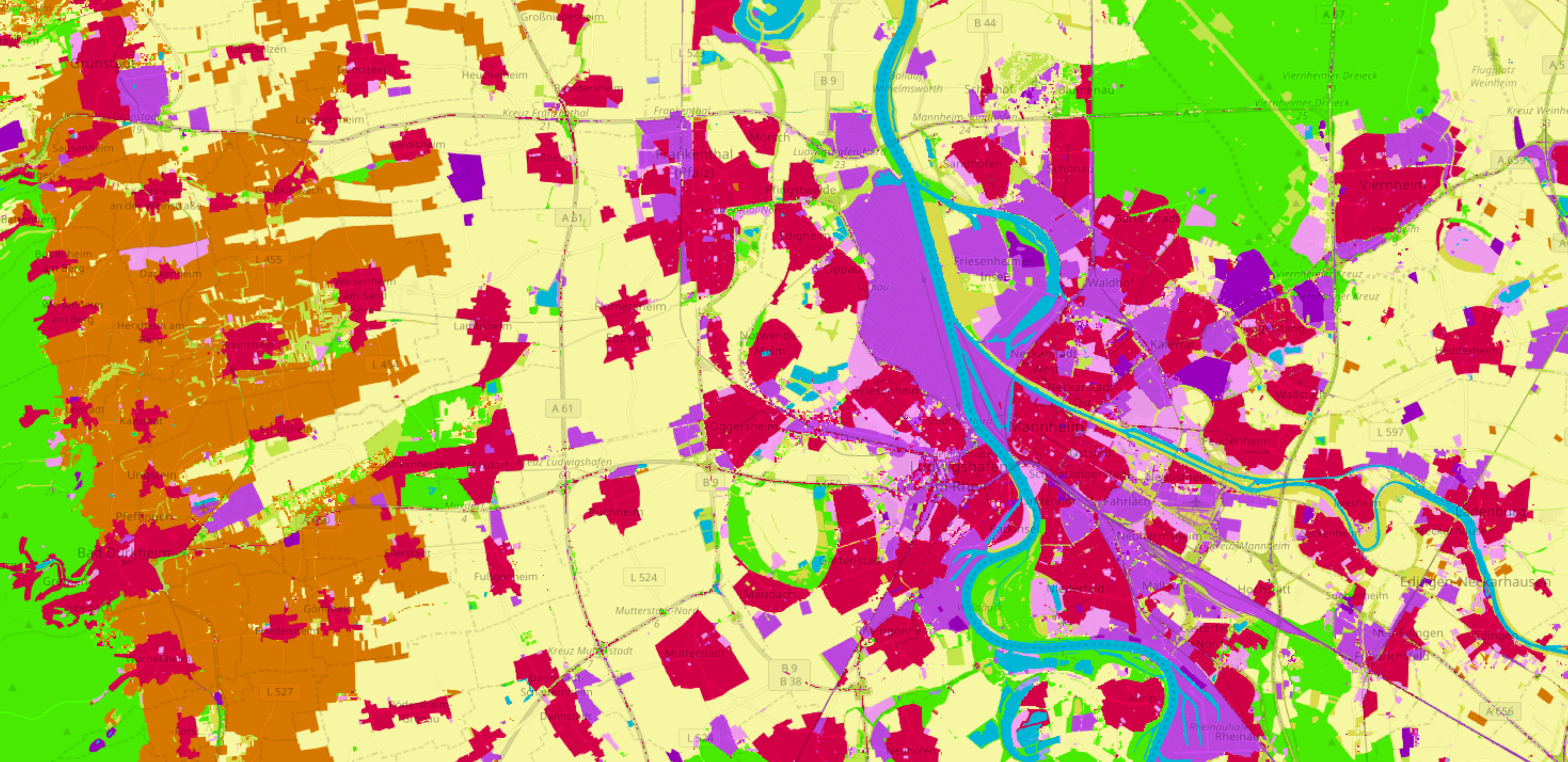
Land use data created by humans (OSM) was fused with satellite remote sensing data, resulting in a conterminous land use data set without gaps. The first version is now available for all Germany at OSMlanduse.org. When human input (OSM data) … Read More

Deep Learning with Satellite Images and Volunteered Geographic Information
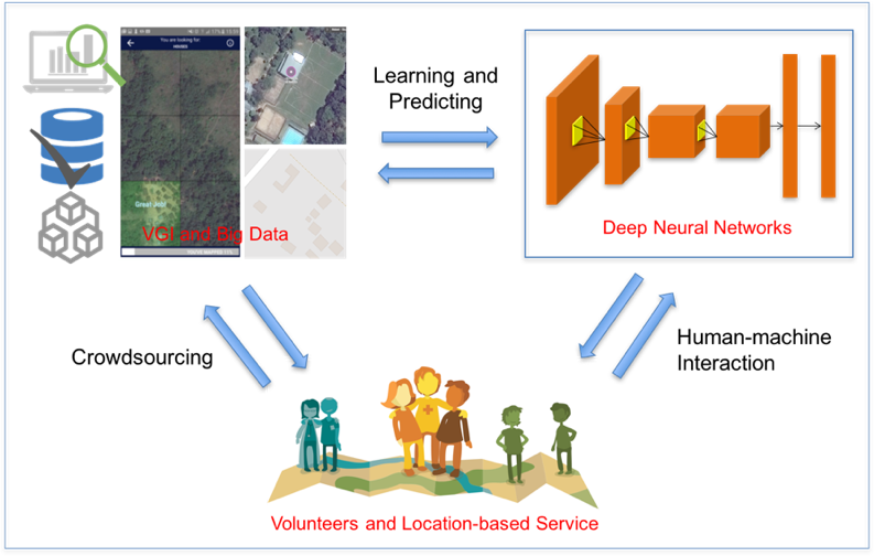
Recently, deep learning has been widely applied in pattern recognition with satellite images. Deep learning techniques like Convolutional Neural Network and Deep Belief Network have shown outstanding performance in detecting ground objects like buildings and roads, and the learnt deep … Read More
HeiGIT/GIScience Heidelberg partnership with Humanitarian OpenStreetMap Team (HOT)
We are happy to hereby announce the official partnership of the HeiGIT/GIScience Research Group Heidelberg and the Humanitarian OpenStreetMap Team (HOT)! The GIScience Research Group at Heidelberg University has been supporting the use of OpenStreetMap for humanitarian and disaster management … Read More
