Gerade beendete die MS Wissenschaft ihre Tour durch 31 Städte zwischen Berlin und Wien in diesem Wissenschaftsjahr zum Thema “Künstliche Intelligenz“. 85.000 Menschen – Schulklassen, Familien und Interessierte aller Altersklassen – besuchten die Ausstellung zum Thema lernende Computersysteme an Bord … Read More
Deutsch
KI-Exponat des HeiGIT zu MissingMaps und Permafrostdetektion auf dem Portal zum Wissenschaftsjahr 2019 “Künstliche Intelligenz”
Seit einiger Zeit findet sich das gemeinsame Exponat des HeiGIT und des Alfred-Wegener-Instituts Helmholtz-Zentrum für Polar- und Meeresforschung für die Ausstellung “Künstliche Intelligenz” auf der “MS Wissenschaft” auch auf dem Webportal zum Wissenschaftsjahr 2019. Das Thema “Künstliche Intelligenz” des Wissenschaftjahres … Read More
Disaster Risk Reduction, OpenStreetMap and Missing Maps at Global Platform 2019
Global Platform 2019 in Geneva Creating maps helps humanity. Drawing maps together with communities is crucial for effective risk reduction interventions, ensuring no one is left behind. The progress of the implementation of the targets set by the Sendai … Read More
HeiGIT supports Citizien Science @ Helmholtz ThinkCamp
We are always happy to support citizen science projects at the HeiGIT. HeiGIT/ GIScience efforts already range from tools that assess the data quality of citizen science projects (see, e.g., this blog post about “Plausible Parrots“) to approaches related to … Read More

Deep Learning from Multiple Crowds: A Case Study of Humanitarian Mapping
Satellite images are widely applied in humanitarian mapping which labels buildings, roads and so on for humanitarian aid and economic development. However, the labeling now is mostly done by volunteers. In a recently accepted study, we utilize deep learning to … Read More
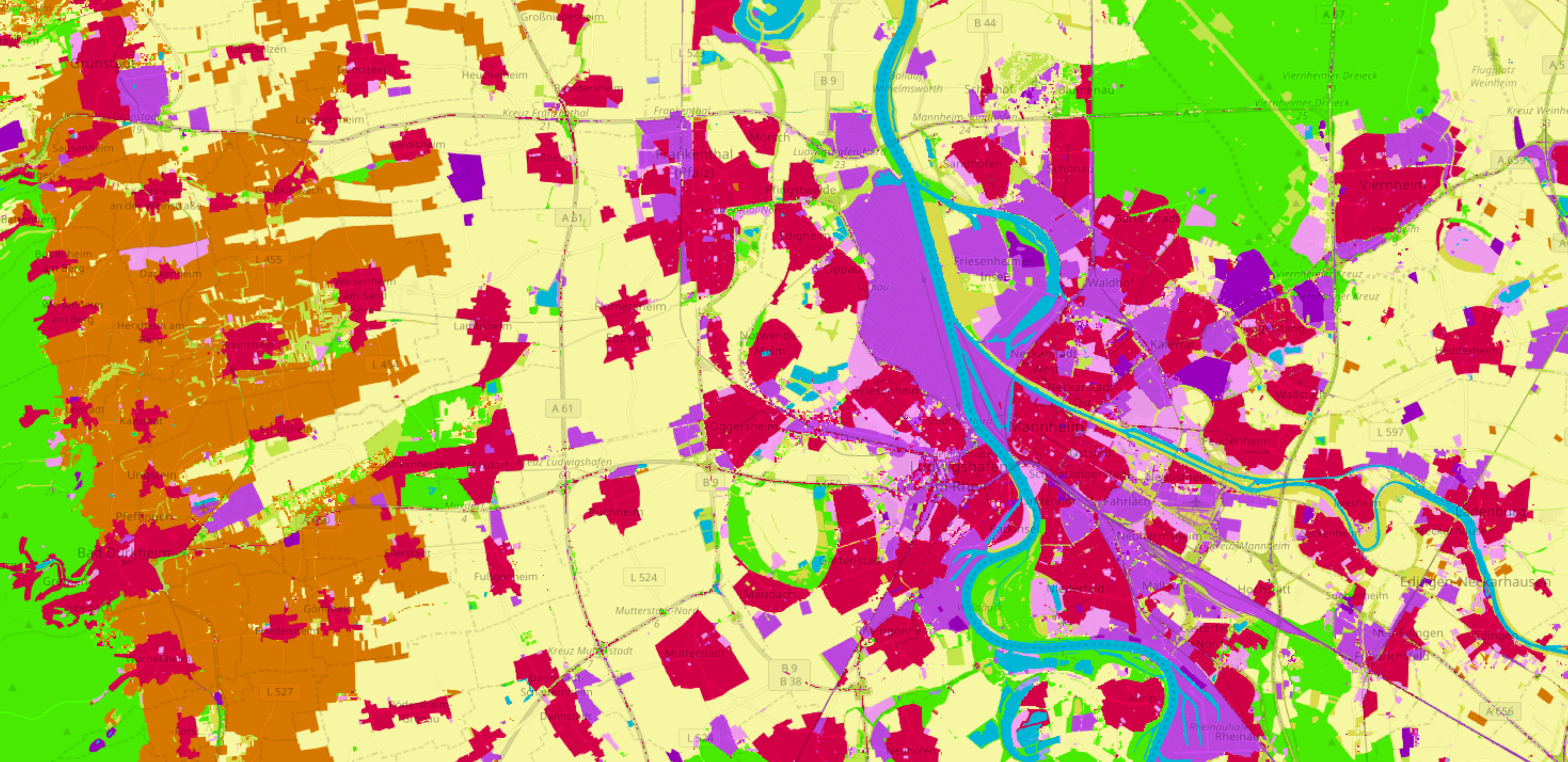
OSMlanduse.org + Remote Sensing = New conterminous land use data set for Germany released – filling gaps in OSM through machine learning
Land use data created by humans (OSM) was fused with satellite remote sensing data, resulting in a conterminous land use data set without gaps. The first version is now available for all Germany at OSMlanduse.org. When human input (OSM data) … Read More