Über die letzten Jahre wurden von der OpenStreetMap Community in Ulm vermehrt Mapathons und Mappingaktionen veranstaltet. Am Donnerstag, den 1. Oktober 2020 ab 19:00 Uhr ist ein weiterer Mapathon des Ulmer OSM-Stammtisches geplant – mit Unterstützung von Melanie Eckle-Elze (disastermappers … Read More
Blog
ohsome API v1.1 – changes and new functionalities
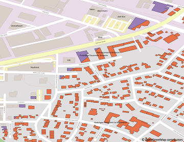
Recently we’ve had the first minor release 1.1 of the ohsome API, which brings several new features and upgrades. In the following lines we want to present to you the most important ones. Prior to 1.1, when you were requesting … Read More
The future of working with OSM data
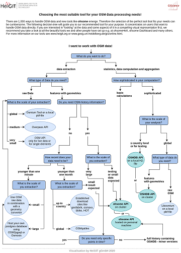
The open, flexible and collaborative nature as well as the benefits and advantages of OpenStreetMap (OSM) lead to the creation of a whole new ecosystem evolving around the project. They range from local and global communities of data and software … Read More
A Comprehensive Framework for Intrinsic OpenStreetMap Quality Analysis among Most Cited Paper in Transactions in GIS
We are happy to share that our paper “A Comprehensive Framework for Intrinsic OpenStreetMap Quality Analysis” (Barron, Neis, Zipf 2013) belongs to the top 5 most cited papers of the international journal “Transaction in GIS” (TGIS). Only recently we became … Read More
Disy integriert openrouteservice in Cadenza
Das Karlsruher Softwareunternehmen Disy Informationssysteme GmbH stellt die neue Version der Data-Analytics-, Reporting- und GIS-Plattform “Cadenza” vor. Die Erweiterung der Analytics-Funktionalitäten mit der Bereitstellung einer integrierten Routingfunktion und der POI-Suche sind zwei der wesentlichen Neuerungen. Realisiert wurde das Routing in … Read More
Integration of Authoritative and Volunteered Geographic Information for updating Urban Mapping: Challenges and Potentials
A recently published paper provides a bibliometric review between integration of authoritative and volunteered geographic information (VGI) for the specific purpose of cartographic updating of urban mappings. The adopted methodology was through a bibliometric survey of the literature published by … Read More
Long Distance Bike and Foot Routing With Restrictions released in ORS Version 6.2.1
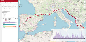
After the latest update of openrouteservice to v6.2.1, we are pleased to announce that it is now possible to calculate long distance routes using all bike and pedestrian profiles whilst taking into account of restrictions such as avoiding ferries. Previously, … Read More
OSM Missing Areas Identification paper is featured in August by ISPRS Journal of Photogrammetry and Remote Sensing
We are pleased that our article has been selected by the editors of ISPRS Journal of Photogrammetry and Remote Sensing as the featured Article in August 2020. This means it will be available open access for 1 year. Get your … Read More
Setting maximum speed is back in openrouteservice
Recently openrouteservice has been updated to version 6.2 which has brought some pretty useful features to routing. One of the main “new” features is the re-introducing of the maximum_speed parameter where users can set the maximum speed their vehicle can … Read More
A revamped ORS map client to celebrate the 16th OpenStreetMap anniversary
#OpenStreetMap is turning 16! Happy Birthday from the HeiGIT team. After 16 years OSM is a reference of collaborative work and how we can give our best to create and maintain global, free and multipurpose projects that bring benefits to … Read More
We wish you an ohsome birthday OpenStreetMap! Our gift: the new ohsome2X time-series tool
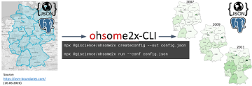
#OpenStreetMap is turning 16! Happy Birthday from the HeiGIT team. 16 years of OSM activity has created the most feature rich and global free multi purpose map that the world has ever seen. The ohsome team at HeiGIT has created … Read More
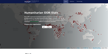
Introducing the humstats.heigit.org dashboard about Humanitarian Mapping in OpenStreetMap
Since 2010 organized humanitarian mapping has evolved as a constant and growing element of the global OpenStreetMap (OSM) community. With more than 7,000 projects in 150 countries humanitarian mapping has become a global community effort. Mappers have added more than … Read More
How to become ohsome part 7 different ways to access the ohsome API
A new month – a new post of the how to become #ohsome blog series. Welcome to part 7, in which we will show you 7 different ways how you can send a request to the ohsome API using different … Read More
Do you need a shady route because it is too hot?
IT IS REALLY HOT! Again! So it seems, we need to repeat an updated version of a Blogpost from exactly one year ago: You are looking for a more shady pedestrian route through the urban jungle? You might then prefer … Read More

Karlsruhe relies on openrouteservice – ESRI client plugin developed
Since some time the City of Karlsruhe uses the API of Openrouteservice (ORS) by HeiGIT for routing of pedestrians, bicycles and cars in the new online city plan and the citizen GIS app for the general public, i.e. the citizens … Read More

New function in the ohsome API for checking query parameters
As you may already know from the latest blog posts, new advancements are brought with the release 1.0 of the #ohsome API. One minor function involves the correctness of parameters that you can use in your queries, which was developed … Read More
GIScience for physical activity research
GIScience methods are becoming more and more widespread in different domains. A current review article under involvement of HeiGIT researchers discusses the potential of ambulatory assessments and GIScience approaches for physical activity research. The article is on of the outcomes … Read More

Introducing ohsome2label tool to generate training samples from OpenStreetMap for geospatial deep learning
After more than a decade of rapid development of volunteered geographic information (VGI), VGI has already become one of the most important research topics in the GIScience community. Almost in the meantime, we have witnessed the ever-fast growth of geospatial … Read More
Quiet route planning for pedestrians in traffic noise polluted environments
#Noise #pollution is one of the main stressors in urban environments, having negative impacts on people’s quality of life and health. For some groups of citizens, such as school children, patients, and elders, there is a need to support them … Read More
Physische Erreichbarkeiten von Krankenhäusern in Subsahara Afrika – Analyse und Ergebnisse bei COVID-19 Symposium vorgestellt
Vom 06. bis zum 08. Juli fand das Online Symposiums “COVID-19 als Zäsur? Geographische Perspektiven auf Räume, Gesellschaften und Technologien in der Pandemie” statt. Teilnehmer aus Geographie, Medizin, Public health und meidizinischer Geographie diskutierten über drei Tage in sechs verschiedenen … Read More
