For all media inquiries, please contact the Communications Office.
We are happy to connect you with the right researchers and developers.
Lisa Shkredova
Elena Mercantini
Before downloading our logos, please reach out to us for permission or additional guidelines.
Numbers alone do not show whether a child can reach…
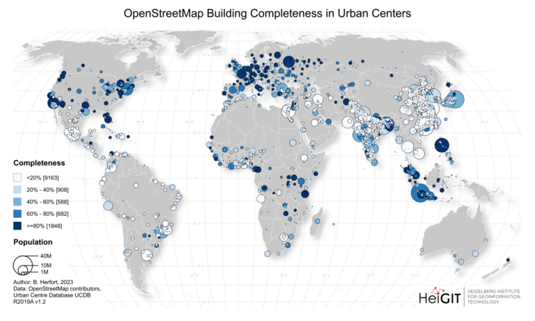
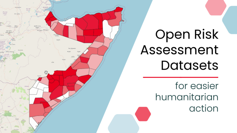
A new global dataset released by the HeiGIT (Heidelberg Institute…
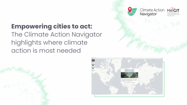
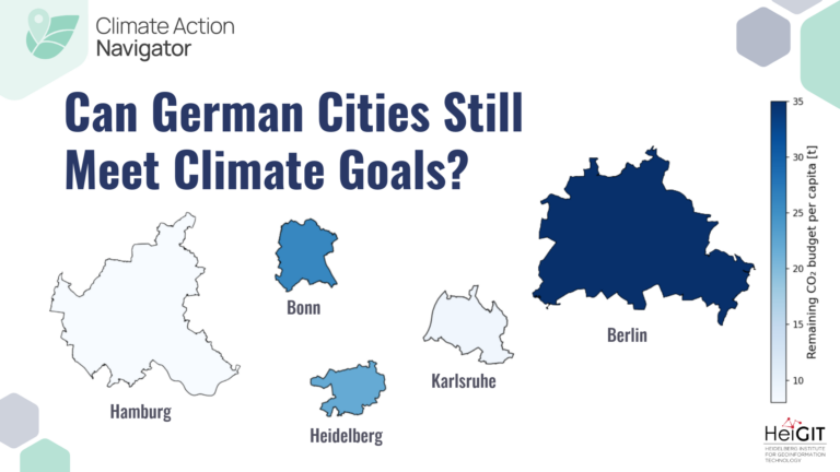
What does a climate-neutral, livable city look like – and…
Researchers at HeiGIT (Heidelberg Institute for Geoinformation Technology) have publicly…
As summer temperatures soar, the health risks associated with heat…
The HeiGIT gGmbH (Heidelberg Institute for Geoinformation Technology) team has…
HeiGIT is embarking on an initiative to address one of…
The “Waterproofing Data” project has won the ESRC Celebrating Impact…
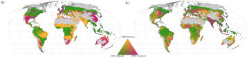
Re-arranging food production: How we could use the vegetation zones…
The transdisciplinary project HEAL involves citizens in the research process…
Benjamin Herfort and his colleagues Sven Lautenbach, João Porto de…
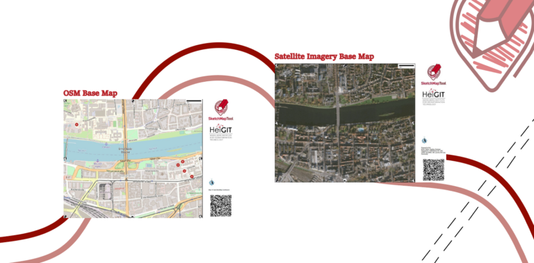
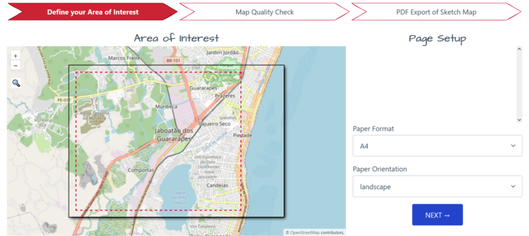
Sketch Map Tool (SMT) – An easy-to-use way to create…
During catastrophic events such as the recent Türkiye/Syria earthquake, the…
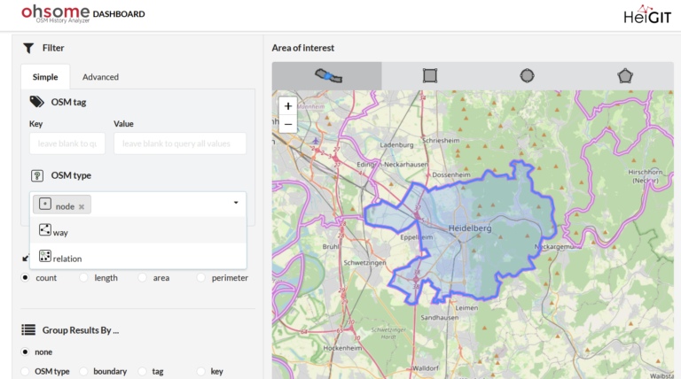
With the OSHDB Ver. 1.0, the Heidelberg Institute for Geoinformation…
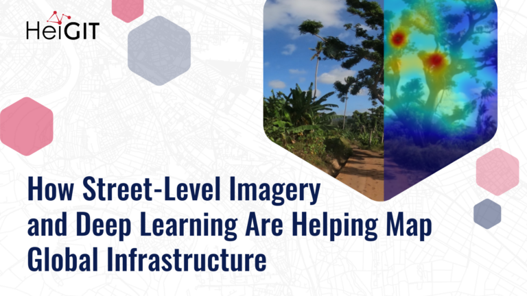
Geoinformatics researchers from Heidelberg are helping to improved the usability…
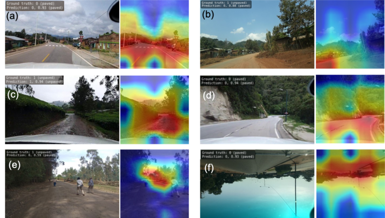
Underpasses, stairs, and high curbsides are a challenge for people…
The impact of climate change is particularly strong in higher…
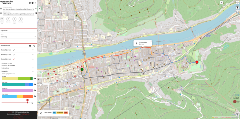
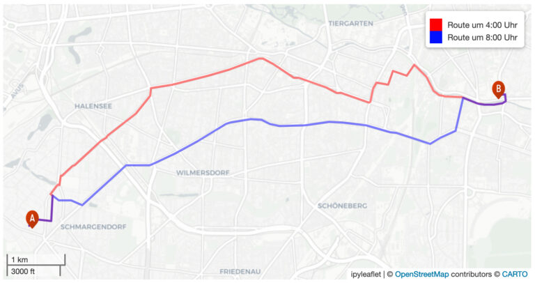
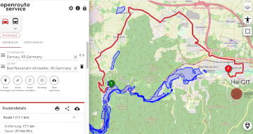
Die Universität Heidelberg berichtet aktuell über impfzentrum.openrouteservice.org NEUER ROUTENPLANER ERMITTELT…
At HeiGIT, we focus on developing useable and useful tools…
In 2023, a shared vision emerged to make geospatial skills…
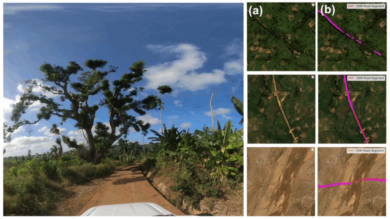
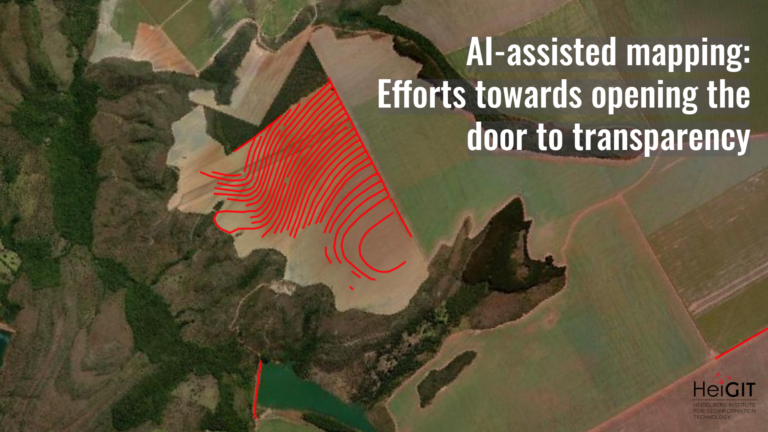
What role does the human-in-the-loop play in AI-assisted mapping? AI-assisted…
Reliable geodata is essential for informed decisions, such as preparing…
This blog article was originally posted on Medium by Maciej…
The Sketch Map Tool was strategically used within Colombia’s National…
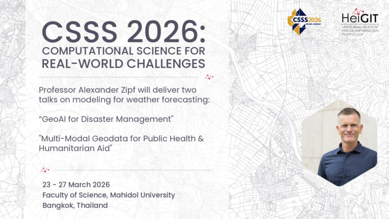
The Computational Science Summer School (CSSS 2026) will take place…
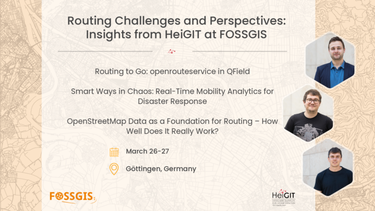
The FOSSGIS-Conference 2026 is the main yearly event for the…
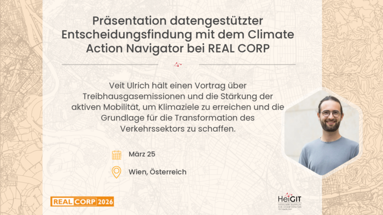
For three decades, the REAL CORP conference series has been…