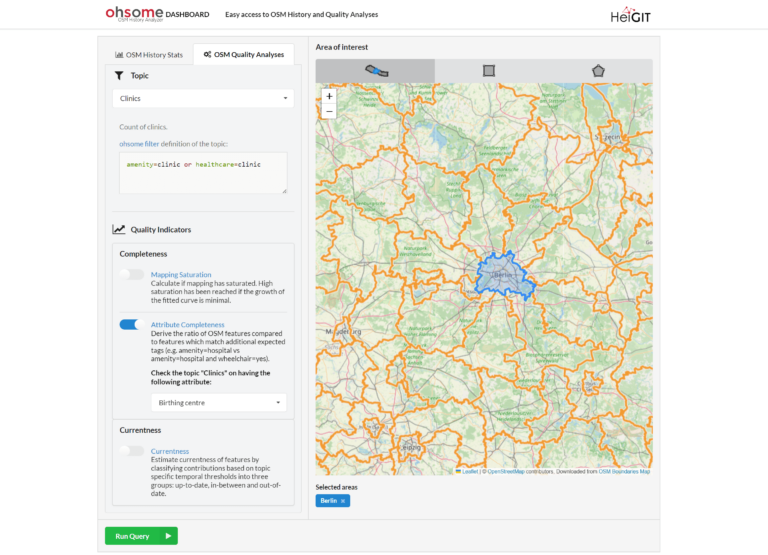
In the last few weeks, a lot of work has been put into expanding the functionalities of the ohsome Quality API. Most notably, the ohsome dashboard now has a new…
A workgroup of the World Bank is researching and evaluating the key spatial factors affecting women’s employment opportunities in the renewable energy sector. Their research aimed to develop an analytical…
With thousands of people mapping in OSM every day, missing building data in urban centers is steadily decreasing. Since OSM is a widely used source for projects researching urban phenomena…
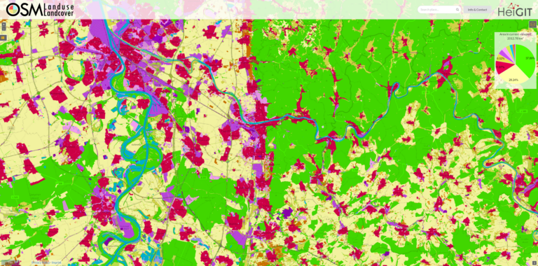
We are excited to announce that the data displayed on OSM – Landuse is now freely accessible. These data sets offer valuable insights and can be utilized for various applications….
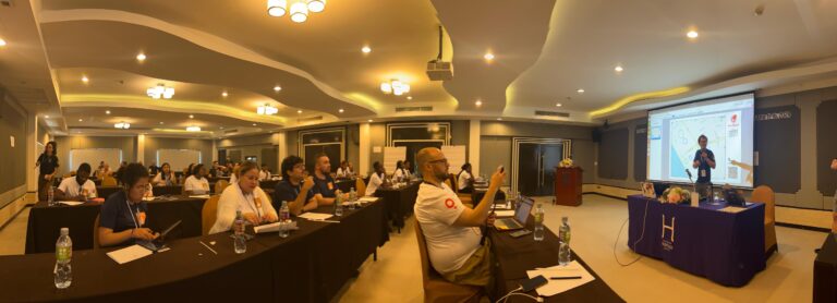
The YouthMappers network recently held its 2024 Leadership Fellows Workshop, an inspiring event that brought together a top cohort of university students from around the globe. This year’s workshop, held…
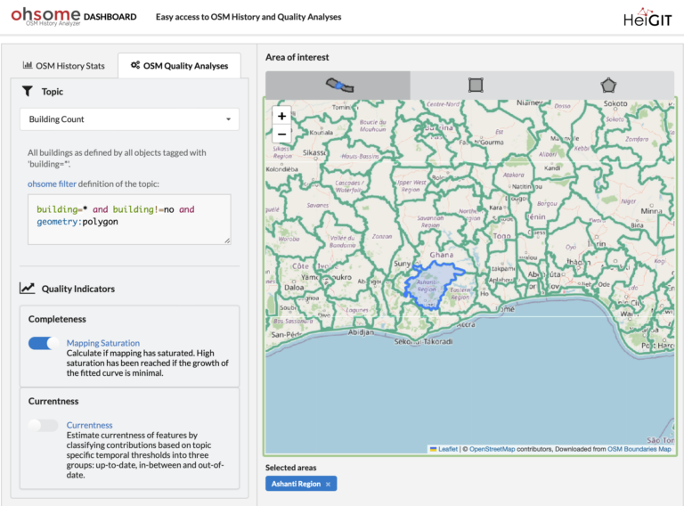
Are you ready to take your OpenStreetMap (OSM) data analysis to the next level? We’re excited to showcase the latest features of our ohsome Dashboard, designed to provide you with…
The 2024 Fachtagung Katastrophenvorsorge (Disaster Risk Reduction Symposium) centered around the theme “On the Edge? Disaster risk reduction in uncertain times.” Held in a hybrid format on April 22 and…
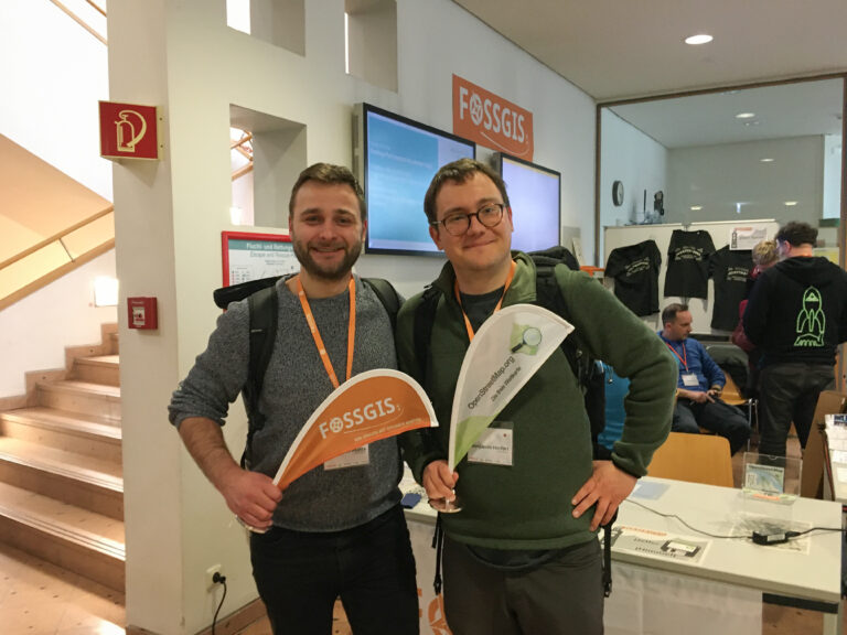
We’re proud to share our recent conference experience with you! Our HeiGIT Product Owners for Big Data and Smart Mobility, @Benjamin Herfort and Julian Psotta, had the privilege of attending…
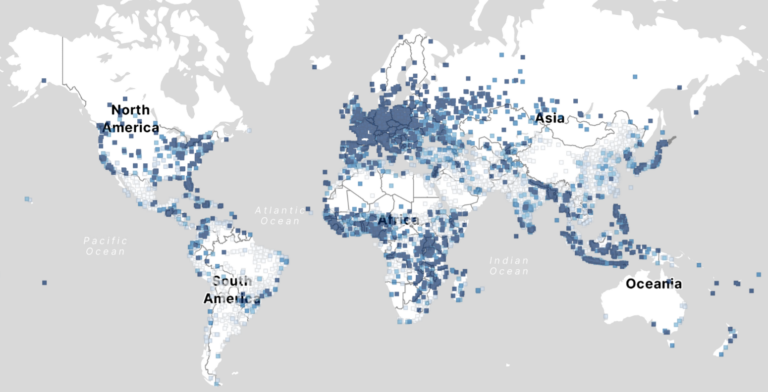
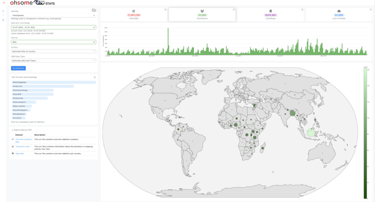
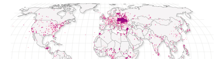
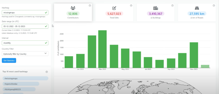
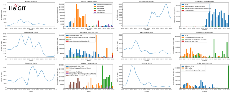
OhsomeNow stats makes it possible to monitor contributions to OpenStreetMap (OSM) in real time. We developed this new dashboard as part of our long-term cooperation with the Humanitarian OpenStreetMap Team…
A new rate limit is introduced The OpenStreetMap (OSM) API recently introduced a rate limit, which is designed to limit the impact of a particular kind of map vandalism: new…
HeiGIT and the Amsterdam University Medical Center (UMC) partnered up to investigate food environments through the lens of OpenStreetMap (OSM) data. UMC analyses how exposure to different categories of food…
Today, we’d like to shine a light on the online tool OhsomeNowStats. OhsomeNowStats allows users to take a look at the mapping activity in OpenStreetMap. This is especially useful for…
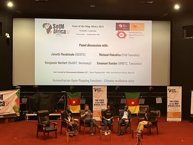
The recently concluded State of the Map Africa 2023, hosted in Yaoundé, Cameroon, marked the fourth edition of this regional OpenStreetMap (OSM) conference. The State of the Map was a…
Introduction In this blogpost we are taking a look at humanitarian mapping through the Tasking Manager (HOT-TM) that is operated by the Humanitarian OpenStreetMap Team (HOT). At HeiGIT we work…
HeiGIT and the Amsterdam University Medical Centers (UMC) partnered up to investigate food environments through the lens of OpenStreetMap (OSM) data. UMC analyses how exposure to different categories of food…
The completeness of the OpenStreetMap (OSM) road network has been an ongoing focus for researchers for more than 15 years. For instance, Neis et al. (2011) investigated the OSM street…
At HeiGIT and in particular within the ohsome team, we strive to provide valuable insights into OpenStreetMap (OSM) data. The ohsome API offers aggregated statistics on the evolution of OSM…
Did you know that the OpenStreetMap (OSM) taginfo site now lets you access the ohsome dashboard? This allows you to gain refined insights into the usage stats of specific keys…
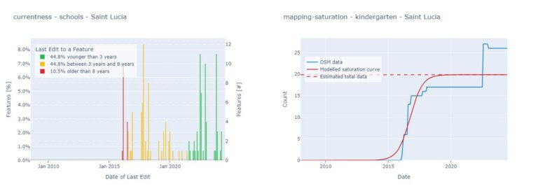
Using the ohsome dashboard, it is possible to explore quality estimation for OpenStreetMap (OSM) data from the ohsome quality analyst (OQT) for arbitrary regions. Also, OQT does provide an API…
In his bachelor’s thesis, supervised by HeiGIT’s apl. Prof. Dr. Sven Lautenbach, Lars Reckhaus examined the suitability of OpenStreetMap (OSM) for location analyses in the context of residential real estate…