The new ohsome quality API (OQAPI) country reports are a meta-dataset designed to provide an overview of whether OpenStreetMap (OSM) data quality for a country or region of interest is…
The new release of ohsomeNow allows users to retrieve statistics for individual OSM usernames, opening up new possibilities for exploring personal contribution histories and understanding organized editing activities….
The article is based on the talk Benjamin Herfort (HeiGIT) and Benjamin Würzler (Bundesamt für Kartographie und Geodäsie) presented at FOSSGIS 2026 in Göttingen….
The latest release of ohsome-planet introduces Parquet files continuously derived from OpenStreetMap replication data. This eliminates costly reprocessing and allows seamless analysis of the full lifecycle of OSM data in…
At State of the Map Europe 2025, we have introduced ohsomeDB, the successor to the OpenStreetMap History Database (OSHDB), which offers a faster, more flexible foundation for analyzing OpenStreetMap (OSM)…
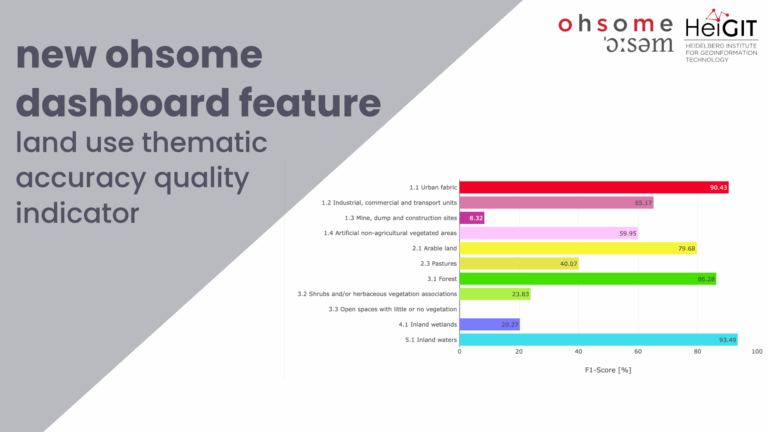
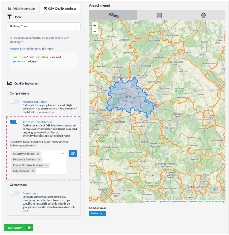
Together with the German Federal Agency for Cartography and Geodesy (BKG) we released a new version of the ohsome dashboard, introducing a new indicator for assessing the thematic accuracy of…
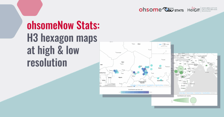
The ohsomeNow Stats dashboard has been updated to enhance its visual and functional elements. This facilitates the exploration of OpenstreetMap (OSM) mapping activities across space and time. New H3 hexagon…
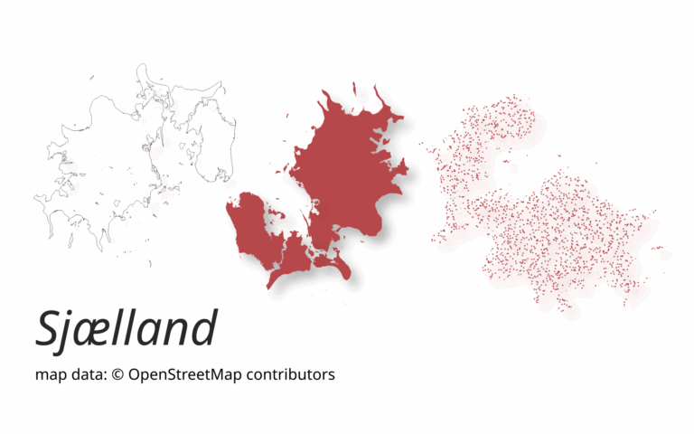
A new version of ohsome-planet (codename “Sjælland”) has been released. It is the newest version of HeiGIT´s command line tool, which transforms OpenStreetMap (history) PBF files into into an analysis-ready…
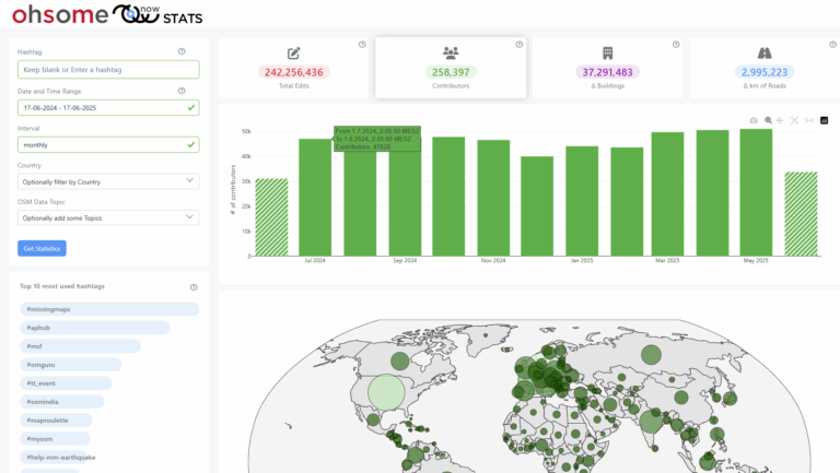
The enhanced ohsomeNow Stats dashboard now provides near real-time access to all OpenStreetMap contributions since 2005, enabling more flexible and detailed analysis of global mapping activities. ohsomeNow stats provides a…
This project explores how OpenStreetMap data can complement satellite imagery for tracking land cover changes in Germany. Using a small test area, we compare datasets over time to better understand…
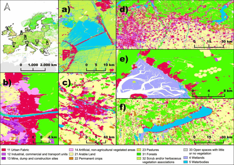
The paper, published in Nature Scientific Data, presents the first high-resolution (10m or finer) land use map of the European Union derived from a large-scale fusion of OpenStreetMap (OSM) and…
We are excited to share the release of the ohsome-planet – a new software library on GitHub, marking a significant step toward the development of ohsome 2.0. This tool is…
The concept of a “Digital Earth” has long envisioned a future where technological advancements enable the large-scale collection and visualization of spatial and environmental data. Today, open data sources such…
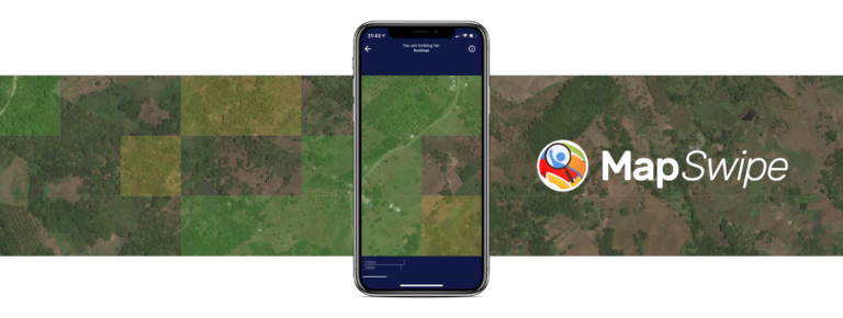
The crowdmapping app MapSwipe now integrates also street-level imagery. This new feature enables even mapping efforts that require the highest level of detail, such as detecting waste on the street….
We recently added the attribute completeness indicator to the ohsome Dashboard, and we’re now happy to introduce major upgrades to its functionalities. The ohsome quality API (OQAPI) and the ohsome…
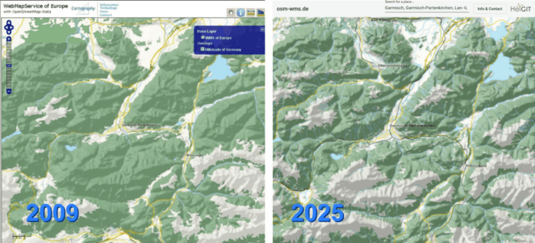
After 16 years, the OSM WMS – osm-wms.de website and the underlying map service will be shut down in March 2025. Back when the project went online in February 2009,…
Free and open-source map data has become a keystone for research across diverse fields. The extensive coverage of OpenStreetMap (OSM) data allows scientists to conduct independent studies without relying on…
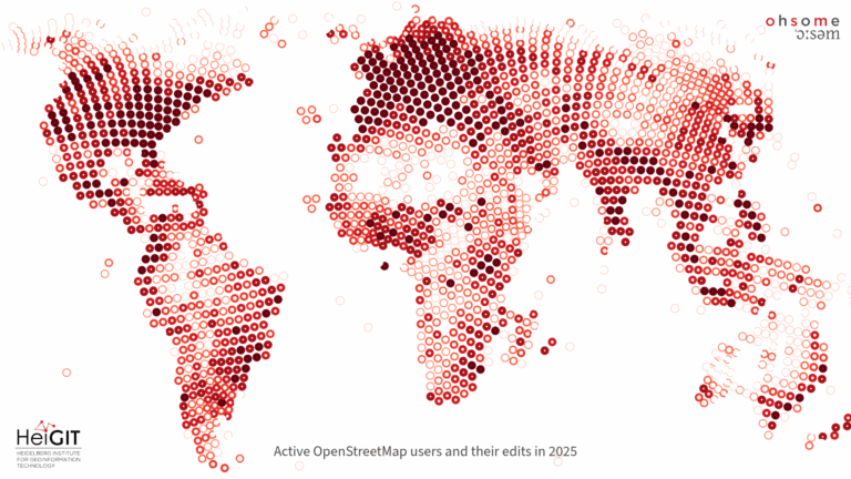
Explore some of metrics from ohsome tools and impact of OpenStreetMap (OSM) in 2024. From building data coverage in Baden-Württemberg to millions of API requests and contributions, these figures showcase…
The ohsome-py Python package is a client for the ohsome API, designed to facilitate the extraction and analysis of historical OpenStreetMap (OSM) data. The package simplifies handling API requests and…
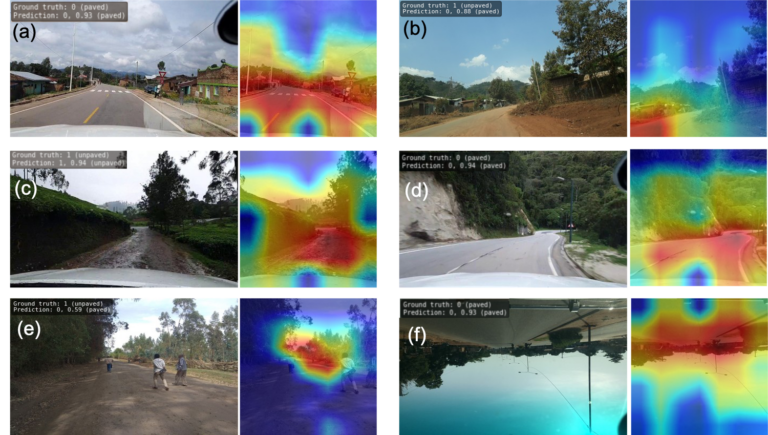
Researchers at HeiGIT (Heidelberg Institute for Geoinformation Technology) have publicly released a first of its kind planet-scale dataset on road surface type (paved or unpaved) using state-of-the-art GeoAI methods based on…