The openrouteservice (ORS) continuously evolves, bringing a suite of new features: the export and snap endpoints. These new features will change the way how users interact with and process routing…
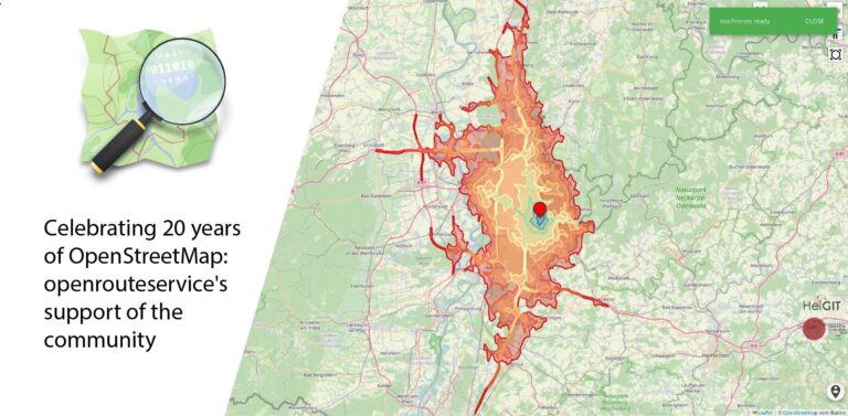
August 9 marks a turning point for the global mapping community: the 20th anniversary of OpenStreetMap (OSM). For two decades, OSM has revolutionized the way we perceive and interact with…
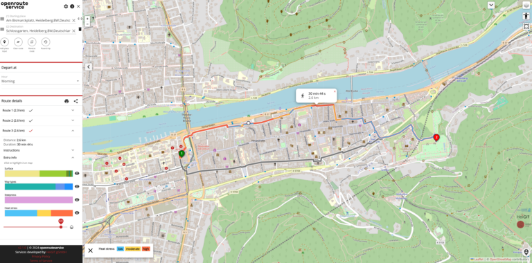
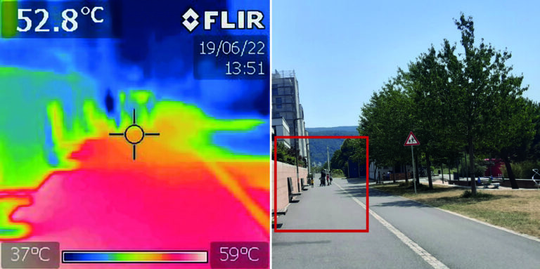
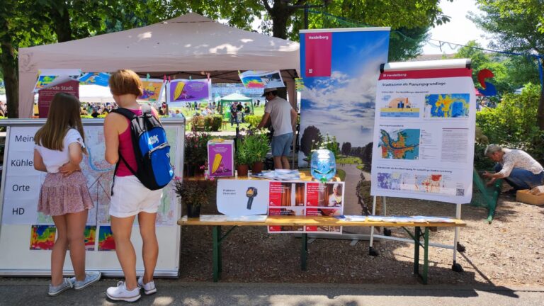
As summer temperatures soar, the health risks associated with heat stress become increasingly significant. This issue is particularly pronounced in urban areas such as Heidelberg and other cities, where dense…
The OpenStreetMap (OSM) and openrouteservice (ORS) provide free geospatial data that serve a multitude of research and practical applications. OSM thrives on its community-driven approach, ensuring its data is always…
Open-source tools that incorporate open geospatial data, such as openrouteservice (ORS), prove to be beneficial for both academic research and practical applications. These tools enable researchers to pursue innovative approaches…
The openrouteservice (ORS) QGIS plugin continues to evolve, bringing a suite of new features, improvements, and fixes that enhance its functionality and user experience. This update incorporates significant changes that…
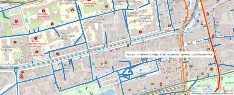
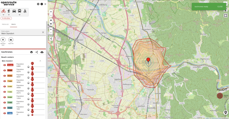
Free open geodata are of increasing importance. They are used in research or case studies and can lead to important insights on social, economic or environmental topics. A problem that…
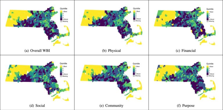
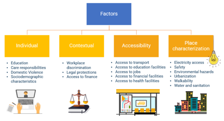
The research team of the transdisciplinary project HEAL (Heat Adaptation for Vulnerable Population Groups), focusing on providing heat adaptation measures for vulnerable groups in Heidelberg, has published a research paper…
We’re thrilled to announce the release of openrouteservice (ors) version 8.0, designated “Wilfried”, as a tribute to Prof. Dr. Wilfried Juling, whose steady support and advice fundamentally shaped the growth…
The use of open-source geospatial data, exemplified by services like openrouteservice (ORS), proves to be beneficial for both academic research and use case studies. Witnessing our technologies applied in unanticipated…
Introduction In an era where technology continuously reshapes our world, the fusion of artificial intelligence and geospatial data offers exciting possibilities. HeiGIT (Heidelberg Institute for Geoinformation Technology), a pioneering research…
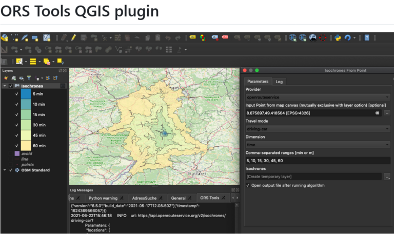
Just in time for the new year, the openrouteservice team proudly announces the release of v1.7.0 of the ORS Tools QGIS plugin! Quite a lot has happened. First, the GUI…
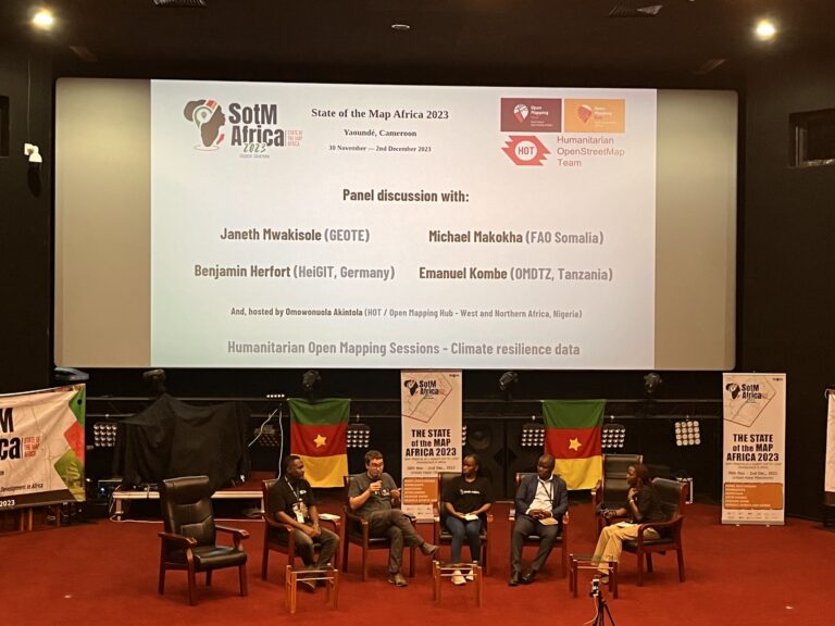
The recently concluded State of the Map Africa 2023, hosted in Yaoundé, Cameroon, marked the fourth edition of this regional OpenStreetMap (OSM) conference. The State of the Map was a…
The HeiGIT team recently secured the top position in the third edition of the Open Source Software for Sustainable Development Goals (OSS4SDG) hackathon. These hackathons are based on the 17…
On October 5th and 6th, 2023, the XP Days Germany 2023, an open conference for agile software development and extreme programming with a focus on software development topics, took place…
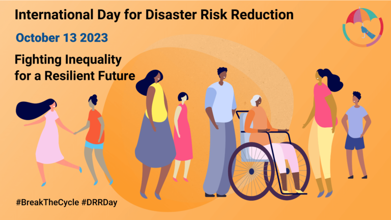
Did you know that October 13th is the International Day for Disaster Risk Reduction (IDDRR)? Since 1989, the United Nations Office for Disaster Risk Reduction promotes a global culture of…
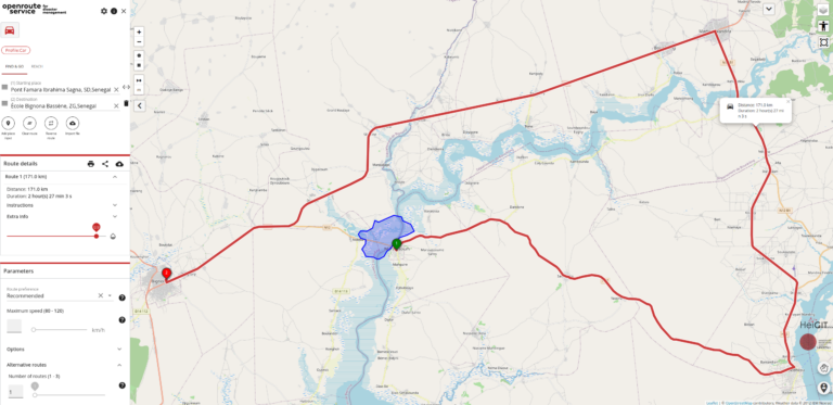
In the context of disaster management, time is of the essence. Quick and accurate response can make all the difference in saving lives and mitigating damage. That’s why the openrouteservice…
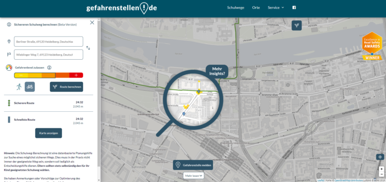
The transdisciplinary project HEAL involves citizens in the research process on heat stress in the city: The aim is to make everyday life easier for at-risk groups during heat waves….
figure from CC-BY 2.0 – NASA/JPL-Caltech/Kevin M. Gill – original version at Callisto – July 8 1979 For some time now, the developers of openrouteservice at HeiGIT gGmbH have…
Heat stress has emerged as an increasing concern for Germany. Since 1881, the number of days per year with a maximum temperature above 30°C has nearly tripled and a further…