During catastrophic events such as the recent Türkiye/Syria earthquake, the road infrastructure in the affected area is often widely interrupted and accessibility varies over time. In spite of this, it…
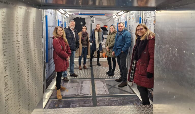
Cover image: Team representatives from German Red Cross, DRL and HeiGIT in the replica of the European research capsule COLUMBUS, which is part of the International Space Station (ISS). Photo…
On February 6, a 7.7 magnitude earthquake struck southern Türkiye at 4:17 a.m. This is Türkiye’s most powerful earthquake recorded since 1939. The Government of Türkiye has since issued a…
Centrality indicators are used to identify important nodes or edges in graph networks. Applied to road networks these indicators can for example be used to model traffic speed or identify…
Geoinformatics researchers from Heidelberg are helping to improved the usability of geocoded information through the project “SocialMedia2Traffic”. Heidelberg 23rd of May, 2022. Navigation services require up-to-date traffic information in order…
Humans rely on clean water for their health, well-being, and various socio-economic activities. During the past few years, the COVID-19 pandemic has been a constant reminder of about the importance…
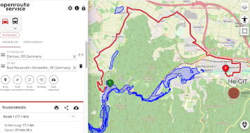
Underpasses, stairs, and high curbsides are a challenge for people with impaired mobility, but these can be circumnavigated using a customized route planner for increasing mobility by calculating routes with…
Just a couple of days ago, on December 16th, large area of the Philippines were hit by Typhoon Rai (local name Odette). The typhoon not only caused vast destruction but…
In the context of the United Nations World Data Forum 2021 organised by theUnited Nations Statistics Division and UN member states a series of blogposts has been published by UNSTATS….
Under pressure from the decision of the Federal Constitutional Court in spring 2021, the German government has amended its climate targets. The new coalition also wants to stick to these…
Aktuelle Meldung der Universität Heidelberg zum Projekt HEAL: https://www.uni-heidelberg.de/de/newsroom/wenn-es-in-der-stadt-zu-heiss-wird BADEN-WÜRTTEMBERG STIFTUNG FÖRDERT HEIDELBERGER PROJEKT ZU ROUTINGDIENST MIT HITZEVERMEIDENDEN WEGSTRECKEN Wo in der Stadt Heidelberg ist es besonders heiß und wie…
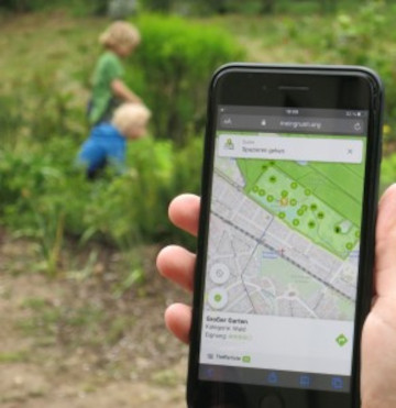
Urban green spaces (UGSs) can provide important ecosystem services for citizens and their well-being. To make use of these services according to UGS user demands, urban residents, tourists, and city…
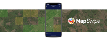
MapSwipe has ben announced as ‘App of the Day‘ in the Apple AppStore! (27.08.2021) Thank you to all our volunteers for the continued help and support which keeps the app…
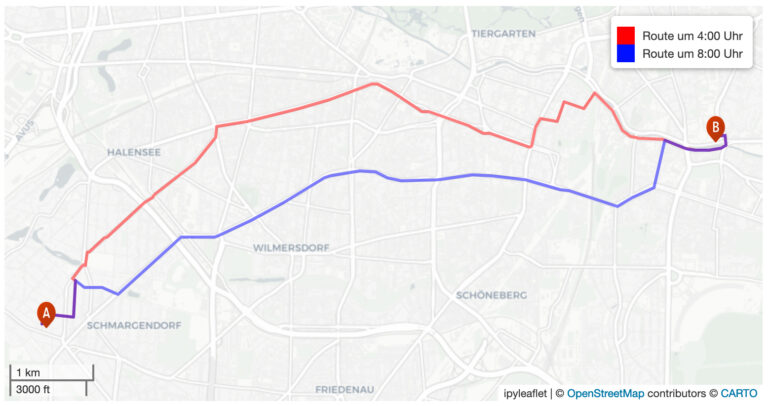
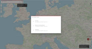
We are happy to announce a revamped openrouteservice maps client for disaster management. It was built based on the new openrouteservice maps client, that is an open source route planner…
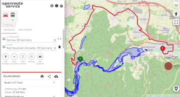
The current flooding in Germany has destroyed countless streets or temporarily made them impassable in the affected areas. HeiGIT is working on free and open solutions for humanitarian aid that…
Im Juni 2020 haben wir mit unseren Partnern aus dem meinGrün Projekt die gleichnamige WebApp gestartet. Nun sind die Nutzenden in Dresden und Heidelberg aufgerufen, sich ein letztes Mal an…
The Regionalverband Ruhr (Team 9-2 Geodata Technology) has used the potential of HeiGIT’s openrouteservice (ORS) in a new QGIS extension and thereby created another possible application for the ORS: The…
The AGILE 2021 conference is taking place this week. It is the the 24rd AGILE conference on GIScience. AGILE is the Association of Geographic Information Laboratories in Europe and the…
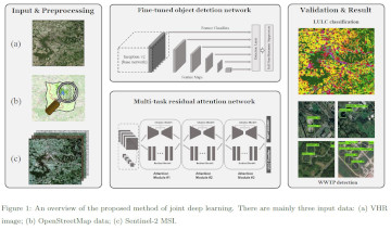
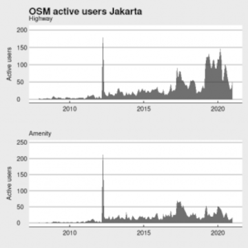
Data quality is an important issue then performing analysis based on OpenStreetMap data. We have recently demonstrated how the effects of the 2013 flood in Jakarta on the accessibility of…
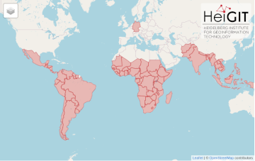
After Sub-Saharan Africa and South and Southeast Asia we have now published all countries of Central and South America on the Open Healthcare Access Map. The web application is available…