Deadline extended to 21.12.2020 18th International Conference on Information Systems for Crisis Response and Management (ISCRAM 2021) May 23-26, 2021, VIRTUAL, Interactive ONLINE EVENT https://www.drrm.fralinlifesci.vt.edu/iscram2021/ Track: Geospatial Technologies and Geographic Information Science for Crisis Management (GIS) https://www.drrm.fralinlifesci.vt.edu/iscram2021/files/CFP/ISCRAM2021-Track10-Geospatial_Technologies New Deadline for … Read More
Blog
Disastermappers Heidelberg International Mapathon on December 8th
On December 8th at 6.30 pm the next international mapathon organized by the disastermappers heidelberg takes place! This time we map together with MAMAPA, an integration project for migrants and refugees from Mannheim, CartONG, LECLARA Larabanga and OSM Ghana. We … Read More
HeiGIT participates at virtual HOT Summit 2020
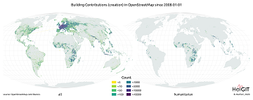
Next week the HOT Summit will take place. The conference takes already place for the sixth time and it is the fifth consecutive time that we from HeiGIT/GIScience Heidelberg do contribute a session. This years topic is 10 Years of … Read More
New Jupyter Notebook: Analysis of Access to Health Care using openrouteservice Isochrones API
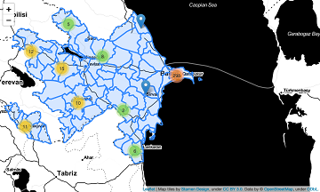
What is the idea behind the Notebook? In the case of an emergency (e.g. floods, earthquakes, political crisis) it is important to know where the health facilities are located. Furthermore, it is important to identify which cities/districts have a reduced … Read More
Recent changes to OpenStreetMap healthcare infrastructure in India
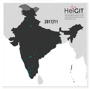
India accounts for nearly 18% of the worlds population. The country is also one of the main carrier of the worlds disease burden. Despite the general increase in life expectancy and decreasing mortality due to communicable diseases and malnutrition in … Read More
Exploring Localness of OSM Data – An Analysis using the OSHDB and ohsome api
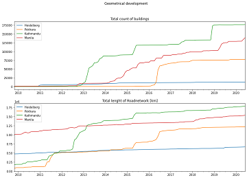
“Local Knowledge” is constituting the exceptional value of Volunteered Geographical Information and thus also considered as an important indicator of data quality. We are interested in how much local information is captured in OpenStreetMap data. In this blog post we … Read More
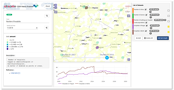
Neu: Globale OSM History Analysen mit ohsomeHeX v1.0
Erhalten Sie mit ohsomeHeX wertvolle Einblicke in die Qualität und den Entwicklungsprozess von OpenStreetMap-Daten! (see for english version here) Das HeiGIT Big Data Team freut sich zur Exploration der Veränderungen der globalen Daten in OpenStreetMap nun eine Version 1.0 von … Read More
GIScience at GeOnG 2020
These days so much is different- also conferences. Carolin Klonner and Marcel Reinmuth attended the GeOnG 2020 virtually. Thanks to the organizers! It worked well and there was great exchange between the participants. The workshop on experiences in defining health … Read More
OSMlanduse European Union validation effort EuroSDR conference 11/24/2020
During the EuroSDR workshop we will present our OSMlanduse product (earlier post) to the land use (LU) and land cover community (LC) and highlight class accuracies and a benchmark comparison towards existing national authoritative products. Accuracy estimated to be presented … Read More
2nd CALL FOR PAPERS – GIS Track at 18th International Conference on Information Systems for Crisis Response and Management (ISCRAM 2021)
2nd CALL FOR PAPERS – 18th International Conference on Information Systems for Crisis Response and Management (ISCRAM 2021) May 23-26, 2021, Virginia, USA – https://www.drrm.fralinlifesci.vt.edu/iscram2021/ Virginia Tech Track: Geospatial Technologies and Geographic Information Science for Crisis Management (GIS) https://www.drrm.fralinlifesci.vt.edu/iscram2021/files/CFP/ISCRAM2021-Track10-Geospatial_Technologies Deadline … Read More
Mapathons im Rahmen der OSM Geography Awareness Week – OSM GeoWeek
Kooperation ist in der Humanitären Hilfe oft der Schlüssel, um Menschen in Not schnell und effizient helfen zu können. Das gilt insbesondere beim Austausch von Informationen und Kartenmaterial. Besonders herausfordernd sind die Situationen für Humanitäre Organisationen in Gebieten, von denen … Read More
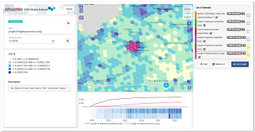
OSM History Analysis with ohsomeHeX v1.0
Get valuable insights into the quality and development process of OpenStreetMap data with ohsomeHeX! We are proud to announce a new release that provides a completely redesigned UI that makes it easier to keep track of all relevant information. Choose … Read More
New paper published: Participatory Mapping and Visualization of Local Knowledge: An Example from Eberbach, Germany
Flooded parking area in Eberbach in January 2019 (Picture: C.Klonner) Worldwide, more and more people are affected by flooding. Local knowledge provides a valuable source of information for disaster risk reduction. We present an approach for visualizing and formalizing this … Read More
Regional Variations of Context-based Association Rules in OpenStreetMap
As a user‐generated map of the whole world, OpenStreetMap (OSM) provides valuable information about the natural and built environment. However, the spatial heterogeneity of the data due to cultural differences and the spatially varying mapping process makes the extraction of … Read More
Optimal ans Ziel: Routing-Dienste auf Basis nutzergenerierter Geodaten
Ein neues Buch gibt in einem Buchkapitel einen Überblick der vielfältigen Aktivitäten von HeiGIT und GIScience im Bereich Routenplanung und Navigation. Neben Grundlagen (wie schnelle Routing-Algorithmen) zur Umsetzung werden vor allem diverse Anwendungsbeispiele für flexible Routing-Dienste in Spezialanwendungen vorgestellt. Hierzu … Read More
Sucessfull HeiKA autumn school urban data science
The HeiKA autumn school urban data science that took place last week was a good success with participating students varying between five and fifteen during the week. Topics covered included visualization, spatial statistics, analysis of movement data, intrinsic data quality … Read More
One step forward for “25 Mapathons” – today Online Mapathon at Humanitarian Congress
The project “25 Mapathons” made an important step forward by successfully completing the first four Mapathons of the project. Two Mapathons were conducted with German Red Cross (GRC) members from the Red Cross Regional association of Westfalen-Lippe. Another two Mapathons … Read More
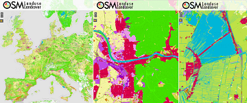
OSMlanduse wird auf Geonet.MRN Meetup zu Flächennutzung und Flächenmanagement vorgestellt: Donnerstag 29.10.2020, 16:30
Am am 29.10.20, 16:30 Uhr veranstaltet das Netzwerk Geoinformation der Metropolregion Rhein-Neckar GeoNet.MRN zum Thema: Flächennutzung und Flächenmanagement: Ein Geoinformation Meetup Teilnahme: Kostenlos und ohne Anmeldung mit Teams unter diesem Link. Themen des Meetups sind die Online-Beteiligung von Kommunen, Bürgern … Read More
“Open Data und die Sustainable Development Goals” geht in die zweite Runde
Liebe disastermappers-Freund*innen und Vorkämpfer*innen für freie Geoinformationen! Es ist wieder so weit: Unsere Veranstaltungsreihe “Open Data und die Sustainable Development Goals” geht in die zweite Runde! Nachdem wir uns im Sommersemester schon dem Thema Nachhaltige Entwicklung und deren Verknüpfung mit … Read More
Estimating trade-offs of land use at global scale
Land use decision involve trade-off with respect to the ecosystem service produced by the different land use systems. Agricultural use versus natural ecosystems is the main alternative for which trade-offs need to be estimated. Given the varying climatic and soil … Read More
