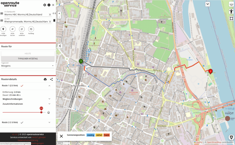
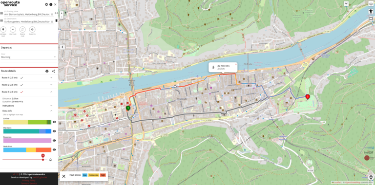
As summer temperatures soar, being outdoors poses rising health risks, especially in urban areas and for vulnerable groups like the elderly, children, and citizen with pre-existing conditions. The HEAL project…
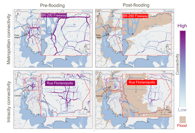
This study examines the resilience of urban infrastructure, with a focus on road network connectivity and redundancy in the face of extreme weather events. Using OpenStreetMap (OSM) data and the…
Do we really need digital sovereignty—and why? Today, over 80% of Europe’s digital products, services, infrastructures, and intellectual property originate from outside the EU. This dependency affects not only innovation…
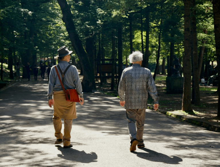
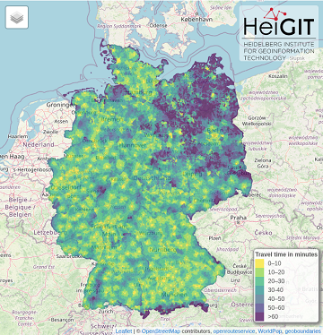
The 15-minute city concept is gaining traction in urban planning, aiming to ensure that essential services are within a short walk or bike ride. As the older population grows, walking…
As summer temperatures soar, the health risks associated with heat stress become increasingly significant. This issue is particularly pronounced in urban areas such as Heidelberg and other cities, where dense…
Introduction In an era where technology continuously reshapes our world, the fusion of artificial intelligence and geospatial data offers exciting possibilities. HeiGIT (Heidelberg Institute for Geoinformation Technology), a pioneering research…
The HeiGIT team recently secured the top position in the third edition of the Open Source Software for Sustainable Development Goals (OSS4SDG) hackathon. These hackathons are based on the 17…
Earlier this month, the Association of Geographic Information Laboratories in Europe (AGILE) held its 2023 conference, and GIScience and HeiGIT team members contributed presentations, analyses and papers toward this year’s…
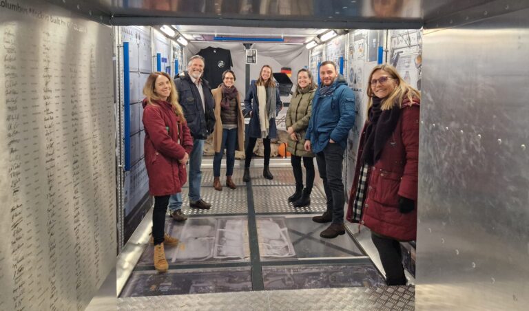
Cover image: Team representatives from German Red Cross, DRL and HeiGIT in the replica of the European research capsule COLUMBUS, which is part of the International Space Station (ISS). Photo…
On February 6, a 7.7 magnitude earthquake struck southern Türkiye at 4:17 a.m. This is Türkiye’s most powerful earthquake recorded since 1939. The Government of Türkiye has since issued a…
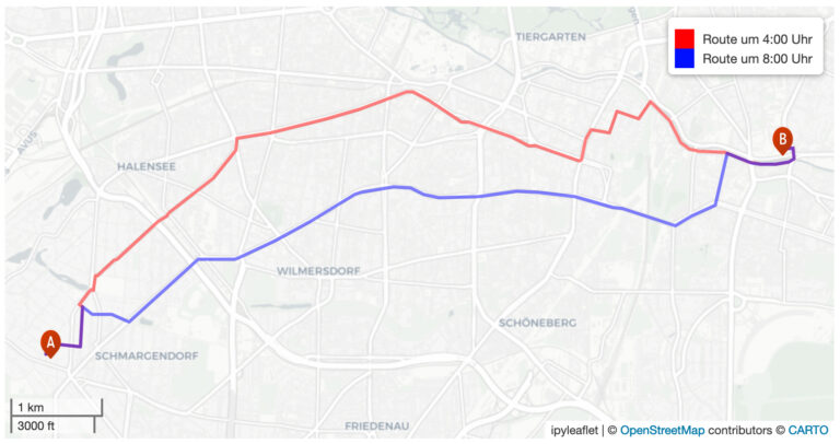
Geoinformatics researchers from Heidelberg are helping to improved the usability of geocoded information through the project “SocialMedia2Traffic”. Heidelberg 23rd of May, 2022. Navigation services require up-to-date traffic information in order…
Aktuelle Meldung der Universität Heidelberg zum Projekt HEAL: https://www.uni-heidelberg.de/de/newsroom/wenn-es-in-der-stadt-zu-heiss-wird BADEN-WÜRTTEMBERG STIFTUNG FÖRDERT HEIDELBERGER PROJEKT ZU ROUTINGDIENST MIT HITZEVERMEIDENDEN WEGSTRECKEN Wo in der Stadt Heidelberg ist es besonders heiß und wie…
Urban green spaces (UGSs) can provide important ecosystem services for citizens and their well-being. To make use of these services according to UGS user demands, urban residents, tourists, and city…
The current flooding in Germany has destroyed countless streets or temporarily made them impassable in the affected areas. HeiGIT is working on free and open solutions for humanitarian aid that…
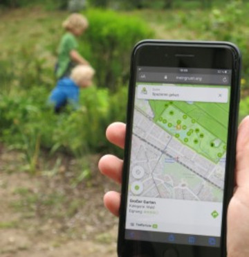
Im Juni 2020 haben wir mit unseren Partnern aus dem meinGrün Projekt die gleichnamige WebApp gestartet. Nun sind die Nutzenden in Dresden und Heidelberg aufgerufen, sich ein letztes Mal an…
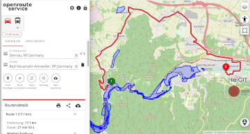
The Regionalverband Ruhr (Team 9-2 Geodata Technology) has used the potential of HeiGIT’s openrouteservice (ORS) in a new QGIS extension and thereby created another possible application for the ORS: The…
The AGILE 2021 conference is taking place this week. It is the the 24rd AGILE conference on GIScience. AGILE is the Association of Geographic Information Laboratories in Europe and the…
Seit kurzem nutzt die Stadt Mannheim openrouteservice (ORS) von HeiGIT für das Routing von Fußgängern, Fahrräder, Autos, LKW und Rollstuhlfahrern im Online-Stadtplan für die breite Öffentlichkeit, d.h. die Bürger und…
Up-to-date traffic information is a prerequisite for navigation solutions to determine the best route and travel time. In the SocialMedia2Traffic project by HeiGIT and GIScience Heidelberg , conclusions about current…
Last week we introduced Open Healthcare Access Map. Our new web application for interactively sharing results of accessibility estimates based on OpenStreetMap healthcare facilities and openrouteservice isochrones. A new update…