The computing center (URZ) of Heidelberg University will be celebrating its 50th anniversary on Friday 11th October 2019 with a festive colloquium. Prof. Dr. Alexander Zipf gives a speech on Big Spatial Data Analytics of geodata in the cloud. Examples … Read More
Blog
HeiGIT support for Humanitarian Village and Mapathon at Humanitarian Congress in Berlin 2019
On October 17/18th the Humanitarian Congress is organized in Berlin by Médecins Sans Frontières/Ärzte ohne Grenzen (MSF), Médecins du Monde/Doctors of the World (MdM), German Red Cross (GRC) and Berlin Chamber of Physicians. For more than 20 years, this congress … Read More
Brownbag Presentation by Jennings Anderson (University of Colorado Boulder) on OpenStreetMap data analysis
We cordially invite you to a Brownbag presentation by our Guest Researcher Dr. Jennings Anderson! When? Tuesday, 8/10/2019, 1-2.30 pm Where? Seminar room 15, INF 348 Jennings is a postdoctoral researcher at the University of Colorado Boulder exploring new approaches … Read More
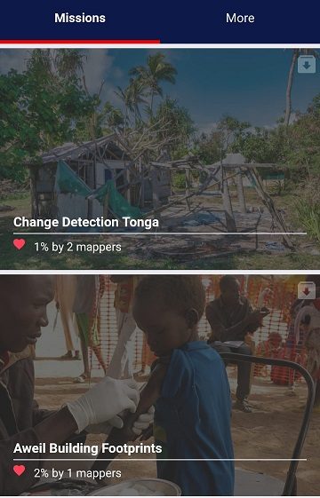
MapSwipe 2.0: Reimagining how a mobile app can support humanitarian response worldwide
In 2015, MapSwipe began as a solution to a complex question: how do we better identify where communities and populations are, allowing mapping to be more efficient and effective? Using a simple mobile app, volunteers are able to swipe through … Read More
Mapathon at “JKG” during German Congress for Geography 2019
This year the bi-annual German Congress for Geography was held in Kiel in northern Germany. The conference is the main platform for German speaking researchers to exchange recent research results in the field of geography. Besides this, a growing number … Read More
State of the Map and HOT Summit in Heidelberg
SotM Image by Thomas Skowron, licensed under CC BY 2.0 Over the last few days, Heidelberg has been host to the annual HOT Summit and State of the Map conference with a combined attendance of over 800 people. The HOT … Read More
OpenStreetMap, eine stille und nützliche digitale Revolution
Über 500 Mitgestalter des ehrenamtlich erstellten Kartenwerks treffen sich in Heidelberg. Ihr Motto: „Freie Projekte benötigen freie Daten“ Verkehrsminister Winfried Hermann: „Nachhaltige Mobilität und frei verfügbare Daten passen sehr gut zusammen“ Ein besonderes Beispiel der digitalen Mitgestaltung ist die OpenStreetMap … Read More
Pressekonferenz: State of the Map, Heidelberg 21.09.2019
Presseeinladung 18.09.2019 (PDF Link hier) Weltkonferenz für eine Freie Karte Die Macher von OpenStreetMap treffen sich in Heidelberg Universität Heidelberg und Verkehrsministerium Baden-Württemberg unterstützen Initiative Sehr geehrte Damen und Herren, hochwertiges digitales Kartenmaterial muss nicht kommerziell sein. Seit mittlerweile 15 … Read More
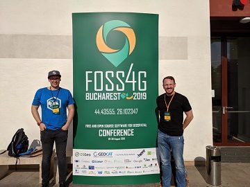
Recap of HeiGIT @ FOSS4G 2019
First of all, thanks to everybody who attended our ohsome lab at last weeks FOSS4G in Bucharest. Even though there were eleven (!) tracks running in parallel, and our lab was not in the same location as the program track, … Read More
Die MS Wissenschaft ist in Heidelberg
Bis zum 01.09.2019 kann die Austellung auf der MS Wissenschaft zum Thema “Künstliche Intelligenz” in Heidelberg besucht werden. Wir waren da und sind begeistert! Für die Ausstellung hat das HeiGIT gemeinsam mit dem Alfred-Wegener-Institut für Polar- und Meeresforschung in Potsdam … Read More
New version of ORS Tools QGIS Plugin
We’re happy to announce a new version of our QGIS Plugin ORS Tools. Additionally to the core services of giving easy access to our directions, isochrone and matrix API’s, the plugin now allows users to optimize their trips via a … Read More
HeiGIT presents ohsome Lab at FOSS4G 2019 Bucharest
This week, the annual conference FOSS4G (Free and Open Source Software for Geospatial) is taking place in Bucharest, Romania. The conference is organized by The Open Source Geospatial Foundation (OSGeo) and attracts over 1000 professionals from industry and academia each … Read More
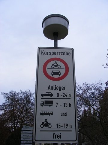
Interested in time-dependent routing?
We are delighted to invite you to join a workshop on open-source routing with time-dependent restrictions, see http://giscienceblog.uni-hd.de/2019/04/17/project-tardur-starts-open-source-routing-with-time-dependent-restrictions/. The workshop is taking place on Friday before the State of the Map conference, 20th September 2019 in Heidelberg. It is free … Read More
HeiGIT beim Tag der offenen Tür im Auswärtigem Amt, 17.-18. August
Wer steckt eigentlich hinter Missing Maps? Und wie können auch Sie in dem humanitären Mappingprojekt aktiv werden? Besuchen Sie uns heute beim Tag der offenen Tür im Auswärtigem Amt an unserem gemeinsamen Stand mit dem Deutschen Roten Kreuz. Weitere Informationen … Read More
KI-Exponat des HeiGIT zu MissingMaps und Permafrostdetektion auf dem Portal zum Wissenschaftsjahr 2019 “Künstliche Intelligenz”
Seit einiger Zeit findet sich das gemeinsame Exponat des HeiGIT und des Alfred-Wegener-Instituts Helmholtz-Zentrum für Polar- und Meeresforschung für die Ausstellung “Künstliche Intelligenz” auf der “MS Wissenschaft” auch auf dem Webportal zum Wissenschaftsjahr 2019. Das Thema “Künstliche Intelligenz” des Wissenschaftjahres … Read More
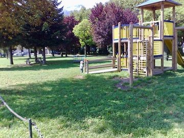
GRÜNFLÄCHEN IN STÄDTEN FÖRDERN WOHLBEFINDEN; ‘Nature’ Neuroscience Studie mit Beteiligung der Geoinformatik der Universität Heidelberg veröffentlicht:
INTERDISZIPLINÄRE STUDIE ZEIGT, DASS INNERSTÄDTISCHES GRÜN UNMITTELBAR EINFLUSS AUF STADTBEWOHNER HAT Innerstädtische Grünflächen wie Rasen, Blumenbeete, Bäume oder Parks können unmittelbar das Wohlbefinden im Alltag von Stadtbewohnern verbessern. Das zeigt eine aktuelle Studie, die Wissenschaftler des Zentralinstituts für Seelische Gesundheit … Read More
HeiGIT beim Tag der offenen Tür beim Auswärtigen Amt
Am 16. und 17. August öffnet das Auswärtige Amt in Berlin die Tore für die Öffentlichkeit. An diesen Tagen kann nicht nur das Auswärtige Amt selbst besichtigt werden, verschiedene Diplomaten, Vertreter verschiedener Ministerien, Einrichtungen und Organisationen werden vor Ort sein, … Read More
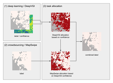
Mapping Human Settlements with Higher Accuracy and Less Volunteer Efforts by Combining Crowdsourcing and Deep Learning
Our new paper on Machine Learning and Humanitarian Mapping Nowadays, Machine Learning and Deep Learning approaches are steadily gaining popularity within the humanitarian (mapping) community. New tools such as the ML Enabler or the rapId editor might change the way … Read More
Successfull PhD defence by Michael Auer on 3D WebGIS
Last month Dr. Michael Auer successfully defended his PhD on Advancing 3D WebGIS – browser-based Methods for Visualization and Analysis and their Integration in Virtual Research Environments in the Context of Cultural Heritage . We congratulate cordially! We are happy … Read More
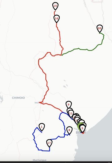
New ORS Jupyter example about Fleet Scheduling for Disaster Response with ORS and VROOM
Routing optimization in a humanitarian context Routing optimization generally solves the Vehicle Routing Problem (a simple example being the more widely known Traveling Salesman Problem). A more complex example would be the distribution of goods by a fleet of … Read More
