We published a new endpoint within the openrouteservice API ecosystem: openelevationservice. It queries a remote DEM for every vertex of a LineString or Point geometry. The underlying DEM is limited to SRTM v4.1 by CGIAR Consortium for Spatial Information as … Read More
Blog
How to become ohsome part 1: Visualizing the historical evolution of OSM buildings of your city
This blog post is the start of a series of posts, which describe what you are able to do using the ohsome framework developed at the Heidelberg Institute of Geoinformation Technology (HeiGIT). OpenStreetMap (OSM), the biggest open map of our … Read More
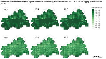
Conceptual compliance analysis with the OSHDB, Part 2
In a previous blog post we performed a conceptual compliance analysis between OSM data and several tagging-guidelines using the OSHDB API. The results were visualized in a linechart, comparing the different compliance ratio over several months. In this post we explain … Read More
Spatial conceptual compliance analysis with the OpenStreetMap History Database (OSHDB)
In a previous blog post we performed a conceptual compliance analysis between OSM data and several tagging-guidelines using the OSHDB API. The results were visualized in a line chart, comparing the different compliance ratio over several months. The following analysis … Read More
Conceptual compliance analysis with the OSHDB, Part 1
Conceptual compliance measures to what degree contributors of volunteered geographic information (VGI) are using proposed tagging-standards. Here, we look into OpenStreetMap (OSM) as the most well-known example for VGI. In OSM the most important tagging-guideline is defined by its wiki. … Read More
Conceptual compliance analysis with the OpenStreetMap History Database (OSHDB)
Conceptual compliance measures to what degree contributors of volunteered geographic information (VGI) are using proposed tagging-standards. Here, we look into OpenStreetMap (OSM) as the most well-known example for VGI. In OSM the most important tagging guideline is defined by its … Read More
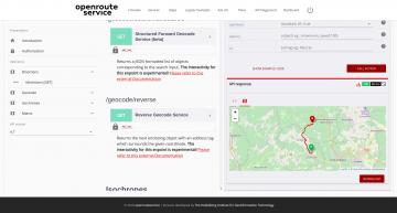
New OpenRouteService API playground
After the release of the new OpenRouteService dashboard the team has worked on a new interactive API documentation application named API Playground , that allows the users to explore all the OpenRouteService API services, parameters and responses in an intuitive … Read More
Generating Customized Pleasant Pedestrian Routes Based on OpenStreetMap Data
In a newly published open access paper, we present a system that generates customized pedestrian routes entirely based on data from OpenStreetMap (OSM). The system enables users to define to what extent they would like the route to have green … Read More
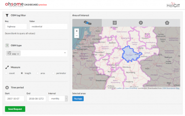
Explore the ohsome OSM History of whole Germany
Our new ohsome dashboard is another preview on what is and will be possible with our ohsome OpenStreetMap history analytics platform. Behind the scenes, we added support for the Apache Ignite big data framework and deployed an instance using the … Read More
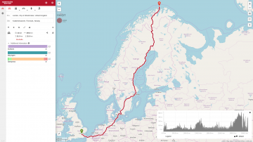
openrouteservice elevation goes farther north than ever before
Last week we have been upgrading the openrouteservice, and with that has come the ability to include elevation information in routing pretty much anywhere on the globe (sorry people on Antarctica, but we don’t have routing for you just yet). … Read More
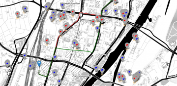
Jupyter Notebook: Combining Twitter Data and OpenRouteService Directions API
In the case of a disaster fast response is important and life saving. Information on blocked streets is crucial, but a the same time this infornations needs to be considered by routing engines in real-time. However, many routing engines use … Read More
MeinGrün – project proposal approved (mFund BMVI)
Informationen und Navigation zu urbanen Grünflächen in Städten – meinGrün Neues mFund Kooperations-Projekt meinGrün wird vom BMVI gefoerdert. Problemstellung Um in Städten trotz Wachstum und Nachverdichtung eine hohe Lebensqualität zu sichern, spielen Grünflächen eine essentielle Rolle, da sie sich positiv … Read More
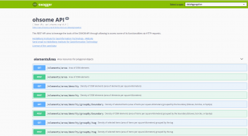
Documentation of the Ohsome API
In a previous blog post we introduced the REST-based interface of our framework Ohsome (the OpenStreetmap History Analytics plattform) and gave an example link of a request. This blog post aims to give you some further information about the documentation … Read More
OpenStreetMap Analytics Development for OpenCities Africa
Recently a consultancy and development agreement about OpenStreetMap Analytics Development has been reached with the World Bank in the context of the Open Cities Africa project and the Global Facility for Disaster Reduction and Recovery (GFDRR) Open Data for Resilience … Read More
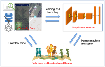
Deep Learning from Multiple Crowds: A Case Study of Humanitarian Mapping
Satellite images are widely applied in humanitarian mapping which labels buildings, roads and so on for humanitarian aid and economic development. However, the labeling now is mostly done by volunteers. In a recently accepted study, we utilize deep learning to … Read More
Openrouteservice Developers Dashboard Revamped
Over the past few months the openrouteservice team has worked on a new developers dashboard in order to make the registration and usage of the API more easy and accessible. Now the developers using the openrouteservice API will experience a … Read More

Analyse HOT Tasking Manager Projects with the ohsome API
In this example we show you how to use a Jupyter Notebook with the ohsome API to analyse mapping efforts for a HOT Tasking Manager project in Nepal!
Perspective Article: Volunteered Geographic Information for Disaster Risk Reduction
Over the past few years, the Missing Maps approach has repeatedly proved its potential for humanitarian assistance and disaster management. While the project was launched by only four organizations, there are now 17 member organizations in Missing Maps, and nearly … Read More
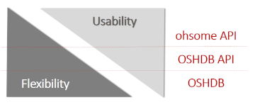
Ohsome – a high level architectural overview of the OSM History Analytics platform
Recently we introduced the ohsome platform for OSM History Analytics. Now we want to give you a high-level overview of the ohsome platform and the components it consists of. Ohsome API The ohsome platform is based on a three-layers API … Read More

The Ohsome API: dynamic OSM statistics for real-world applications
The Ohsome API, developed at HeiGIT, is part of the ohsome OSM history analytics platform (and yes, it is pronounced like the word “awesome” 😉. It serves as the connection between the OpenStreetMap History Database (OSHDB) and possible frontends, such … Read More
